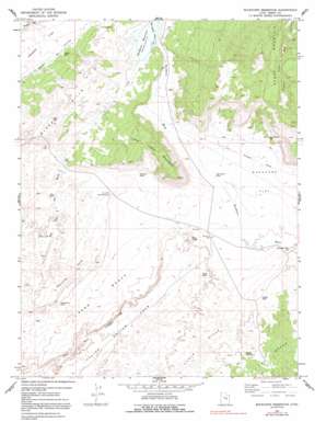
Buckhorn Reservoir Topo Map Utah
To zoom in, hover over the map of Buckhorn Reservoir
USGS Topo Quad 39110b7 - 1:24,000 scale
| Topo Map Name: | Buckhorn Reservoir |
| USGS Topo Quad ID: | 39110b7 |
| Print Size: | ca. 21 1/4" wide x 27" high |
| Southeast Coordinates: | 39.125° N latitude / 110.75° W longitude |
| Map Center Coordinates: | 39.1875° N latitude / 110.8125° W longitude |
| U.S. State: | UT |
| Filename: | o39110b7.jpg |
| Download Map JPG Image: | Buckhorn Reservoir topo map 1:24,000 scale |
| Map Type: | Topographic |
| Topo Series: | 7.5´ |
| Map Scale: | 1:24,000 |
| Source of Map Images: | United States Geological Survey (USGS) |
| Alternate Map Versions: |
Buckhorn Reservoir UT 1969, updated 1972 Download PDF Buy paper map Buckhorn Reservoir UT 1969, updated 1991 Download PDF Buy paper map Buckhorn Reservoir UT 2011 Download PDF Buy paper map Buckhorn Reservoir UT 2014 Download PDF Buy paper map |
1:24,000 Topo Quads surrounding Buckhorn Reservoir
> Back to 39110a1 at 1:100,000 scale
> Back to 39110a1 at 1:250,000 scale
> Back to U.S. Topo Maps home
Buckhorn Reservoir topo map: Gazetteer
Buckhorn Reservoir: Benches
Sand Bench elevation 1733m 5685′Buckhorn Reservoir: Cliffs
The Red Ledges elevation 1715m 5626′Buckhorn Reservoir: Dams
Buckhorn Dam elevation 1759m 5770′Buckhorn Reservoir: Flats
Buckhorn Flat elevation 1714m 5623′Buckhorn Reservoir: Lakes
Blue Pond elevation 1715m 5626′Cat Pond elevation 1703m 5587′
Cloyds Pond elevation 1742m 5715′
Guymon Pond elevation 1741m 5711′
Jorgensen Pond elevation 1699m 5574′
Lynns Pond elevation 1736m 5695′
Petes Hole elevation 1738m 5702′
Sand Pond elevation 1696m 5564′
Wedge Pond Number 1 elevation 1780m 5839′
Buckhorn Reservoir: Pillars
White Rocks elevation 1734m 5688′Buckhorn Reservoir: Reservoirs
Buckhorn Reservoir elevation 1759m 5770′Buckhorn Reservoir elevation 1763m 5784′
Drought Relief Reservoir elevation 1703m 5587′
J J Reservoir elevation 1758m 5767′
Jim Wilson Reservoir elevation 1752m 5748′
Job Corps Pond elevation 1724m 5656′
Buckhorn Reservoir: Ridges
Hadden Reef elevation 1775m 5823′Buckhorn Reservoir: Springs
Red Seep elevation 1728m 5669′Buckhorn Reservoir: Summits
Chalk Hills elevation 1757m 5764′Favorite Hills elevation 1746m 5728′
Little Cedar Mountain elevation 1948m 6391′
Red Knoll elevation 1775m 5823′
Buckhorn Reservoir: Valleys
Bull Hollow Wash elevation 1763m 5784′Buckhorn Reservoir: Wells
Buckhorn Well elevation 1714m 5623′Buckhorn Reservoir digital topo map on disk
Buy this Buckhorn Reservoir topo map showing relief, roads, GPS coordinates and other geographical features, as a high-resolution digital map file on DVD:


