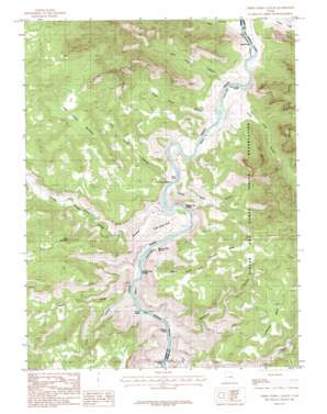
Three Fords Canyon Topo Map Utah
To zoom in, hover over the map of Three Fords Canyon
USGS Topo Quad 39110c1 - 1:24,000 scale
| Topo Map Name: | Three Fords Canyon |
| USGS Topo Quad ID: | 39110c1 |
| Print Size: | ca. 21 1/4" wide x 27" high |
| Southeast Coordinates: | 39.25° N latitude / 110° W longitude |
| Map Center Coordinates: | 39.3125° N latitude / 110.0625° W longitude |
| U.S. State: | UT |
| Filename: | o39110c1.jpg |
| Download Map JPG Image: | Three Fords Canyon topo map 1:24,000 scale |
| Map Type: | Topographic |
| Topo Series: | 7.5´ |
| Map Scale: | 1:24,000 |
| Source of Map Images: | United States Geological Survey (USGS) |
| Alternate Map Versions: |
Three Fords Canyon UT 1985, updated 1985 Download PDF Buy paper map Three Fords Canyon UT 2011 Download PDF Buy paper map Three Fords Canyon UT 2014 Download PDF Buy paper map |
1:24,000 Topo Quads surrounding Three Fords Canyon
> Back to 39110a1 at 1:100,000 scale
> Back to 39110a1 at 1:250,000 scale
> Back to U.S. Topo Maps home
Three Fords Canyon topo map: Gazetteer
Three Fords Canyon: Bars
Jacks Rock elevation 1304m 4278′Three Fords Canyon: Benches
Last Chance Benches elevation 1680m 5511′Three Fords Benches elevation 1583m 5193′
Three Fords Canyon: Bends
Beaver Slide Bottom elevation 1299m 4261′Three Fords Canyon: Channels
Jacks Hole elevation 1755m 5757′Three Fords Canyon: Cliffs
Beaver Slide Rim elevation 1611m 5285′Three Fords Canyon: Rapids
Coal Creek Rapids elevation 1277m 4189′Curry Rapids elevation 1283m 4209′
Last Chance Rapids elevation 1291m 4235′
Rabbit Valley Rapids elevation 1286m 4219′
Range Creek Rapids elevation 1289m 4229′
Saleratus Rapids elevation 1279m 4196′
Three Fords Rapids elevation 1300m 4265′
Three Fords Canyon: Streams
Coal Creek elevation 1289m 4229′Florence Creek elevation 1315m 4314′
Range Creek elevation 1290m 4232′
Three Fords Canyon: Summits
Boulder Mesa elevation 1770m 5807′Pinnacle Mesa elevation 1710m 5610′
Three Golden Stairs elevation 1423m 4668′
Xmas Mountain elevation 1787m 5862′
Three Fords Canyon: Valleys
Curry Canyon elevation 1313m 4307′Last Chance Canyon elevation 1312m 4304′
Rabbit Valley elevation 1298m 4258′
Rain Canyon elevation 1332m 4370′
Range Creek Canyon elevation 1291m 4235′
Saleratus Canyon elevation 1282m 4206′
Spring Wash Canyon elevation 1368m 4488′
Three Fords Canyon elevation 1303m 4274′
Three Fords Canyon elevation 1321m 4333′
Wire Fence Canyon elevation 1317m 4320′
Three Fords Canyon digital topo map on disk
Buy this Three Fords Canyon topo map showing relief, roads, GPS coordinates and other geographical features, as a high-resolution digital map file on DVD:


