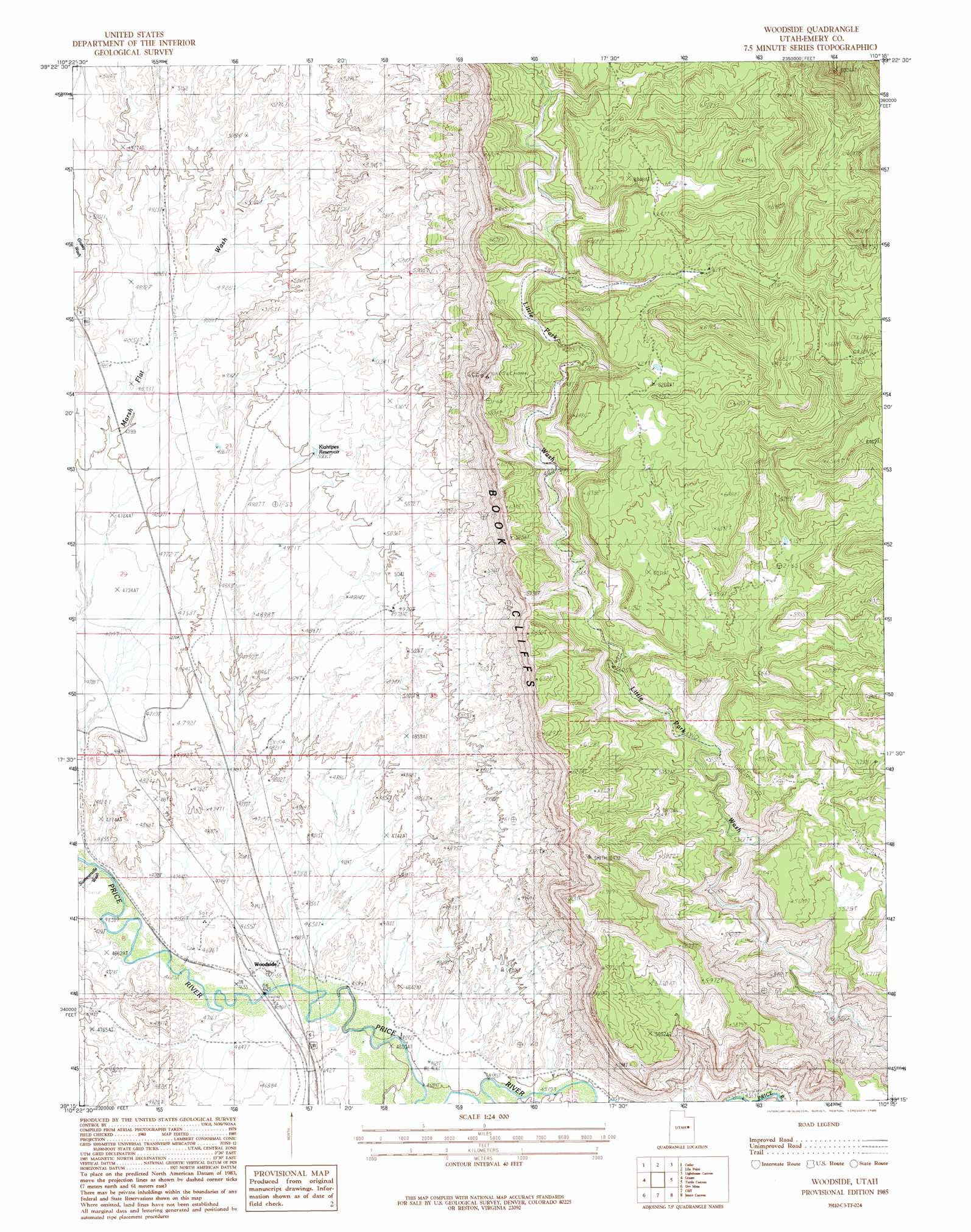
Woodside Topo Map Utah
To zoom in, hover over the map of Woodside
USGS Topo Quad 39110c3 - 1:24,000 scale
| Topo Map Name: | Woodside |
| USGS Topo Quad ID: | 39110c3 |
| Print Size: | ca. 21 1/4" wide x 27" high |
| Southeast Coordinates: | 39.25° N latitude / 110.25° W longitude |
| Map Center Coordinates: | 39.3125° N latitude / 110.3125° W longitude |
| U.S. State: | UT |
| Filename: | o39110c3.jpg |
| Download Map JPG Image: | Woodside topo map 1:24,000 scale |
| Map Type: | Topographic |
| Topo Series: | 7.5´ |
| Map Scale: | 1:24,000 |
| Source of Map Images: | United States Geological Survey (USGS) |
| Alternate Map Versions: |
Woodside UT 1985, updated 1985 Download PDF Buy paper map Woodside UT 2011 Download PDF Buy paper map Woodside UT 2014 Download PDF Buy paper map |
1:24,000 Topo Quads surrounding Woodside
Sunnyside Junction |
Sunnyside |
Patmos Head |
Summerhouse Ridge |
Steer Ridge Canyon |
Mounds |
Cedar |
Lila Point |
Lighthouse Canyon |
Chandler Falls |
Flattop Mountain |
Grassy |
Woodside |
Turtle Canyon |
Three Fords Canyon |
Chimney Rock |
Dry Mesa |
Cliff |
Jenny Canyon |
Butler Canyon |
Devils Hole |
Mexican Mountain |
Desert |
Blue Castle Butte |
Tusher Canyon |
> Back to 39110a1 at 1:100,000 scale
> Back to 39110a1 at 1:250,000 scale
> Back to U.S. Topo Maps home
Woodside topo map: Gazetteer
Woodside: Populated Places
Woodside elevation 1415m 4642′Woodside: Reservoirs
Kiahtipes Reservoir elevation 1527m 5009′Woodside digital topo map on disk
Buy this Woodside topo map showing relief, roads, GPS coordinates and other geographical features, as a high-resolution digital map file on DVD: