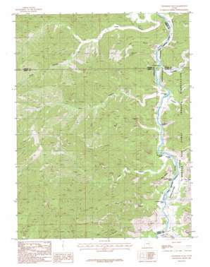
Chandler Falls Topo Map Utah
To zoom in, hover over the map of Chandler Falls
USGS Topo Quad 39110d1 - 1:24,000 scale
| Topo Map Name: | Chandler Falls |
| USGS Topo Quad ID: | 39110d1 |
| Print Size: | ca. 21 1/4" wide x 27" high |
| Southeast Coordinates: | 39.375° N latitude / 110° W longitude |
| Map Center Coordinates: | 39.4375° N latitude / 110.0625° W longitude |
| U.S. State: | UT |
| Filename: | o39110d1.jpg |
| Download Map JPG Image: | Chandler Falls topo map 1:24,000 scale |
| Map Type: | Topographic |
| Topo Series: | 7.5´ |
| Map Scale: | 1:24,000 |
| Source of Map Images: | United States Geological Survey (USGS) |
| Alternate Map Versions: |
Chandler Falls UT 1985, updated 1985 Download PDF Buy paper map Chandler Falls UT 2011 Download PDF Buy paper map Chandler Falls UT 2014 Download PDF Buy paper map |
1:24,000 Topo Quads surrounding Chandler Falls
> Back to 39110a1 at 1:100,000 scale
> Back to 39110a1 at 1:250,000 scale
> Back to U.S. Topo Maps home
Chandler Falls topo map: Gazetteer
Chandler Falls: Capes
Red Point elevation 1705m 5593′Chandler Falls: Falls
Chandler Falls elevation 1333m 4373′Chandler Falls: Rapids
Bull Canyon Rapids elevation 1323m 4340′Joe Hutch Canyon Rapids elevation 1310m 4297′
Joe Hutch Creek Rapids elevation 1313m 4307′
Moonwater Rapids elevation 1320m 4330′
Red Point Rapids elevation 1318m 4324′
Trail Canyon Rapids elevation 1329m 4360′
Chandler Falls: Streams
Bluebell Creek elevation 1329m 4360′Joe Hutch Creek elevation 1321m 4333′
Chandler Falls: Valleys
Big Canyon elevation 1342m 4402′Bull Canyon elevation 1341m 4399′
Chandler Canyon elevation 1340m 4396′
Desolation Canyon elevation 1316m 4317′
Joe Hatch Canyon elevation 1331m 4366′
Lion Hollow elevation 1381m 4530′
Three Canyon elevation 1382m 4534′
Trail Canyon elevation 1351m 4432′
Chandler Falls digital topo map on disk
Buy this Chandler Falls topo map showing relief, roads, GPS coordinates and other geographical features, as a high-resolution digital map file on DVD:


