Mounds Topo Map Utah
To zoom in, hover over the map of Mounds
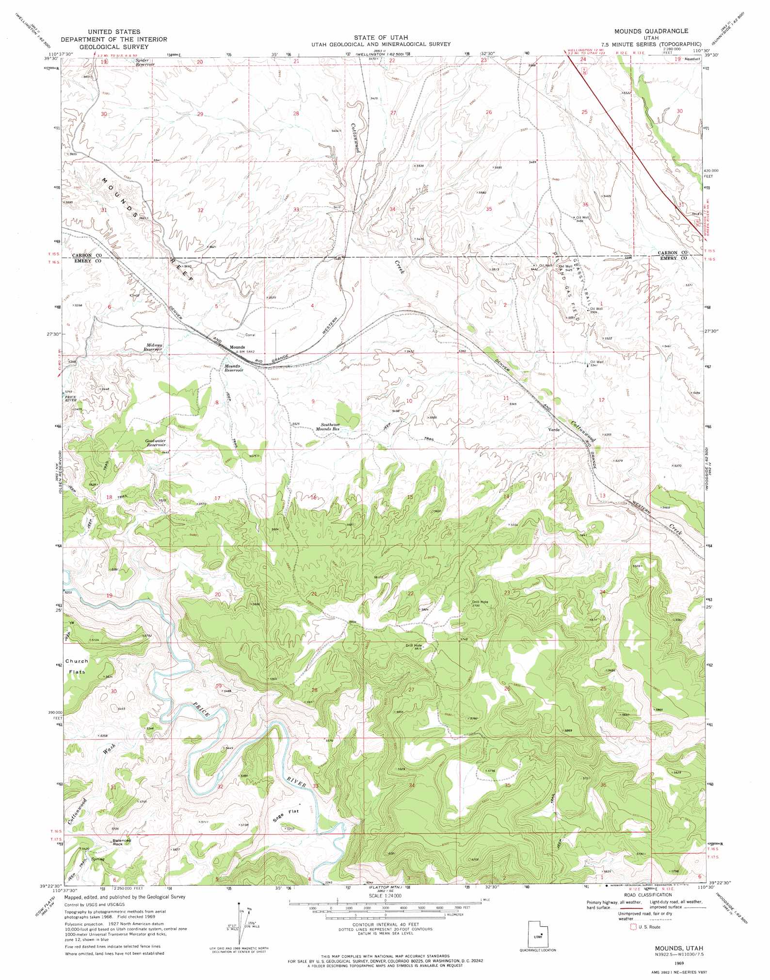
USGS Topo Quad 39110d5 - 1:24,000 scale
| Topo Map Name: | Mounds |
| USGS Topo Quad ID: | 39110d5 |
| Print Size: | ca. 21 1/4" wide x 27" high |
| Southeast Coordinates: | 39.375° N latitude / 110.5° W longitude |
| Map Center Coordinates: | 39.4375° N latitude / 110.5625° W longitude |
| U.S. State: | UT |
| Filename: | o39110d5.jpg |
| Download Map JPG Image: | Mounds topo map 1:24,000 scale |
| Map Type: | Topographic |
| Topo Series: | 7.5´ |
| Map Scale: | 1:24,000 |
| Source of Map Images: | United States Geological Survey (USGS) |
| Alternate Map Versions: |
Mounds UT 1969, updated 1972 Download PDF Buy paper map Mounds UT 2011 Download PDF Buy paper map Mounds UT 2014 Download PDF Buy paper map |
1:24,000 Topo Quads surrounding Mounds
Helper |
Deadman Canyon |
Pine Canyon |
Mount Bartles |
Bruin Point |
Price |
Wellington |
Sunnyside Junction |
Sunnyside |
Patmos Head |
Elmo |
Olsen Reservoir |
Mounds |
Cedar |
Lila Point |
Cleveland |
Cow Flats |
Flattop Mountain |
Grassy |
Woodside |
Buckhorn Reservoir |
Bob Hill Knoll |
Chimney Rock |
Dry Mesa |
Cliff |
> Back to 39110a1 at 1:100,000 scale
> Back to 39110a1 at 1:250,000 scale
> Back to U.S. Topo Maps home
Mounds topo map: Gazetteer
Mounds: Oilfields
Grassy Trail Oil and Gas Field elevation 1672m 5485′Mounds: Pillars
Balanced Rock elevation 1640m 5380′Mounds: Reservoirs
Goodwater Reservoir elevation 1667m 5469′Midway Reservoir elevation 1648m 5406′
Mounds Reservoir elevation 1658m 5439′
Southeast Mounds Reservoir elevation 1668m 5472′
Spider Reservoir elevation 1696m 5564′
Mounds: Ridges
Mounds Reef elevation 1703m 5587′Mounds: Valleys
Cottonwood Wash elevation 1577m 5173′Mounds digital topo map on disk
Buy this Mounds topo map showing relief, roads, GPS coordinates and other geographical features, as a high-resolution digital map file on DVD: