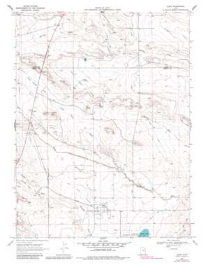
Elmo Topo Map Utah
To zoom in, hover over the map of Elmo
USGS Topo Quad 39110d7 - 1:24,000 scale
| Topo Map Name: | Elmo |
| USGS Topo Quad ID: | 39110d7 |
| Print Size: | ca. 21 1/4" wide x 27" high |
| Southeast Coordinates: | 39.375° N latitude / 110.75° W longitude |
| Map Center Coordinates: | 39.4375° N latitude / 110.8125° W longitude |
| U.S. State: | UT |
| Filename: | o39110d7.jpg |
| Download Map JPG Image: | Elmo topo map 1:24,000 scale |
| Map Type: | Topographic |
| Topo Series: | 7.5´ |
| Map Scale: | 1:24,000 |
| Source of Map Images: | United States Geological Survey (USGS) |
| Alternate Map Versions: |
Elmo UT 1969, updated 1972 Download PDF Buy paper map Elmo UT 1969, updated 1983 Download PDF Buy paper map Elmo UT 2011 Download PDF Buy paper map Elmo UT 2014 Download PDF Buy paper map |
1:24,000 Topo Quads surrounding Elmo
> Back to 39110a1 at 1:100,000 scale
> Back to 39110a1 at 1:250,000 scale
> Back to U.S. Topo Maps home
Elmo topo map: Gazetteer
Elmo: Airports
Intermountain Sprayers Airport elevation 1742m 5715′Elmo: Canals
Elmo Branch Cleveland Canal elevation 1746m 5728′North Branch Cleveland Canal elevation 1766m 5793′
Elmo: Flats
Twin Peaks Flat elevation 1774m 5820′Elmo: Populated Places
Elmo elevation 1735m 5692′Elmo: Summits
Twin Peaks elevation 1814m 5951′Elmo: Valleys
Twin Peaks Wash elevation 1714m 5623′Wildcat Draw elevation 1773m 5816′
Elmo digital topo map on disk
Buy this Elmo topo map showing relief, roads, GPS coordinates and other geographical features, as a high-resolution digital map file on DVD:


