Pine Canyon Topo Map Utah
To zoom in, hover over the map of Pine Canyon
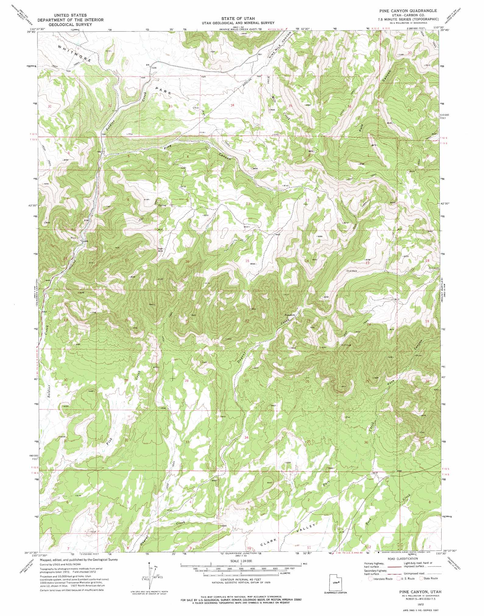
USGS Topo Quad 39110f5 - 1:24,000 scale
| Topo Map Name: | Pine Canyon |
| USGS Topo Quad ID: | 39110f5 |
| Print Size: | ca. 21 1/4" wide x 27" high |
| Southeast Coordinates: | 39.625° N latitude / 110.5° W longitude |
| Map Center Coordinates: | 39.6875° N latitude / 110.5625° W longitude |
| U.S. State: | UT |
| Filename: | o39110f5.jpg |
| Download Map JPG Image: | Pine Canyon topo map 1:24,000 scale |
| Map Type: | Topographic |
| Topo Series: | 7.5´ |
| Map Scale: | 1:24,000 |
| Source of Map Images: | United States Geological Survey (USGS) |
| Alternate Map Versions: |
Pine Canyon UT 1972, updated 1976 Download PDF Buy paper map Pine Canyon UT 1972, updated 1976 Download PDF Buy paper map Pine Canyon UT 2011 Download PDF Buy paper map Pine Canyon UT 2014 Download PDF Buy paper map |
1:24,000 Topo Quads surrounding Pine Canyon
Gray Head Peak |
Jones Hollow |
Lance Canyon |
Anthro Mountain |
Anthro Mountain Ne |
Matts Summit |
Minnie Maud Creek West |
Minnie Maud Creek East |
Wood Canyon |
Currant Canyon |
Helper |
Deadman Canyon |
Pine Canyon |
Mount Bartles |
Bruin Point |
Price |
Wellington |
Sunnyside Junction |
Sunnyside |
Patmos Head |
Elmo |
Olsen Reservoir |
Mounds |
Cedar |
Lila Point |
> Back to 39110e1 at 1:100,000 scale
> Back to 39110a1 at 1:250,000 scale
> Back to U.S. Topo Maps home
Pine Canyon topo map: Gazetteer
Pine Canyon: Valleys
Dugout Canyon elevation 1925m 6315′Pace Canyon elevation 1851m 6072′
Pine Canyon elevation 2133m 6998′
Pine Canyon digital topo map on disk
Buy this Pine Canyon topo map showing relief, roads, GPS coordinates and other geographical features, as a high-resolution digital map file on DVD: