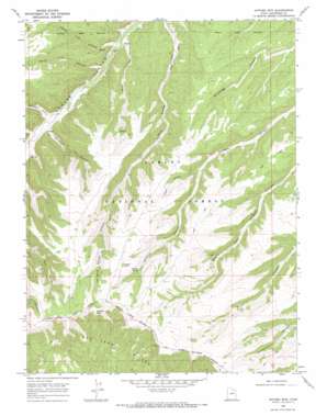
Anthro Mountain Topo Map Utah
To zoom in, hover over the map of Anthro Mountain
USGS Topo Quad 39110h4 - 1:24,000 scale
| Topo Map Name: | Anthro Mountain |
| USGS Topo Quad ID: | 39110h4 |
| Print Size: | ca. 21 1/4" wide x 27" high |
| Southeast Coordinates: | 39.875° N latitude / 110.375° W longitude |
| Map Center Coordinates: | 39.9375° N latitude / 110.4375° W longitude |
| U.S. State: | UT |
| Filename: | o39110h4.jpg |
| Download Map JPG Image: | Anthro Mountain topo map 1:24,000 scale |
| Map Type: | Topographic |
| Topo Series: | 7.5´ |
| Map Scale: | 1:24,000 |
| Source of Map Images: | United States Geological Survey (USGS) |
| Alternate Map Versions: |
Anthro Mtn UT 1968, updated 1971 Download PDF Buy paper map Anthro Mountain UT 1996, updated 1999 Download PDF Buy paper map Anthro Mountain UT 2011 Download PDF Buy paper map Anthro Mountain UT 2014 Download PDF Buy paper map |
| FStopo: | US Forest Service topo Anthro Mountain is available: Download FStopo PDF Download FStopo TIF |
1:24,000 Topo Quads surrounding Anthro Mountain
> Back to 39110e1 at 1:100,000 scale
> Back to 39110a1 at 1:250,000 scale
> Back to U.S. Topo Maps home
Anthro Mountain topo map: Gazetteer
Anthro Mountain: Springs
Mine Hollow Spring elevation 2380m 7808′Nutters Spring elevation 2598m 8523′
Anthro Mountain: Summits
Anthro Mountain elevation 2757m 9045′Anthro Mountain: Valleys
Clem Hollow elevation 2135m 7004′Mine Hollow elevation 2060m 6758′
North Lost Hollow elevation 2070m 6791′
Quitchampau Canyon elevation 2128m 6981′
South Lost Hollow elevation 2095m 6873′
The Squeeze elevation 2450m 8038′
Wolf Hollow elevation 2317m 7601′
Anthro Mountain: Woods
Cracker Grove elevation 2672m 8766′Anthro Mountain digital topo map on disk
Buy this Anthro Mountain topo map showing relief, roads, GPS coordinates and other geographical features, as a high-resolution digital map file on DVD:


