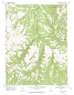
Gray Head Peak Topo Map Utah
To zoom in, hover over the map of Gray Head Peak
USGS Topo Quad 39110h7 - 1:24,000 scale
| Topo Map Name: | Gray Head Peak |
| USGS Topo Quad ID: | 39110h7 |
| Print Size: | ca. 21 1/4" wide x 27" high |
| Southeast Coordinates: | 39.875° N latitude / 110.75° W longitude |
| Map Center Coordinates: | 39.9375° N latitude / 110.8125° W longitude |
| U.S. State: | UT |
| Filename: | o39110h7.jpg |
| Download Map JPG Image: | Gray Head Peak topo map 1:24,000 scale |
| Map Type: | Topographic |
| Topo Series: | 7.5´ |
| Map Scale: | 1:24,000 |
| Source of Map Images: | United States Geological Survey (USGS) |
| Alternate Map Versions: |
Gray Head Peak UT 1969, updated 1971 Download PDF Buy paper map Gray Head Peak UT 1996, updated 2000 Download PDF Buy paper map Gray Head Peak UT 2011 Download PDF Buy paper map Gray Head Peak UT 2014 Download PDF Buy paper map |
| FStopo: | US Forest Service topo Gray Head Peak is available: Download FStopo PDF Download FStopo TIF |
1:24,000 Topo Quads surrounding Gray Head Peak
> Back to 39110e1 at 1:100,000 scale
> Back to 39110a1 at 1:250,000 scale
> Back to U.S. Topo Maps home
Gray Head Peak topo map: Gazetteer
Gray Head Peak: Benches
Wilbur Bench elevation 2226m 7303′Gray Head Peak: Lakes
Twin Ponds elevation 2475m 8120′Gray Head Peak: Parks
Avintaquin Wildlife Management Area elevation 2420m 7939′Gray Head Peak: Ridges
Fossil Ridge elevation 2582m 8471′Horse Ridge elevation 2633m 8638′
Little Horse Ridge elevation 2459m 8067′
Tub Ridge elevation 2507m 8225′
Gray Head Peak: Springs
Big Draw Spring elevation 2332m 7650′Cow Spring elevation 2426m 7959′
High Line Spring elevation 2556m 8385′
Lake Spring elevation 2504m 8215′
Little Mud Spring elevation 2468m 8097′
Meadow Spring elevation 2500m 8202′
Mud Spring elevation 2744m 9002′
Olsen Spring elevation 2499m 8198′
Pinto Spring elevation 2414m 7919′
Red Cedar Spring elevation 2319m 7608′
Sick Cow Spring elevation 2315m 7595′
Split Spring elevation 2438m 7998′
Steer Spring elevation 2519m 8264′
Sulphur Spring elevation 2625m 8612′
Trail Ridge Spring elevation 2456m 8057′
Wilbur Spring elevation 2400m 7874′
Wild Horse Spring elevation 2452m 8044′
Gray Head Peak: Streams
Cottonwood Creek elevation 2131m 6991′Dry Fork elevation 2379m 7805′
Minnie Creek elevation 2093m 6866′
South Fork Avintaquin Creek elevation 2071m 6794′
West Fork Avintaquin Creek elevation 2071m 6794′
Gray Head Peak: Summits
Gray Head Peak elevation 2889m 9478′Gray Head Peak: Valleys
First Canyon elevation 2132m 6994′Horse Ridge Canyon elevation 2091m 6860′
Reserve Canyon elevation 2191m 7188′
Wilbur Canyon elevation 2073m 6801′
Gray Head Peak digital topo map on disk
Buy this Gray Head Peak topo map showing relief, roads, GPS coordinates and other geographical features, as a high-resolution digital map file on DVD:


