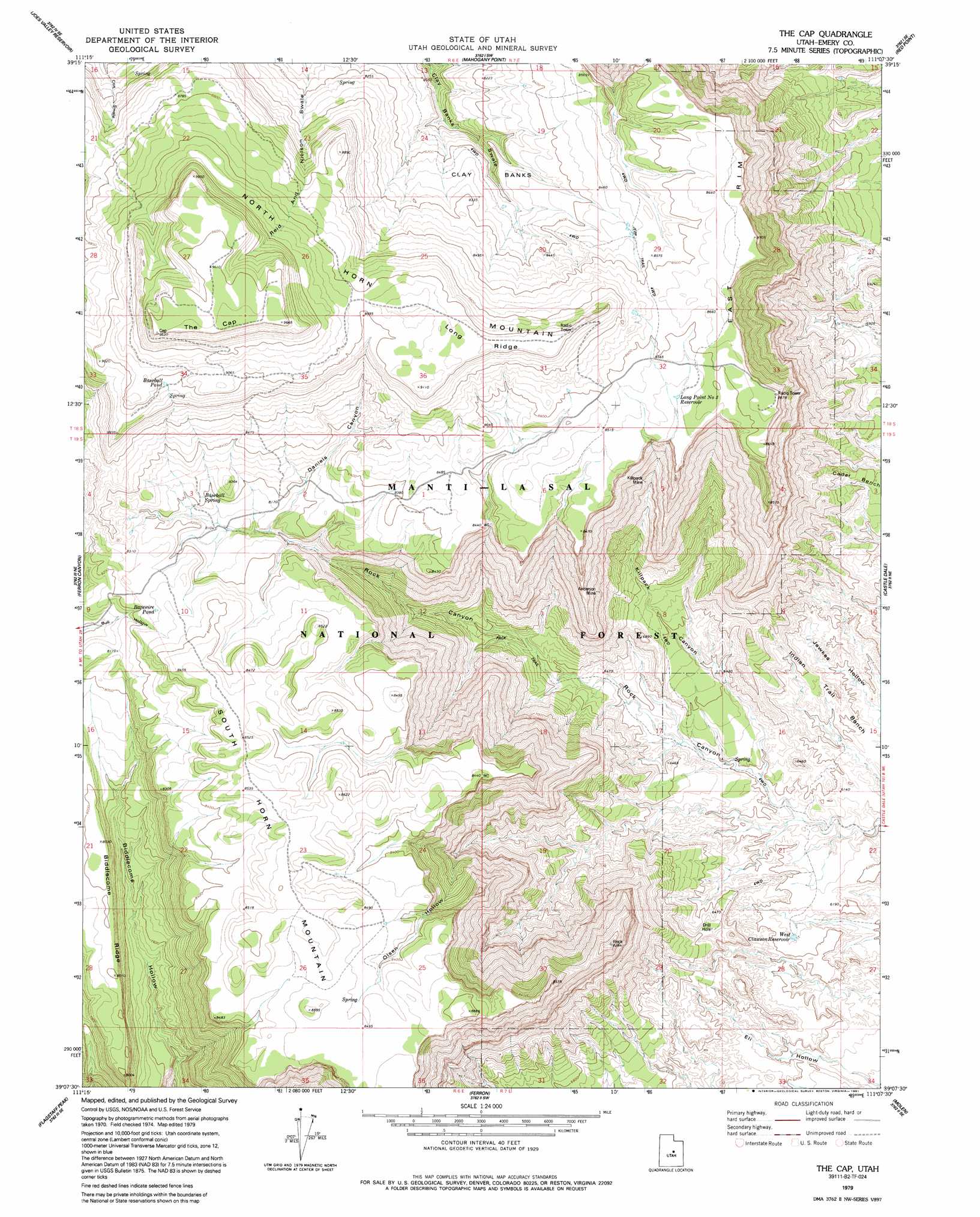
The Cap Topo Map Utah
To zoom in, hover over the map of The Cap
USGS Topo Quad 39111b2 - 1:24,000 scale
| Topo Map Name: | The Cap |
| USGS Topo Quad ID: | 39111b2 |
| Print Size: | ca. 21 1/4" wide x 27" high |
| Southeast Coordinates: | 39.125° N latitude / 111.125° W longitude |
| Map Center Coordinates: | 39.1875° N latitude / 111.1875° W longitude |
| U.S. State: | UT |
| Filename: | o39111b2.jpg |
| Download Map JPG Image: | The Cap topo map 1:24,000 scale |
| Map Type: | Topographic |
| Topo Series: | 7.5´ |
| Map Scale: | 1:24,000 |
| Source of Map Images: | United States Geological Survey (USGS) |
| Alternate Map Versions: |
The Cap UT 1979, updated 1991 Download PDF Buy paper map The Cap UT 2001, updated 2004 Download PDF Buy paper map The Cap UT 2011 Download PDF Buy paper map The Cap UT 2014 Download PDF Buy paper map |
| FStopo: | US Forest Service topo The Cap is available: Download FStopo PDF Download FStopo TIF |
1:24,000 Topo Quads surrounding The Cap
Spring City |
South Tent Mountain |
Rilda Canyon |
Hiawatha |
Poison Spring Bench |
Danish Knoll |
Joes Valley Reservoir |
Mahogany Point |
Red Point |
Huntington |
Ferron Reservoir |
Ferron Canyon |
The Cap |
Castle Dale |
Hadden Holes |
Heliotrope Mountain |
Flagstaff Peak |
Ferron |
Molen |
Horn Silver Gulch |
Acord Lakes |
Emery West |
Emery East |
Short Canyon |
Sid And Charley |
> Back to 39111a1 at 1:100,000 scale
> Back to 39110a1 at 1:250,000 scale
> Back to U.S. Topo Maps home
The Cap topo map: Gazetteer
The Cap: Cliffs
East Rim elevation 2651m 8697′The Cap: Flats
The Cap elevation 2940m 9645′The Cap: Mines
Anderson Mine elevation 2280m 7480′Killpack Mine elevation 2303m 7555′
The Cap: Reservoirs
Barewire Pond elevation 2522m 8274′Baseball Pond elevation 2737m 8979′
Long Point Number 3 Reservoir elevation 2593m 8507′
West Clawson Reservoir elevation 1876m 6154′
The Cap: Ridges
Long Ridge elevation 2767m 9078′The Cap: Slopes
Clay Banks elevation 2435m 7988′The Cap: Springs
Baseball Spring elevation 2719m 8920′Baseball Spring elevation 2504m 8215′
The Cap: Summits
North Horn Mountain elevation 2783m 9130′South Horn Mountain elevation 2610m 8562′
The Cap: Valleys
Daniels Canyon elevation 2450m 8038′Eil Hollow elevation 1867m 6125′
Killpack Canyon elevation 1882m 6174′
Olsen Hollow elevation 2264m 7427′
The Cap digital topo map on disk
Buy this The Cap topo map showing relief, roads, GPS coordinates and other geographical features, as a high-resolution digital map file on DVD: