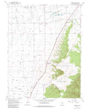
Chester Topo Map Utah
To zoom in, hover over the map of Chester
USGS Topo Quad 39111d5 - 1:24,000 scale
| Topo Map Name: | Chester |
| USGS Topo Quad ID: | 39111d5 |
| Print Size: | ca. 21 1/4" wide x 27" high |
| Southeast Coordinates: | 39.375° N latitude / 111.5° W longitude |
| Map Center Coordinates: | 39.4375° N latitude / 111.5625° W longitude |
| U.S. State: | UT |
| Filename: | o39111d5.jpg |
| Download Map JPG Image: | Chester topo map 1:24,000 scale |
| Map Type: | Topographic |
| Topo Series: | 7.5´ |
| Map Scale: | 1:24,000 |
| Source of Map Images: | United States Geological Survey (USGS) |
| Alternate Map Versions: |
Chester UT 1966, updated 1968 Download PDF Buy paper map Chester UT 1966, updated 1980 Download PDF Buy paper map Chester UT 2001, updated 2004 Download PDF Buy paper map Chester UT 2011 Download PDF Buy paper map Chester UT 2014 Download PDF Buy paper map |
| FStopo: | US Forest Service topo Chester is available: Download FStopo PDF Download FStopo TIF |
1:24,000 Topo Quads surrounding Chester
> Back to 39111a1 at 1:100,000 scale
> Back to 39110a1 at 1:250,000 scale
> Back to U.S. Topo Maps home
Chester topo map: Gazetteer
Chester: Canals
Bill Allred Ditch elevation 1789m 5869′Crawford Ditch elevation 1844m 6049′
Gobblefield Ditch elevation 1703m 5587′
Lower Chimney Ditch elevation 1696m 5564′
Rock Dam Canal elevation 1677m 5501′
Silver Creek Ditch elevation 1676m 5498′
Spring Ditch elevation 1695m 5561′
The Canal Ditch elevation 1686m 5531′
Upper Chimney Ditch elevation 1715m 5626′
Chester: Dams
McKinley Strates Dam elevation 1750m 5741′Chester: Parks
Black Hills Wildlife Management Area elevation 1856m 6089′Spring City Wildlife Management Area elevation 1815m 5954′
Chester: Populated Places
Chester elevation 1681m 5515′Pigeon Hollow Junction elevation 1696m 5564′
West Ephraim elevation 1674m 5492′
Chester: Post Offices
Chester Post Office elevation 1671m 5482′Chester: Reservoirs
Chester Ponds elevation 1696m 5564′McKinley Strates Reservoir elevation 1750m 5741′
Olafs Pond elevation 1659m 5442′
Chester: Ridges
Sand Ridge elevation 1687m 5534′Chester: Springs
Johnson Springs elevation 1659m 5442′Chester: Streams
Bill Allred Creek elevation 1721m 5646′Canal Creek elevation 1723m 5652′
Pigeon Creek elevation 1677m 5501′
Silver Creek elevation 1671m 5482′
Chester: Summits
Black Hill elevation 1952m 6404′White Hill elevation 1946m 6384′
Chester: Valleys
Little Pigeon Hollow elevation 1738m 5702′Pigeon Hollow elevation 1699m 5574′
Chester digital topo map on disk
Buy this Chester topo map showing relief, roads, GPS coordinates and other geographical features, as a high-resolution digital map file on DVD:


