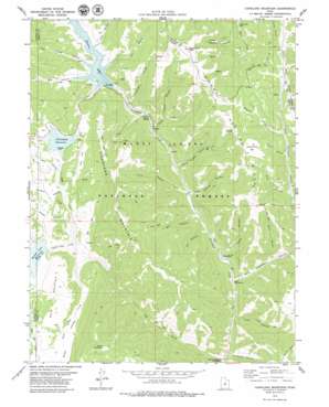
Candland Mountain Topo Map Utah
To zoom in, hover over the map of Candland Mountain
USGS Topo Quad 39111e2 - 1:24,000 scale
| Topo Map Name: | Candland Mountain |
| USGS Topo Quad ID: | 39111e2 |
| Print Size: | ca. 21 1/4" wide x 27" high |
| Southeast Coordinates: | 39.5° N latitude / 111.125° W longitude |
| Map Center Coordinates: | 39.5625° N latitude / 111.1875° W longitude |
| U.S. State: | UT |
| Filename: | o39111e2.jpg |
| Download Map JPG Image: | Candland Mountain topo map 1:24,000 scale |
| Map Type: | Topographic |
| Topo Series: | 7.5´ |
| Map Scale: | 1:24,000 |
| Source of Map Images: | United States Geological Survey (USGS) |
| Alternate Map Versions: |
Candland Mountain UT 1979, updated 1979 Download PDF Buy paper map Candland Mountain UT 2001, updated 2004 Download PDF Buy paper map Candland Mountain UT 2011 Download PDF Buy paper map Candland Mountain UT 2014 Download PDF Buy paper map |
| FStopo: | US Forest Service topo Candland Mountain is available: Download FStopo PDF Download FStopo TIF |
1:24,000 Topo Quads surrounding Candland Mountain
> Back to 39111e1 at 1:100,000 scale
> Back to 39110a1 at 1:250,000 scale
> Back to U.S. Topo Maps home
Candland Mountain topo map: Gazetteer
Candland Mountain: Dams
Cleveland Dam elevation 2687m 8815′Electric Lake Dam elevation 2615m 8579′
Miller Flat Dam elevation 2582m 8471′
Candland Mountain: Flats
Hog Flat elevation 2732m 8963′Yellow Brush Flat elevation 3027m 9931′
Candland Mountain: Mines
Fireside Mine elevation 2671m 8763′Huntington Mine elevation 2665m 8743′
Old Fireside Mine elevation 2638m 8654′
Old Larsen Mine elevation 2645m 8677′
Candland Mountain: Reservoirs
Cleveland Reservoir elevation 2683m 8802′Electric Lake elevation 2615m 8579′
Miller Flat Reservoir elevation 2582m 8471′
Candland Mountain: Ridges
Trough Springs Ridge elevation 2959m 9708′Candland Mountain: Springs
Sulphur Spring elevation 2510m 8234′Candland Mountain: Streams
Miller Flat Creek elevation 2541m 8336′Scad Valley Creek elevation 2510m 8234′
Candland Mountain: Summits
Bald Mountain elevation 2827m 9274′Candland Mountain elevation 3153m 10344′
Monument Peak elevation 3177m 10423′
Seeley Mountain elevation 3145m 10318′
Candland Mountain: Valleys
Bear Canyon elevation 2615m 8579′Coal Canyon elevation 2615m 8579′
Corral Canyon elevation 2440m 8005′
Cox Canyon elevation 2615m 8579′
Day Canyon elevation 2520m 8267′
Engineer Canyon elevation 2485m 8152′
First Canyon elevation 2694m 8838′
Flood Canyon elevation 2531m 8303′
Hughes Canyon elevation 2525m 8284′
Lake Canyon elevation 2617m 8585′
Little Eccles Canyon elevation 2615m 8579′
McElprang Canyon elevation 2340m 7677′
Mill Canyon elevation 2486m 8156′
North Hughes Canyon elevation 2528m 8293′
Nuck Woodward Canyon elevation 2423m 7949′
Pole Canyon elevation 2386m 7828′
Ragman Canyon elevation 2664m 8740′
Sawmill Canyon elevation 2780m 9120′
Second Canyon elevation 2694m 8838′
Short Canyon elevation 2526m 8287′
South Hughes Canyon elevation 2507m 8225′
Staker Canyon elevation 2566m 8418′
Valentines Gulch elevation 2560m 8398′
Candland Mountain digital topo map on disk
Buy this Candland Mountain topo map showing relief, roads, GPS coordinates and other geographical features, as a high-resolution digital map file on DVD:


