Huntington Reservoir Topo Map Utah
To zoom in, hover over the map of Huntington Reservoir
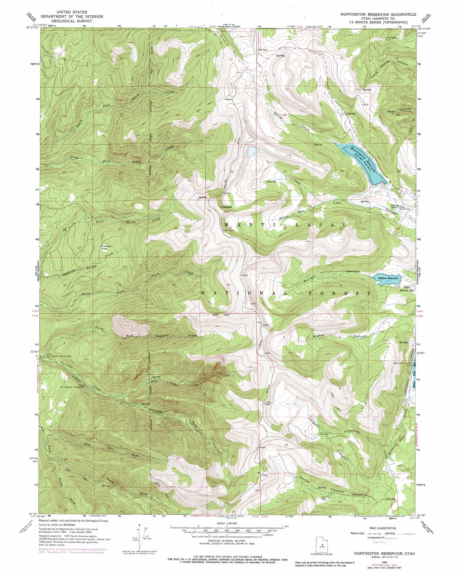
USGS Topo Quad 39111e3 - 1:24,000 scale
| Topo Map Name: | Huntington Reservoir |
| USGS Topo Quad ID: | 39111e3 |
| Print Size: | ca. 21 1/4" wide x 27" high |
| Southeast Coordinates: | 39.5° N latitude / 111.25° W longitude |
| Map Center Coordinates: | 39.5625° N latitude / 111.3125° W longitude |
| U.S. State: | UT |
| Filename: | o39111e3.jpg |
| Download Map JPG Image: | Huntington Reservoir topo map 1:24,000 scale |
| Map Type: | Topographic |
| Topo Series: | 7.5´ |
| Map Scale: | 1:24,000 |
| Source of Map Images: | United States Geological Survey (USGS) |
| Alternate Map Versions: |
Huntington Reservoir UT 1965, updated 1968 Download PDF Buy paper map Huntington Reservoir UT 1965, updated 1979 Download PDF Buy paper map Huntington Reservoir UT 2001, updated 2004 Download PDF Buy paper map Huntington Reservoir UT 2011 Download PDF Buy paper map Huntington Reservoir UT 2014 Download PDF Buy paper map |
| FStopo: | US Forest Service topo Huntington Reservoir is available: Download FStopo PDF Download FStopo TIF |
1:24,000 Topo Quads surrounding Huntington Reservoir
Spencer Canyon |
Indianola |
C Canyon |
Scofield Reservoir |
Colton |
Big Hollow |
Fairview |
Fairview Lakes |
Scofield |
Jump Creek |
Moroni |
Mount Pleasant |
Huntington Reservoir |
Candland Mountain |
Wattis |
Chester |
Spring City |
South Tent Mountain |
Rilda Canyon |
Hiawatha |
Ephraim |
Danish Knoll |
Joes Valley Reservoir |
Mahogany Point |
Red Point |
> Back to 39111e1 at 1:100,000 scale
> Back to 39110a1 at 1:250,000 scale
> Back to U.S. Topo Maps home
Huntington Reservoir topo map: Gazetteer
Huntington Reservoir: Dams
Huntington Dam elevation 2738m 8982′Rolfson Reservoir Dam elevation 2698m 8851′
Huntington Reservoir: Flats
Pritchett Flat elevation 2482m 8143′Huntington Reservoir: Reservoirs
Huntington Reservoir elevation 2749m 9019′Little Madsen Reservoir elevation 2675m 8776′
Rolfson Reservoir elevation 2697m 8848′
Huntington Reservoir: Streams
Blue Slide Fork elevation 2286m 7500′Dry Pole Fork elevation 2231m 7319′
North Fork Coal Fork elevation 2310m 7578′
North Fork Pleasant Creek elevation 2111m 6925′
PC Fork elevation 2373m 7785′
South Fork Coal Fork elevation 2310m 7578′
Spring Creek elevation 2751m 9025′
Straight Fork elevation 2282m 7486′
Huntington Reservoir: Summits
Towhead elevation 3130m 10269′Huntington Reservoir: Valleys
Jordan Canyon elevation 2750m 9022′North Fork Lake Canyon elevation 2768m 9081′
Rolfson Canyon elevation 2699m 8854′
Seeley Canyon elevation 2749m 9019′
South Fork Lake Canyon elevation 2767m 9078′
Huntington Reservoir digital topo map on disk
Buy this Huntington Reservoir topo map showing relief, roads, GPS coordinates and other geographical features, as a high-resolution digital map file on DVD: