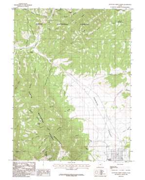
Fountain Green North Topo Map Utah
To zoom in, hover over the map of Fountain Green North
USGS Topo Quad 39111f6 - 1:24,000 scale
| Topo Map Name: | Fountain Green North |
| USGS Topo Quad ID: | 39111f6 |
| Print Size: | ca. 21 1/4" wide x 27" high |
| Southeast Coordinates: | 39.625° N latitude / 111.625° W longitude |
| Map Center Coordinates: | 39.6875° N latitude / 111.6875° W longitude |
| U.S. State: | UT |
| Filename: | o39111f6.jpg |
| Download Map JPG Image: | Fountain Green North topo map 1:24,000 scale |
| Map Type: | Topographic |
| Topo Series: | 7.5´ |
| Map Scale: | 1:24,000 |
| Source of Map Images: | United States Geological Survey (USGS) |
| Alternate Map Versions: |
Fountain Green North UT 1983, updated 1983 Download PDF Buy paper map Fountain Green North UT 2001, updated 2004 Download PDF Buy paper map Fountain Green North UT 2011 Download PDF Buy paper map Fountain Green North UT 2014 Download PDF Buy paper map |
| FStopo: | US Forest Service topo Fountain Green North is available: Download FStopo PDF Download FStopo TIF |
1:24,000 Topo Quads surrounding Fountain Green North
> Back to 39111e1 at 1:100,000 scale
> Back to 39110a1 at 1:250,000 scale
> Back to U.S. Topo Maps home
Fountain Green North topo map: Gazetteer
Fountain Green North: Cliffs
Red Cliffs elevation 2575m 8448′Fountain Green North: Flats
North Flat elevation 2616m 8582′Fountain Green North: Populated Places
Fountain Green elevation 1798m 5898′Fountain Green North: Post Offices
Fountain Green Post Office elevation 1794m 5885′Fountain Green North: Ridges
Rocky Ridge elevation 2067m 6781′Fountain Green North: Springs
Big Springs elevation 1969m 6459′Bradley Springs elevation 1819m 5967′
Holman Spring elevation 2640m 8661′
Maple Spring elevation 2107m 6912′
Pine Spring elevation 2369m 7772′
Fountain Green North: Streams
Cazier Fork elevation 2428m 7965′Gammett Creek elevation 1844m 6049′
Hop Creek elevation 1832m 6010′
Pole Creek elevation 1829m 6000′
Fountain Green North: Summits
Haystack Hill elevation 2210m 7250′Salt Creek Peak elevation 2940m 9645′
The Buckskin elevation 2124m 6968′
Fountain Green North: Trails
Skyline Trail elevation 2667m 8750′Skyline Trail elevation 2904m 9527′
Fountain Green North: Valleys
Box Hollow elevation 2442m 8011′Bradley Canyon elevation 1769m 5803′
Holman Canyon elevation 2251m 7385′
Indian Hollow elevation 1876m 6154′
Jewkes Canyon elevation 2347m 7700′
Left Fork Log Hollow elevation 2512m 8241′
Log Hollow elevation 1998m 6555′
Maple Spring Hollow elevation 1849m 6066′
Meetinghouse Canyon elevation 1942m 6371′
Mud Spring Hollow elevation 1760m 5774′
North Canyon elevation 1942m 6371′
Quadrat Hollow elevation 1822m 5977′
Right Fork Log Hollow elevation 2512m 8241′
Rolley Canyon elevation 1871m 6138′
Salt Cave Hollow elevation 1814m 5951′
Serviceberry Hollow elevation 1866m 6122′
Spring Canyon elevation 2397m 7864′
Summer Range Canyon elevation 1977m 6486′
Water Hollow elevation 1770m 5807′
White Pine Canyon elevation 2293m 7522′
Fountain Green North digital topo map on disk
Buy this Fountain Green North topo map showing relief, roads, GPS coordinates and other geographical features, as a high-resolution digital map file on DVD:


