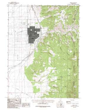
Nephi Topo Map Utah
To zoom in, hover over the map of Nephi
USGS Topo Quad 39111f7 - 1:24,000 scale
| Topo Map Name: | Nephi |
| USGS Topo Quad ID: | 39111f7 |
| Print Size: | ca. 21 1/4" wide x 27" high |
| Southeast Coordinates: | 39.625° N latitude / 111.75° W longitude |
| Map Center Coordinates: | 39.6875° N latitude / 111.8125° W longitude |
| U.S. State: | UT |
| Filename: | o39111f7.jpg |
| Download Map JPG Image: | Nephi topo map 1:24,000 scale |
| Map Type: | Topographic |
| Topo Series: | 7.5´ |
| Map Scale: | 1:24,000 |
| Source of Map Images: | United States Geological Survey (USGS) |
| Alternate Map Versions: |
Nephi UT 1983, updated 1983 Download PDF Buy paper map Nephi UT 1983, updated 1986 Download PDF Buy paper map Nephi UT 2001, updated 2004 Download PDF Buy paper map Nephi UT 2011 Download PDF Buy paper map Nephi UT 2014 Download PDF Buy paper map |
| FStopo: | US Forest Service topo Nephi is available: Download FStopo PDF Download FStopo TIF |
1:24,000 Topo Quads surrounding Nephi
> Back to 39111e1 at 1:100,000 scale
> Back to 39110a1 at 1:250,000 scale
> Back to U.S. Topo Maps home
Nephi topo map: Gazetteer
Nephi: Airports
Central Valley Medical Center Heliport elevation 1570m 5150′Nephi Heliport elevation 1529m 5016′
Nephi Municipal Airport elevation 1523m 4996′
Nephi: Cliffs
Cedar Point elevation 1837m 6026′Nephi: Flats
Rees Flat elevation 1955m 6414′Nephi: Mines
Rowleys Mine elevation 1840m 6036′Nephi: Parks
Mountain View Trailer Park elevation 1559m 5114′Triangle Ranch Wildlife Management Area elevation 1876m 6154′
Nephi: Populated Places
Gypsum Mill elevation 1630m 5347′Nephi elevation 1563m 5127′
Nephi: Post Offices
Nephi Post Office elevation 1564m 5131′Nephi: Springs
Death Hollow Spring elevation 2047m 6715′Gravel Spring elevation 2202m 7224′
Old Pinery Springs elevation 2180m 7152′
Rock Spring elevation 2210m 7250′
Nephi: Streams
Gardner Creek elevation 1619m 5311′Gardners Fork elevation 1701m 5580′
Salt Creek elevation 1593m 5226′
Nephi: Valleys
Andrews Spring Canyon elevation 1657m 5436′Biglows Canyon elevation 1573m 5160′
Broad Canyon elevation 1609m 5278′
Footes Canyon elevation 1707m 5600′
Little Valley elevation 1791m 5875′
Miller Canyon elevation 1610m 5282′
Old Pinery Canyon elevation 1574m 5164′
Quaking Asp Canyon elevation 1661m 5449′
Red Canyon elevation 1565m 5134′
Rocky Ridge Canyon elevation 1722m 5649′
Salt Spring Canyon elevation 1705m 5593′
Suttons Canyon elevation 1751m 5744′
Nephi digital topo map on disk
Buy this Nephi topo map showing relief, roads, GPS coordinates and other geographical features, as a high-resolution digital map file on DVD:


