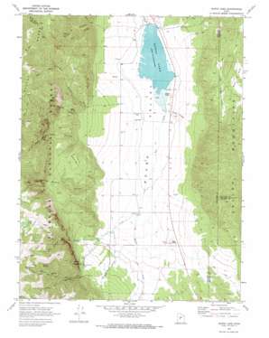
Scipio Lake Topo Map Utah
To zoom in, hover over the map of Scipio Lake
USGS Topo Quad 39112a1 - 1:24,000 scale
| Topo Map Name: | Scipio Lake |
| USGS Topo Quad ID: | 39112a1 |
| Print Size: | ca. 21 1/4" wide x 27" high |
| Southeast Coordinates: | 39° N latitude / 112° W longitude |
| Map Center Coordinates: | 39.0625° N latitude / 112.0625° W longitude |
| U.S. State: | UT |
| Filename: | o39112a1.jpg |
| Download Map JPG Image: | Scipio Lake topo map 1:24,000 scale |
| Map Type: | Topographic |
| Topo Series: | 7.5´ |
| Map Scale: | 1:24,000 |
| Source of Map Images: | United States Geological Survey (USGS) |
| Alternate Map Versions: |
Scipio Lake UT 1969, updated 1972 Download PDF Buy paper map Scipio Lake UT 2001, updated 2003 Download PDF Buy paper map Scipio Lake UT 2011 Download PDF Buy paper map Scipio Lake UT 2014 Download PDF Buy paper map |
| FStopo: | US Forest Service topo Scipio Lake is available: Download FStopo PDF Download FStopo TIF |
1:24,000 Topo Quads surrounding Scipio Lake
> Back to 39112a1 at 1:100,000 scale
> Back to 39112a1 at 1:250,000 scale
> Back to U.S. Topo Maps home
Scipio Lake topo map: Gazetteer
Scipio Lake: Basins
Little Long Valley elevation 2066m 6778′Scipio Lake: Dams
Scipio Lake Dam elevation 1818m 5964′Scipio Lake: Lakes
Robins Lake elevation 2723m 8933′Scipio Lake elevation 1818m 5964′
Scipio Lake: Populated Places
Maple Grove elevation 2156m 7073′Scipio Lake: Reservoirs
Scipio Lake elevation 1818m 5964′Scipio Lake: Ridges
Pharo Ridge elevation 2640m 8661′Scipio Lake: Springs
Cedar Spring elevation 2545m 8349′David Norris Spring (not official) elevation 1831m 6007′
Libbs Spring elevation 2118m 6948′
Scipio Lake: Streams
Ivie Creek elevation 1820m 5971′Pharo Creek elevation 1857m 6092′
Willow Creek elevation 1839m 6033′
Scipio Lake: Summits
Dairy Knoll elevation 1831m 6007′Red Knoll elevation 1902m 6240′
Round Hill elevation 2233m 7326′
Three Knolls elevation 1870m 6135′
Scipio Lake: Valleys
Cutler Canyon elevation 1927m 6322′Dry Canyon elevation 2017m 6617′
Hans Pumpernickle Canyon elevation 1955m 6414′
Left Fork Rock Canyon elevation 2220m 7283′
Libbs Canyon elevation 2026m 6646′
Loafers Canyon elevation 1952m 6404′
Pharo Canyon elevation 1857m 6092′
Rock Canyon elevation 2005m 6578′
Spring Branch Canyon elevation 1921m 6302′
Scipio Lake digital topo map on disk
Buy this Scipio Lake topo map showing relief, roads, GPS coordinates and other geographical features, as a high-resolution digital map file on DVD:


