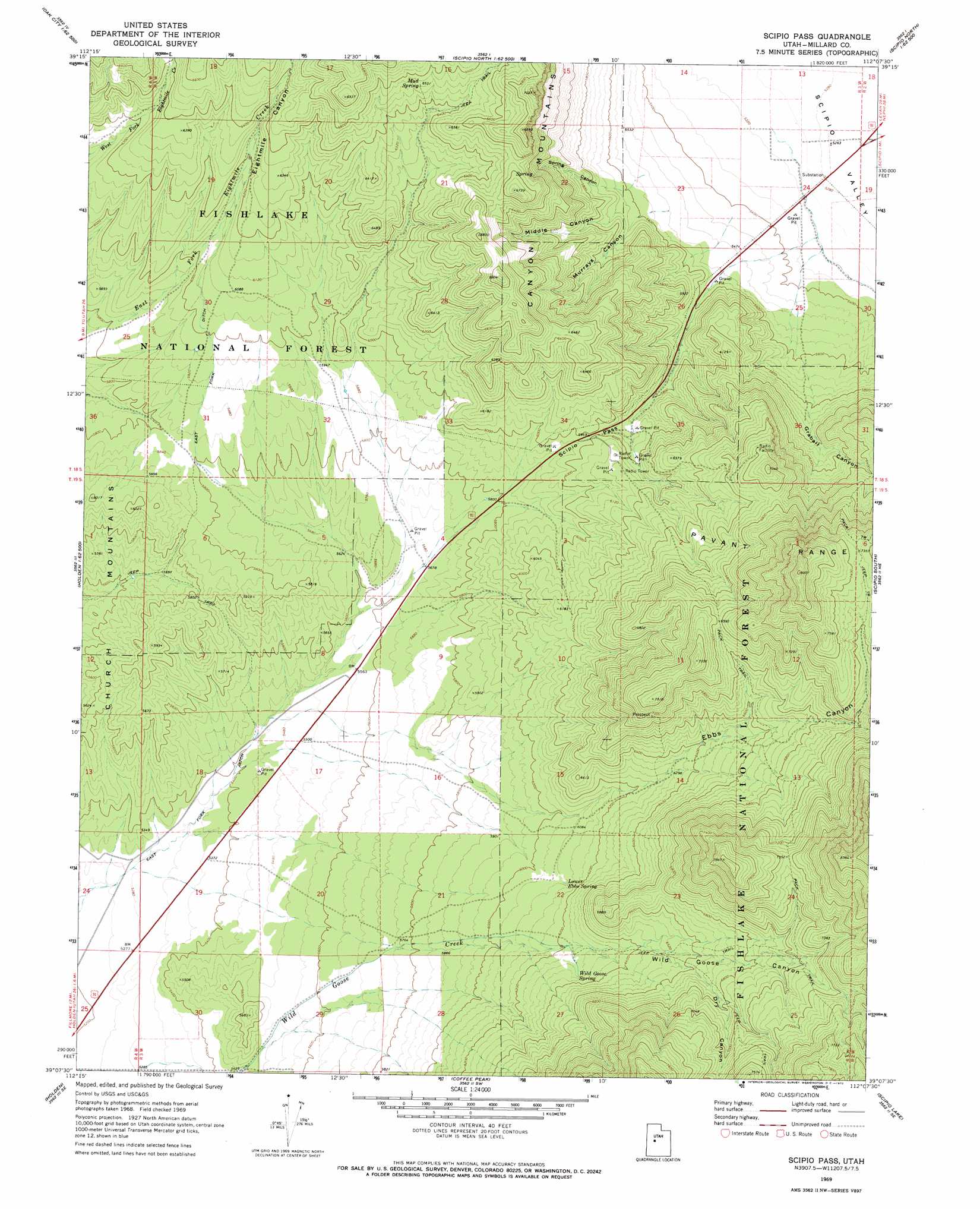
Scipio Pass Topo Map Utah
To zoom in, hover over the map of Scipio Pass
USGS Topo Quad 39112b2 - 1:24,000 scale
| Topo Map Name: | Scipio Pass |
| USGS Topo Quad ID: | 39112b2 |
| Print Size: | ca. 21 1/4" wide x 27" high |
| Southeast Coordinates: | 39.125° N latitude / 112.125° W longitude |
| Map Center Coordinates: | 39.1875° N latitude / 112.1875° W longitude |
| U.S. State: | UT |
| Filename: | o39112b2.jpg |
| Download Map JPG Image: | Scipio Pass topo map 1:24,000 scale |
| Map Type: | Topographic |
| Topo Series: | 7.5´ |
| Map Scale: | 1:24,000 |
| Source of Map Images: | United States Geological Survey (USGS) |
| Alternate Map Versions: |
Scipio Pass UT 1969, updated 1972 Download PDF Buy paper map Scipio Pass UT 2001, updated 2003 Download PDF Buy paper map Scipio Pass UT 2011 Download PDF Buy paper map Scipio Pass UT 2014 Download PDF Buy paper map |
| FStopo: | US Forest Service topo Scipio Pass is available: Download FStopo PDF Download FStopo TIF |
1:24,000 Topo Quads surrounding Scipio Pass
Strong |
Oak City North |
Fool Creek Peak |
Mills |
Skinner Peaks |
Harding |
Oak City South |
Williams Peak |
Scipio North |
Hells Kitchen Canyon Sw |
Mccornick |
Duggins Creek |
Scipio Pass |
Scipio South |
Hayes Canyon |
The Sink |
Holden |
Coffee Peak |
Scipio Lake |
Redmond Canyon |
Meadow |
Fillmore |
Mount Catherine |
Beehive Peak |
Aurora |
> Back to 39112a1 at 1:100,000 scale
> Back to 39112a1 at 1:250,000 scale
> Back to U.S. Topo Maps home
Scipio Pass topo map: Gazetteer
Scipio Pass: Canals
East Fork Ditch elevation 1652m 5419′Scipio Pass: Gaps
Scipio Pass elevation 1830m 6003′Scipio Pass: Parks
Holden Wildlife Management Area elevation 1756m 5761′Young Field Wildlife Management Area elevation 1732m 5682′
Scipio Pass: Springs
Lower Ebbs Spring elevation 1854m 6082′Mud Spring elevation 1993m 6538′
Wild Goose Spring elevation 1914m 6279′
Scipio Pass: Valleys
Dry Canyon elevation 2033m 6669′Ebbs Canyon elevation 1808m 5931′
Eightmile Canyon elevation 1857m 6092′
Graball Canyon elevation 1708m 5603′
Middle Canyon elevation 1732m 5682′
Murrays Canyon elevation 1708m 5603′
Spring Canyon elevation 1709m 5606′
Wild Goose Canyon elevation 1903m 6243′
Scipio Pass digital topo map on disk
Buy this Scipio Pass topo map showing relief, roads, GPS coordinates and other geographical features, as a high-resolution digital map file on DVD: