Duggins Creek Topo Map Utah
To zoom in, hover over the map of Duggins Creek
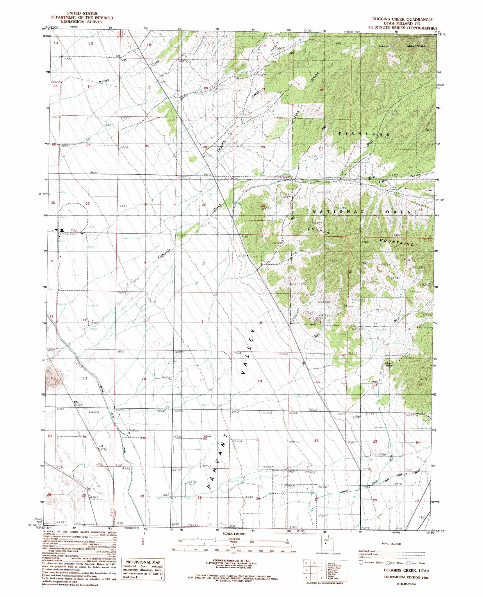
USGS Topo Quad 39112b3 - 1:24,000 scale
| Topo Map Name: | Duggins Creek |
| USGS Topo Quad ID: | 39112b3 |
| Print Size: | ca. 21 1/4" wide x 27" high |
| Southeast Coordinates: | 39.125° N latitude / 112.25° W longitude |
| Map Center Coordinates: | 39.1875° N latitude / 112.3125° W longitude |
| U.S. State: | UT |
| Filename: | o39112b3.jpg |
| Download Map JPG Image: | Duggins Creek topo map 1:24,000 scale |
| Map Type: | Topographic |
| Topo Series: | 7.5´ |
| Map Scale: | 1:24,000 |
| Source of Map Images: | United States Geological Survey (USGS) |
| Alternate Map Versions: |
Duggins Creek UT 1986, updated 1987 Download PDF Buy paper map Duggins Creek UT 2001, updated 2003 Download PDF Buy paper map Duggins Creek UT 2011 Download PDF Buy paper map Duggins Creek UT 2014 Download PDF Buy paper map |
| FStopo: | US Forest Service topo Duggins Creek is available: Download FStopo PDF Download FStopo TIF |
1:24,000 Topo Quads surrounding Duggins Creek
Delta Ne |
Strong |
Oak City North |
Fool Creek Peak |
Mills |
Delta |
Harding |
Oak City South |
Williams Peak |
Scipio North |
Pavant Butte North |
Mccornick |
Duggins Creek |
Scipio Pass |
Scipio South |
Pavant Butte South |
The Sink |
Holden |
Coffee Peak |
Scipio Lake |
Tabernacle Hill |
Meadow |
Fillmore |
Mount Catherine |
Beehive Peak |
> Back to 39112a1 at 1:100,000 scale
> Back to 39112a1 at 1:250,000 scale
> Back to U.S. Topo Maps home
Duggins Creek topo map: Gazetteer
Duggins Creek: Canals
Church Spring Ditch elevation 1567m 5141′Duggins Creek: Ranges
Church Mountains elevation 1770m 5807′Duggins Creek: Springs
Church Spring elevation 1605m 5265′Coyote Spring elevation 1589m 5213′
Duggins Creek: Streams
Duggins Creek elevation 1517m 4977′East Fork Eightmile Creek elevation 1659m 5442′
West Fork Eightmile Creek elevation 1656m 5433′
Duggins Creek: Valleys
Church Spring Wash elevation 1565m 5134′Long Canyon elevation 1629m 5344′
Pahvant Valley elevation 1568m 5144′
Duggins Creek digital topo map on disk
Buy this Duggins Creek topo map showing relief, roads, GPS coordinates and other geographical features, as a high-resolution digital map file on DVD: