Delta Topo Map Utah
To zoom in, hover over the map of Delta
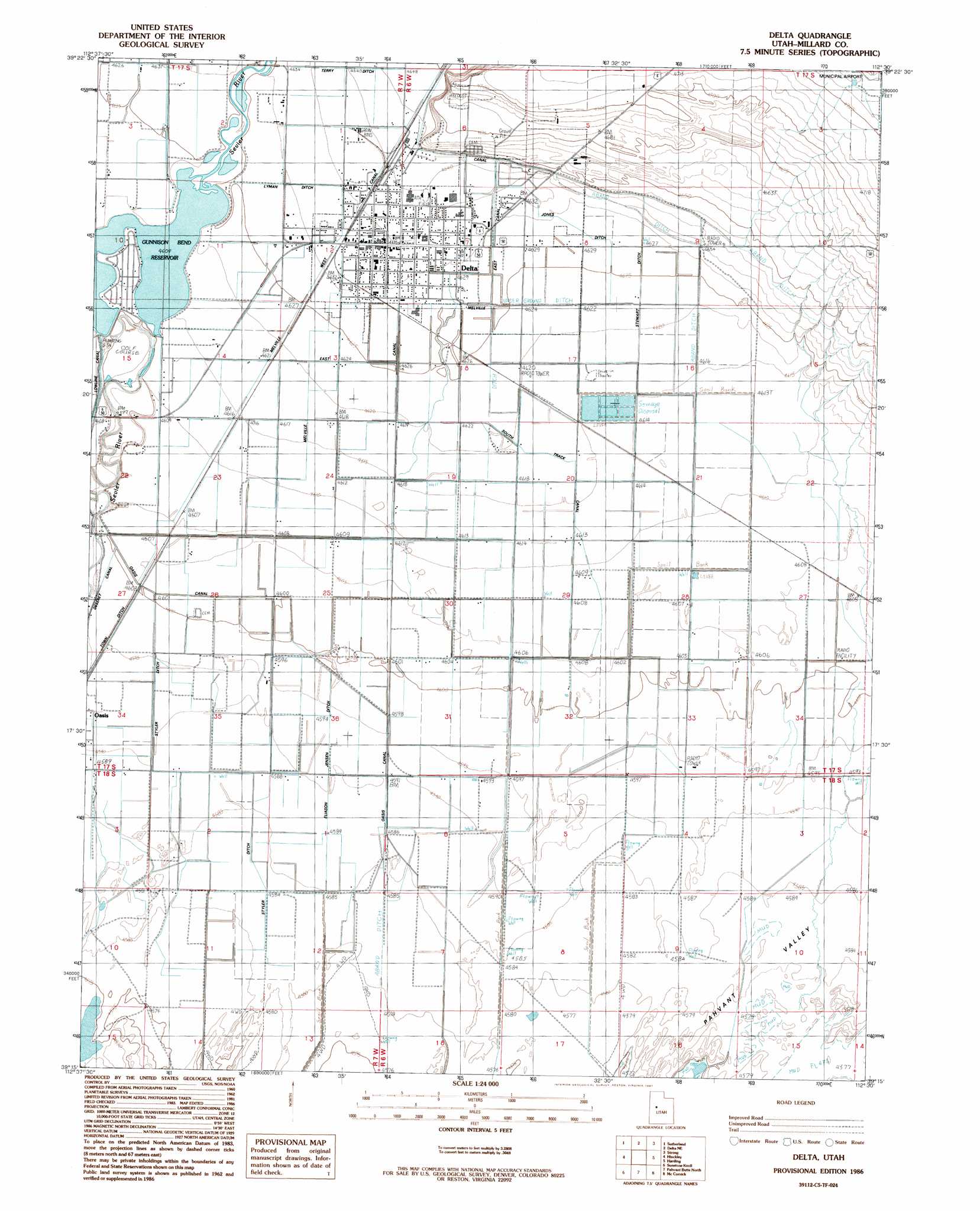
USGS Topo Quad 39112c5 - 1:24,000 scale
| Topo Map Name: | Delta |
| USGS Topo Quad ID: | 39112c5 |
| Print Size: | ca. 21 1/4" wide x 27" high |
| Southeast Coordinates: | 39.25° N latitude / 112.5° W longitude |
| Map Center Coordinates: | 39.3125° N latitude / 112.5625° W longitude |
| U.S. State: | UT |
| Filename: | o39112c5.jpg |
| Download Map JPG Image: | Delta topo map 1:24,000 scale |
| Map Type: | Topographic |
| Topo Series: | 7.5´ |
| Map Scale: | 1:24,000 |
| Source of Map Images: | United States Geological Survey (USGS) |
| Alternate Map Versions: |
Delta UT 1986, updated 1987 Download PDF Buy paper map Delta UT 2010 Download PDF Buy paper map Delta UT 2014 Download PDF Buy paper map |
1:24,000 Topo Quads surrounding Delta
Fumarole Butte |
Baker Hot Springs |
Rain Lake |
Lynndyl West |
Lynndyl East |
Smelter Knolls East |
Sutherland |
Delta Ne |
Strong |
Oak City North |
Crafts Lake |
Hinckley |
Delta |
Harding |
Oak City South |
Pot Mountain |
Sunstone Knoll |
Pavant Butte North |
Mccornick |
Duggins Creek |
Neels |
Clear Lake |
Pavant Butte South |
The Sink |
Holden |
> Back to 39112a1 at 1:100,000 scale
> Back to 39112a1 at 1:250,000 scale
> Back to U.S. Topo Maps home
Delta topo map: Gazetteer
Delta: Canals
Canal C elevation 1417m 4648′Eliason Jensen Ditch elevation 1401m 4596′
Jones Ditch elevation 1412m 4632′
Lyman Ditch elevation 1412m 4632′
Melville East Canal elevation 1411m 4629′
Melville West Canal elevation 1412m 4632′
Oasis Canal elevation 1403m 4603′
South Track Canal elevation 1406m 4612′
Stewart Ditch elevation 1409m 4622′
Styler Ditch elevation 1399m 4589′
Terry Ditch elevation 1415m 4642′
Town Ditch elevation 1402m 4599′
Delta: Dams
Gunnison Bend Dam elevation 1406m 4612′Delta: Populated Places
Delta elevation 1414m 4639′Delta: Post Offices
Delta Post Office elevation 1412m 4632′Delta: Reservoirs
Gunnison Bend Reservoir elevation 1406m 4612′Delta digital topo map on disk
Buy this Delta topo map showing relief, roads, GPS coordinates and other geographical features, as a high-resolution digital map file on DVD: