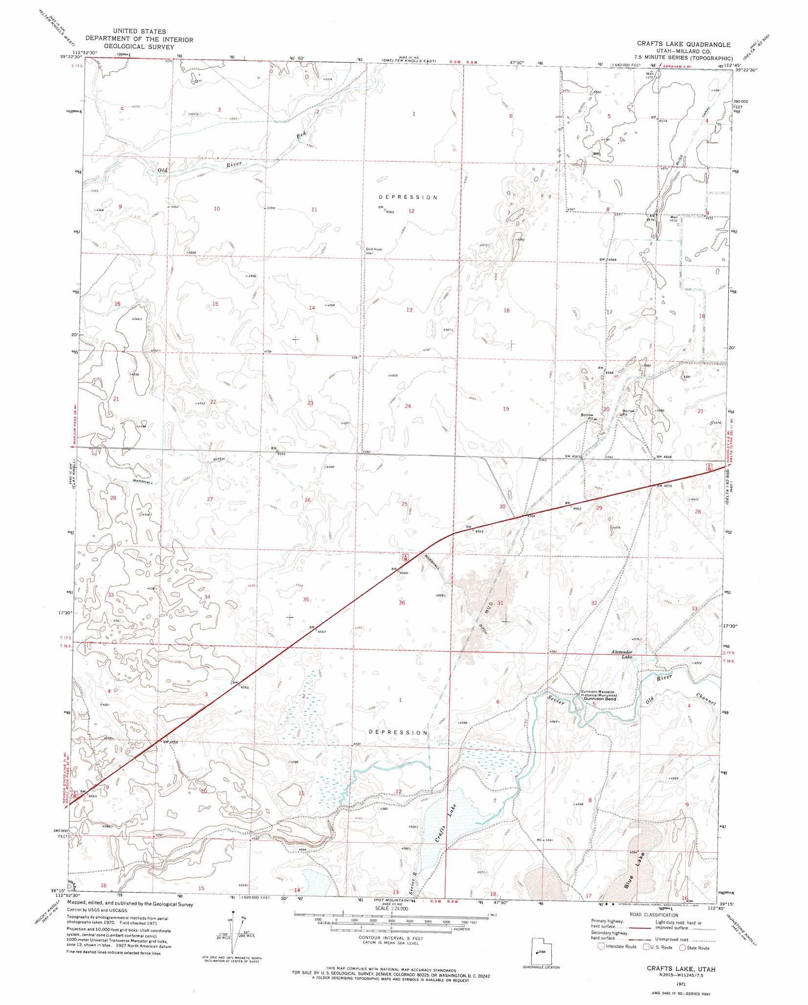
Crafts Lake Topo Map Utah
To zoom in, hover over the map of Crafts Lake
USGS Topo Quad 39112c7 - 1:24,000 scale
| Topo Map Name: | Crafts Lake |
| USGS Topo Quad ID: | 39112c7 |
| Print Size: | ca. 21 1/4" wide x 27" high |
| Southeast Coordinates: | 39.25° N latitude / 112.75° W longitude |
| Map Center Coordinates: | 39.3125° N latitude / 112.8125° W longitude |
| U.S. State: | UT |
| Filename: | o39112c7.jpg |
| Download Map JPG Image: | Crafts Lake topo map 1:24,000 scale |
| Map Type: | Topographic |
| Topo Series: | 7.5´ |
| Map Scale: | 1:24,000 |
| Source of Map Images: | United States Geological Survey (USGS) |
| Alternate Map Versions: |
Crafts Lake UT 1971, updated 1974 Download PDF Buy paper map Crafts Lake UT 2010 Download PDF Buy paper map Crafts Lake UT 2014 Download PDF Buy paper map |
1:24,000 Topo Quads surrounding Crafts Lake
Lady Laird Peak |
Drum Mountains Well |
Fumarole Butte |
Baker Hot Springs |
Rain Lake |
Little Drum Pass |
Smelter Knolls West |
Smelter Knolls East |
Sutherland |
Delta Ne |
Red Knolls |
Clay Knoll |
Crafts Lake |
Hinckley |
Delta |
Long Ridge |
Rocky Knoll |
Pot Mountain |
Sunstone Knoll |
Pavant Butte North |
Long Ridge Se |
Red Pass |
Neels |
Clear Lake |
Pavant Butte South |
> Back to 39112a1 at 1:100,000 scale
> Back to 39112a1 at 1:250,000 scale
> Back to U.S. Topo Maps home
Crafts Lake topo map: Gazetteer
Crafts Lake: Bends
Gunnison Bend elevation 1391m 4563′Crafts Lake: Canals
Marshall Ditch elevation 1391m 4563′Crafts Lake: Channels
Old Channel elevation 1391m 4563′Crafts Lake: Flats
Blue Lake elevation 1390m 4560′Crafts Lake: Lakes
Alexander Lake elevation 1390m 4560′Crafts Lake elevation 1389m 4557′
Crafts Lake: Parks
Gunnison Massacre Historical Monument elevation 1392m 4566′Crafts Lake digital topo map on disk
Buy this Crafts Lake topo map showing relief, roads, GPS coordinates and other geographical features, as a high-resolution digital map file on DVD: