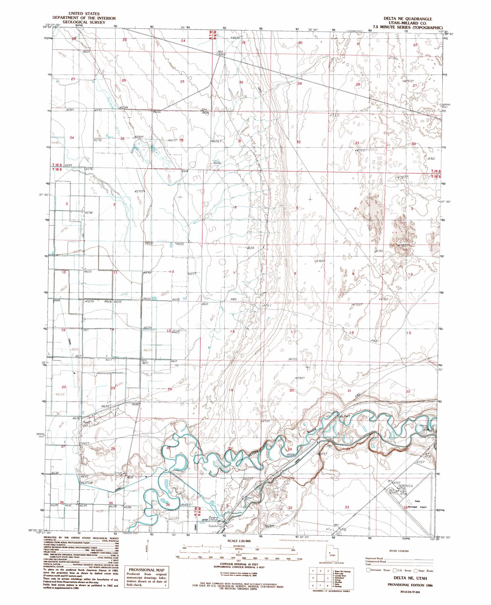
Delta Ne Topo Map Utah
To zoom in, hover over the map of Delta Ne
USGS Topo Quad 39112d5 - 1:24,000 scale
| Topo Map Name: | Delta Ne |
| USGS Topo Quad ID: | 39112d5 |
| Print Size: | ca. 21 1/4" wide x 27" high |
| Southeast Coordinates: | 39.375° N latitude / 112.5° W longitude |
| Map Center Coordinates: | 39.4375° N latitude / 112.5625° W longitude |
| U.S. State: | UT |
| Filename: | o39112d5.jpg |
| Download Map JPG Image: | Delta Ne topo map 1:24,000 scale |
| Map Type: | Topographic |
| Topo Series: | 7.5´ |
| Map Scale: | 1:24,000 |
| Source of Map Images: | United States Geological Survey (USGS) |
| Alternate Map Versions: |
Delta NE UT 1986, updated 1987 Download PDF Buy paper map Delta NE UT 2010 Download PDF Buy paper map Delta NE UT 2014 Download PDF Buy paper map |
1:24,000 Topo Quads surrounding Delta Ne
The Hogback |
Crater Bench Reservoir |
Desert Mountain Reservoir |
Lynndyl Nw |
Tanner Creek Narrows |
Fumarole Butte |
Baker Hot Springs |
Rain Lake |
Lynndyl West |
Lynndyl East |
Smelter Knolls East |
Sutherland |
Delta Ne |
Strong |
Oak City North |
Crafts Lake |
Hinckley |
Delta |
Harding |
Oak City South |
Pot Mountain |
Sunstone Knoll |
Pavant Butte North |
Mccornick |
Duggins Creek |
> Back to 39112a1 at 1:100,000 scale
> Back to 39112a1 at 1:250,000 scale
> Back to U.S. Topo Maps home
Delta Ne topo map: Gazetteer
Delta Ne: Airports
Delta Community Medical Center Heliport elevation 1446m 4744′Delta Municipal Airport elevation 1448m 4750′
Delta Ne: Canals
Canal A elevation 1418m 4652′Canal B elevation 1415m 4642′
Delta Ne digital topo map on disk
Buy this Delta Ne topo map showing relief, roads, GPS coordinates and other geographical features, as a high-resolution digital map file on DVD: