Sutherland Topo Map Utah
To zoom in, hover over the map of Sutherland
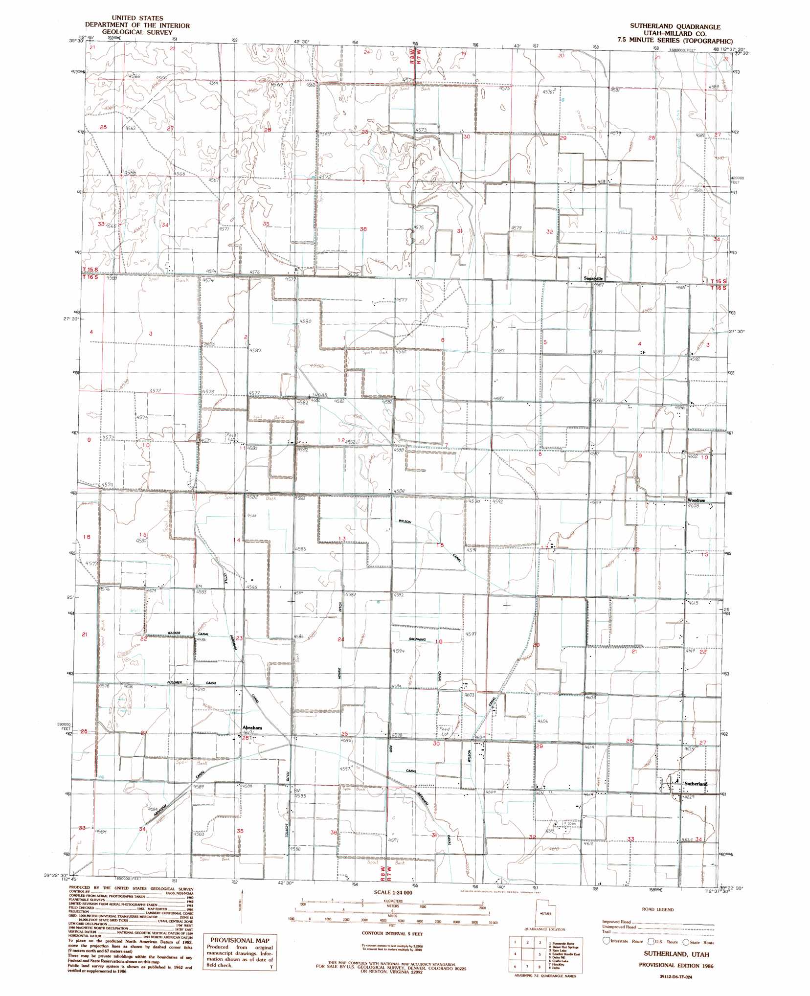
USGS Topo Quad 39112d6 - 1:24,000 scale
| Topo Map Name: | Sutherland |
| USGS Topo Quad ID: | 39112d6 |
| Print Size: | ca. 21 1/4" wide x 27" high |
| Southeast Coordinates: | 39.375° N latitude / 112.625° W longitude |
| Map Center Coordinates: | 39.4375° N latitude / 112.6875° W longitude |
| U.S. State: | UT |
| Filename: | o39112d6.jpg |
| Download Map JPG Image: | Sutherland topo map 1:24,000 scale |
| Map Type: | Topographic |
| Topo Series: | 7.5´ |
| Map Scale: | 1:24,000 |
| Source of Map Images: | United States Geological Survey (USGS) |
| Alternate Map Versions: |
Sutherland UT 1986, updated 1987 Download PDF Buy paper map Sutherland UT 2011 Download PDF Buy paper map Sutherland UT 2014 Download PDF Buy paper map |
1:24,000 Topo Quads surrounding Sutherland
Picture Rock Hills |
The Hogback |
Crater Bench Reservoir |
Desert Mountain Reservoir |
Lynndyl Nw |
Drum Mountains Well |
Fumarole Butte |
Baker Hot Springs |
Rain Lake |
Lynndyl West |
Smelter Knolls West |
Smelter Knolls East |
Sutherland |
Delta Ne |
Strong |
Clay Knoll |
Crafts Lake |
Hinckley |
Delta |
Harding |
Rocky Knoll |
Pot Mountain |
Sunstone Knoll |
Pavant Butte North |
Mccornick |
> Back to 39112a1 at 1:100,000 scale
> Back to 39112a1 at 1:250,000 scale
> Back to U.S. Topo Maps home
Sutherland topo map: Gazetteer
Sutherland: Canals
Abraham Canal elevation 1400m 4593′Fullmer Canal elevation 1399m 4589′
Gronning Canal elevation 1403m 4603′
Henrie Ditch elevation 1400m 4593′
Little Abraham Canal elevation 1400m 4593′
Reid Canal elevation 1403m 4603′
Tolbert Ditch elevation 1400m 4593′
Walker Canal elevation 1399m 4589′
Wilson Canal elevation 1403m 4603′
Sutherland: Plains
Sevier Desert elevation 1402m 4599′Sutherland: Populated Places
Abraham elevation 1400m 4593′Sugarville elevation 1397m 4583′
Sutherland elevation 1410m 4625′
Sutherland digital topo map on disk
Buy this Sutherland topo map showing relief, roads, GPS coordinates and other geographical features, as a high-resolution digital map file on DVD: