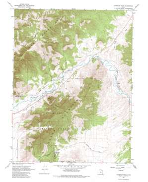
Champlin Peak Topo Map Utah
To zoom in, hover over the map of Champlin Peak
USGS Topo Quad 39112e2 - 1:24,000 scale
| Topo Map Name: | Champlin Peak |
| USGS Topo Quad ID: | 39112e2 |
| Print Size: | ca. 21 1/4" wide x 27" high |
| Southeast Coordinates: | 39.5° N latitude / 112.125° W longitude |
| Map Center Coordinates: | 39.5625° N latitude / 112.1875° W longitude |
| U.S. State: | UT |
| Filename: | o39112e2.jpg |
| Download Map JPG Image: | Champlin Peak topo map 1:24,000 scale |
| Map Type: | Topographic |
| Topo Series: | 7.5´ |
| Map Scale: | 1:24,000 |
| Source of Map Images: | United States Geological Survey (USGS) |
| Alternate Map Versions: |
Champlin Peak UT 1967, updated 1969 Download PDF Buy paper map Champlin Peak UT 1967, updated 1981 Download PDF Buy paper map Champlin Peak UT 2001, updated 2003 Download PDF Buy paper map Champlin Peak UT 2011 Download PDF Buy paper map Champlin Peak UT 2014 Download PDF Buy paper map |
| FStopo: | US Forest Service topo Champlin Peak is available: Download FStopo PDF Download FStopo TIF |
1:24,000 Topo Quads surrounding Champlin Peak
> Back to 39112e1 at 1:100,000 scale
> Back to 39112a1 at 1:250,000 scale
> Back to U.S. Topo Maps home
Champlin Peak topo map: Gazetteer
Champlin Peak: Canals
Leamington Canal elevation 1447m 4747′Champlin Peak: Gaps
Leamington Pass elevation 1764m 5787′Champlin Peak: Populated Places
Parley elevation 1482m 4862′Soma elevation 1479m 4852′
Uisco elevation 1470m 4822′
Champlin Peak: Ranges
Gilson Mountains elevation 2215m 7267′Champlin Peak: Summits
Champlin Peak elevation 2283m 7490′Champlin Peak: Valleys
Dog Valley Wash elevation 1479m 4852′Gilson Wash elevation 1470m 4822′
Sevier Canyon elevation 1479m 4852′
Spring Canyon elevation 1476m 4842′
Tank Canyon elevation 1479m 4852′
Wood Canyon elevation 1540m 5052′
Champlin Peak digital topo map on disk
Buy this Champlin Peak topo map showing relief, roads, GPS coordinates and other geographical features, as a high-resolution digital map file on DVD:


