Furner Ridge Topo Map Utah
To zoom in, hover over the map of Furner Ridge
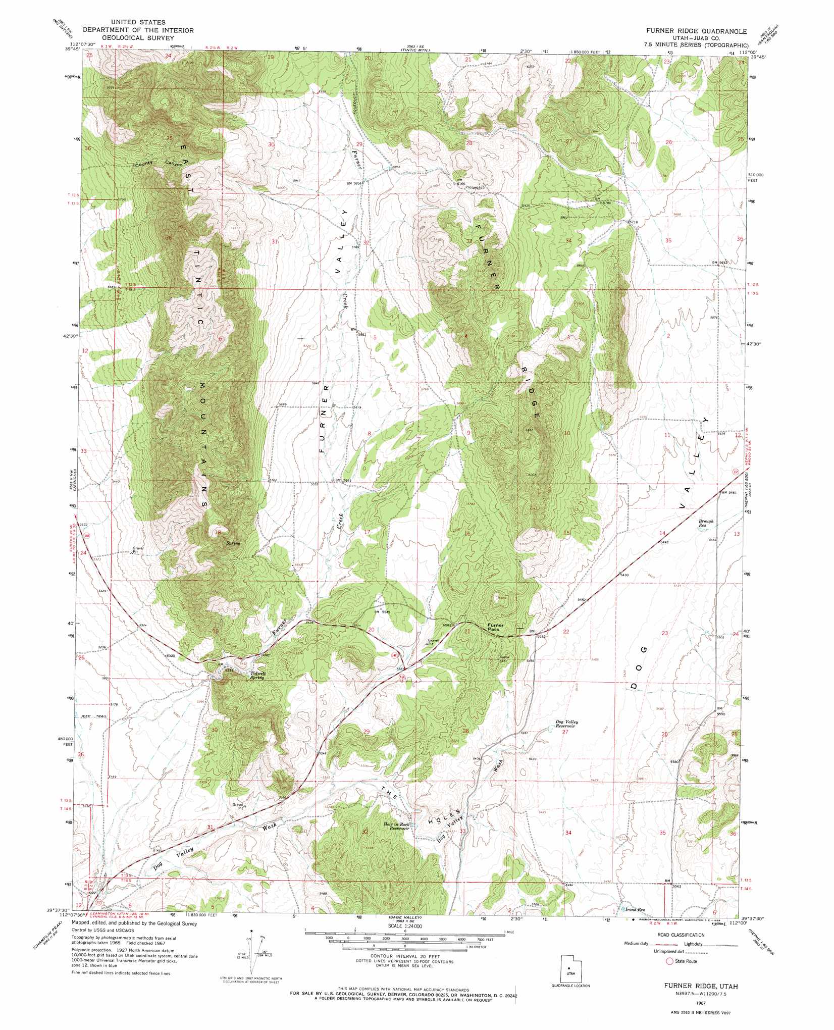
USGS Topo Quad 39112f1 - 1:24,000 scale
| Topo Map Name: | Furner Ridge |
| USGS Topo Quad ID: | 39112f1 |
| Print Size: | ca. 21 1/4" wide x 27" high |
| Southeast Coordinates: | 39.625° N latitude / 112° W longitude |
| Map Center Coordinates: | 39.6875° N latitude / 112.0625° W longitude |
| U.S. State: | UT |
| Filename: | o39112f1.jpg |
| Download Map JPG Image: | Furner Ridge topo map 1:24,000 scale |
| Map Type: | Topographic |
| Topo Series: | 7.5´ |
| Map Scale: | 1:24,000 |
| Source of Map Images: | United States Geological Survey (USGS) |
| Alternate Map Versions: |
Furner Ridge UT 1967, updated 1969 Download PDF Buy paper map Furner Ridge UT 2010 Download PDF Buy paper map Furner Ridge UT 2014 Download PDF Buy paper map |
1:24,000 Topo Quads surrounding Furner Ridge
Sabie Mountain |
Tintic Junction |
Eureka |
Goshen |
Santaquin |
Maple Peak |
Mcintyre |
Tintic Mountain |
Slate Jack Canyon |
Mona |
Tanner Creek Narrows |
Jericho |
Furner Ridge |
Sugarloaf |
Nephi |
Lynndyl East |
Champlin Peak |
Sage Valley |
Juab |
Levan |
Oak City North |
Fool Creek Peak |
Mills |
Skinner Peaks |
Chriss Canyon |
> Back to 39112e1 at 1:100,000 scale
> Back to 39112a1 at 1:250,000 scale
> Back to U.S. Topo Maps home
Furner Ridge topo map: Gazetteer
Furner Ridge: Basins
The Holes elevation 1627m 5337′Furner Ridge: Gaps
Furner Pass elevation 1722m 5649′Furner Ridge: Reservoirs
Brough Reservoir elevation 1660m 5446′Dog Valley Reservoir elevation 1648m 5406′
Hole in Rock Reservoir elevation 1619m 5311′
Irons Reservoir elevation 1680m 5511′
Furner Ridge: Ridges
Furner Ridge elevation 1877m 6158′Furner Ridge: Springs
Tidwell Spring elevation 1642m 5387′Furner Ridge: Streams
Furner Creek elevation 1584m 5196′Furner Ridge: Valleys
County Canyon elevation 1795m 5889′Furner Valley elevation 1679m 5508′
Furner Ridge digital topo map on disk
Buy this Furner Ridge topo map showing relief, roads, GPS coordinates and other geographical features, as a high-resolution digital map file on DVD: