Crater Bench Reservoir Topo Map Utah
To zoom in, hover over the map of Crater Bench Reservoir
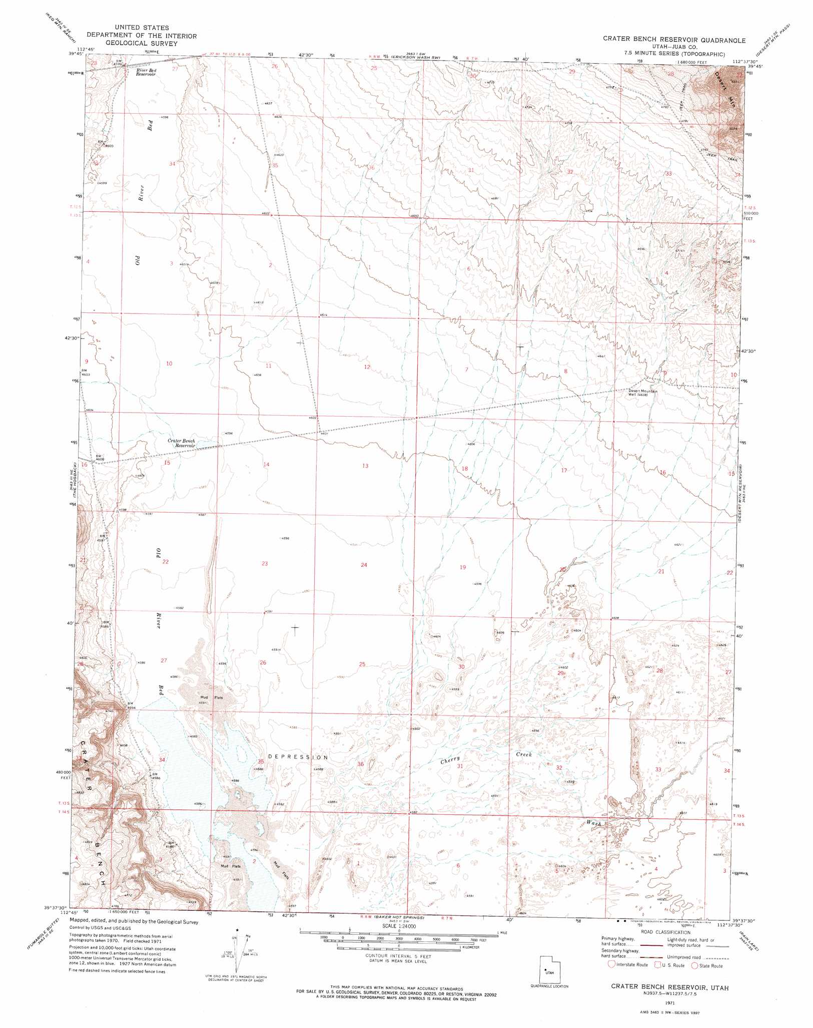
USGS Topo Quad 39112f6 - 1:24,000 scale
| Topo Map Name: | Crater Bench Reservoir |
| USGS Topo Quad ID: | 39112f6 |
| Print Size: | ca. 21 1/4" wide x 27" high |
| Southeast Coordinates: | 39.625° N latitude / 112.625° W longitude |
| Map Center Coordinates: | 39.6875° N latitude / 112.6875° W longitude |
| U.S. State: | UT |
| Filename: | o39112f6.jpg |
| Download Map JPG Image: | Crater Bench Reservoir topo map 1:24,000 scale |
| Map Type: | Topographic |
| Topo Series: | 7.5´ |
| Map Scale: | 1:24,000 |
| Source of Map Images: | United States Geological Survey (USGS) |
| Alternate Map Versions: |
Crater Bench Reservoir UT 1971, updated 1974 Download PDF Buy paper map Crater Bench Reservoir UT 2010 Download PDF Buy paper map Crater Bench Reservoir UT 2014 Download PDF Buy paper map |
1:24,000 Topo Quads surrounding Crater Bench Reservoir
Table Mountain |
Coyote Springs |
Indian Springs |
Erickson Knoll |
Dutch Peak |
Keg Pass |
Keg Mountain Ranch |
Erickson Wash Sw |
Desert Mountain Pass |
Cherry Creek |
Picture Rock Hills |
The Hogback |
Crater Bench Reservoir |
Desert Mountain Reservoir |
Lynndyl Nw |
Drum Mountains Well |
Fumarole Butte |
Baker Hot Springs |
Rain Lake |
Lynndyl West |
Smelter Knolls West |
Smelter Knolls East |
Sutherland |
Delta Ne |
Strong |
> Back to 39112e1 at 1:100,000 scale
> Back to 39112a1 at 1:250,000 scale
> Back to U.S. Topo Maps home
Crater Bench Reservoir topo map: Gazetteer
Crater Bench Reservoir: Reservoirs
Crater Bench Reservoir elevation 1400m 4593′River Bed Reservoir elevation 1402m 4599′
Crater Bench Reservoir: Valleys
Cherry Creek Wash elevation 1397m 4583′Crater Bench Reservoir: Wells
Desert Mountain Well elevation 1415m 4642′Crater Bench Reservoir digital topo map on disk
Buy this Crater Bench Reservoir topo map showing relief, roads, GPS coordinates and other geographical features, as a high-resolution digital map file on DVD: