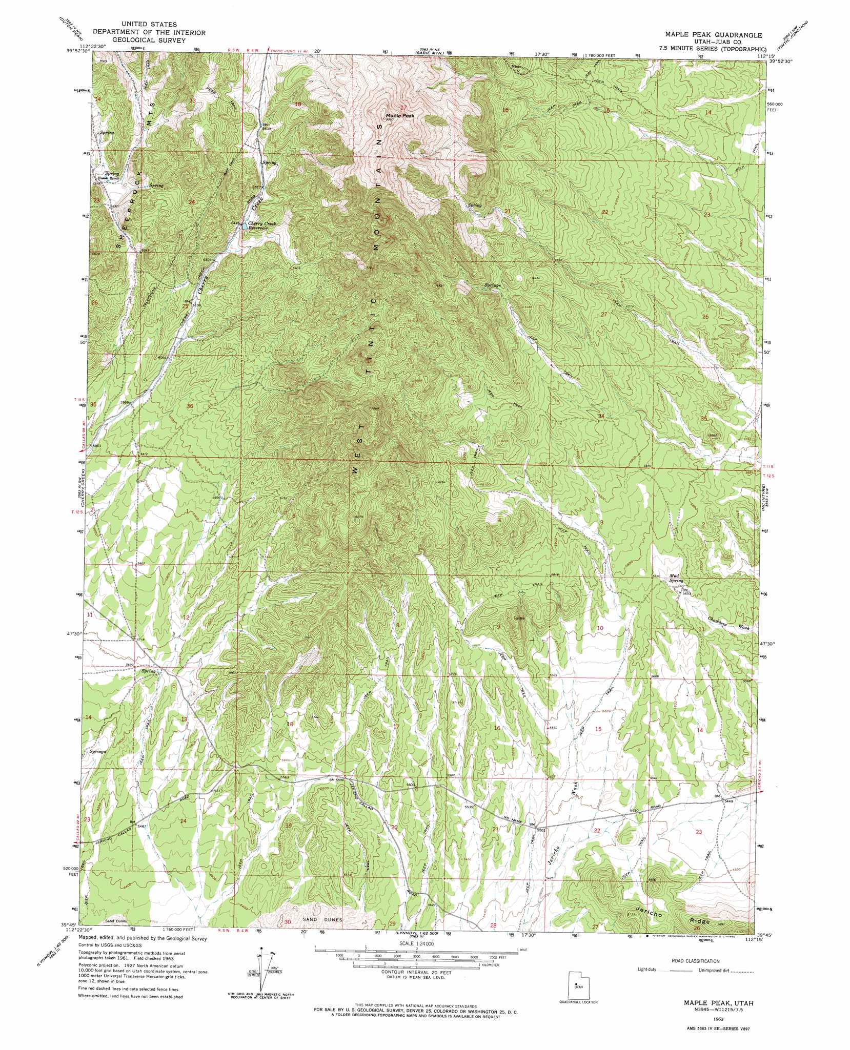
Maple Peak Topo Map Utah
To zoom in, hover over the map of Maple Peak
USGS Topo Quad 39112g3 - 1:24,000 scale
| Topo Map Name: | Maple Peak |
| USGS Topo Quad ID: | 39112g3 |
| Print Size: | ca. 21 1/4" wide x 27" high |
| Southeast Coordinates: | 39.75° N latitude / 112.25° W longitude |
| Map Center Coordinates: | 39.8125° N latitude / 112.3125° W longitude |
| U.S. State: | UT |
| Filename: | o39112g3.jpg |
| Download Map JPG Image: | Maple Peak topo map 1:24,000 scale |
| Map Type: | Topographic |
| Topo Series: | 7.5´ |
| Map Scale: | 1:24,000 |
| Source of Map Images: | United States Geological Survey (USGS) |
| Alternate Map Versions: |
Maple Peak UT 1963, updated 1964 Download PDF Buy paper map Maple Peak UT 2010 Download PDF Buy paper map Maple Peak UT 2014 Download PDF Buy paper map |
1:24,000 Topo Quads surrounding Maple Peak
Lookout Pass |
Vernon |
Lofgreen |
Boulter Peak |
Allens Ranch |
Erickson Knoll |
Dutch Peak |
Sabie Mountain |
Tintic Junction |
Eureka |
Desert Mountain Pass |
Cherry Creek |
Maple Peak |
Mcintyre |
Tintic Mountain |
Desert Mountain Reservoir |
Lynndyl Nw |
Tanner Creek Narrows |
Jericho |
Furner Ridge |
Rain Lake |
Lynndyl West |
Lynndyl East |
Champlin Peak |
Sage Valley |
> Back to 39112e1 at 1:100,000 scale
> Back to 39112a1 at 1:250,000 scale
> Back to U.S. Topo Maps home
Maple Peak topo map: Gazetteer
Maple Peak: Ranges
West Tintic Mountains elevation 2345m 7693′Maple Peak: Reservoirs
Cherry Creek Reservoir elevation 1957m 6420′Maple Peak: Ridges
Jericho Ridge elevation 1713m 5620′Maple Peak: Springs
Mud Spring elevation 1744m 5721′Maple Peak: Summits
Maple Peak elevation 2450m 8038′Maple Peak digital topo map on disk
Buy this Maple Peak topo map showing relief, roads, GPS coordinates and other geographical features, as a high-resolution digital map file on DVD: