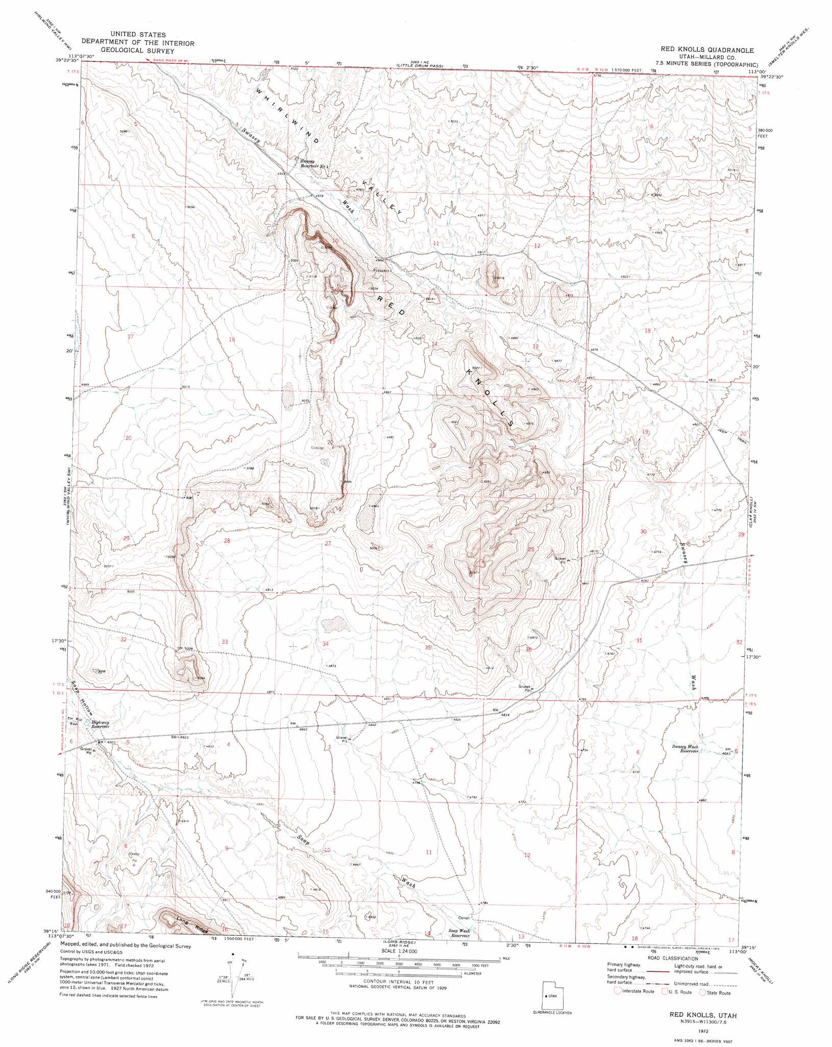
Red Knolls Topo Map Utah
To zoom in, hover over the map of Red Knolls
USGS Topo Quad 39113c1 - 1:24,000 scale
| Topo Map Name: | Red Knolls |
| USGS Topo Quad ID: | 39113c1 |
| Print Size: | ca. 21 1/4" wide x 27" high |
| Southeast Coordinates: | 39.25° N latitude / 113° W longitude |
| Map Center Coordinates: | 39.3125° N latitude / 113.0625° W longitude |
| U.S. State: | UT |
| Filename: | o39113c1.jpg |
| Download Map JPG Image: | Red Knolls topo map 1:24,000 scale |
| Map Type: | Topographic |
| Topo Series: | 7.5´ |
| Map Scale: | 1:24,000 |
| Source of Map Images: | United States Geological Survey (USGS) |
| Alternate Map Versions: |
Red Knolls UT 1972, updated 1974 Download PDF Buy paper map Red Knolls UT 2011 Download PDF Buy paper map Red Knolls UT 2014 Download PDF Buy paper map |
1:24,000 Topo Quads surrounding Red Knolls
Sand Pass Se |
Topaz Mountain Sw |
Lady Laird Peak |
Drum Mountains Well |
Fumarole Butte |
Swasey Peak |
Whirlwind Valley Nw |
Little Drum Pass |
Smelter Knolls West |
Smelter Knolls East |
Marjum Pass |
Whirlwind Valley Sw |
Red Knolls |
Clay Knoll |
Crafts Lake |
Miller Cove |
Long Ridge Reservoir |
Long Ridge |
Rocky Knoll |
Pot Mountain |
Skull Rock Pass |
Long Ridge Sw |
Long Ridge Se |
Red Pass |
Neels |
> Back to 39113a1 at 1:100,000 scale
> Back to 39112a1 at 1:250,000 scale
> Back to U.S. Topo Maps home
Red Knolls topo map: Gazetteer
Red Knolls: Reservoirs
Highway Reservoir elevation 1498m 4914′Soap Wash Reservoir elevation 1456m 4776′
Swasey Reservoir Number 4 elevation 1510m 4954′
Swasey Wash Reservoir elevation 1430m 4691′
Red Knolls: Summits
Red Knolls elevation 1513m 4963′Red Knolls: Valleys
Soap Hollow elevation 1483m 4865′Tin Well Wash elevation 1499m 4917′
Whirlwind Valley elevation 1456m 4776′
Red Knolls digital topo map on disk
Buy this Red Knolls topo map showing relief, roads, GPS coordinates and other geographical features, as a high-resolution digital map file on DVD: