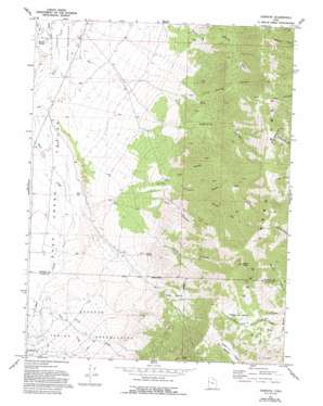
Goshute Topo Map Utah
To zoom in, hover over the map of Goshute
USGS Topo Quad 39113h8 - 1:24,000 scale
| Topo Map Name: | Goshute |
| USGS Topo Quad ID: | 39113h8 |
| Print Size: | ca. 21 1/4" wide x 27" high |
| Southeast Coordinates: | 39.875° N latitude / 113.875° W longitude |
| Map Center Coordinates: | 39.9375° N latitude / 113.9375° W longitude |
| U.S. State: | UT |
| Filename: | o39113h8.jpg |
| Download Map JPG Image: | Goshute topo map 1:24,000 scale |
| Map Type: | Topographic |
| Topo Series: | 7.5´ |
| Map Scale: | 1:24,000 |
| Source of Map Images: | United States Geological Survey (USGS) |
| Alternate Map Versions: |
Goshute UT 1972, updated 1975 Download PDF Buy paper map Goshute UT 1972, updated 1986 Download PDF Buy paper map Goshute UT 1972, updated 1993 Download PDF Buy paper map Goshute UT 2011 Download PDF Buy paper map Goshute UT 2014 Download PDF Buy paper map |
1:24,000 Topo Quads surrounding Goshute
> Back to 39113e1 at 1:100,000 scale
> Back to 39112a1 at 1:250,000 scale
> Back to U.S. Topo Maps home
Goshute topo map: Gazetteer
Goshute: Basins
Scotts Basin elevation 2348m 7703′The Delle elevation 2224m 7296′
Goshute: Flats
Open A elevation 2420m 7939′The Meadows elevation 2821m 9255′
Goshute: Pillars
Chimney Rock elevation 2614m 8576′Goshute: Springs
Cold Spring elevation 2000m 6561′Rocky Spring elevation 1997m 6551′
Skinner Springs elevation 1660m 5446′
Goshute: Streams
Sams Creek elevation 1813m 5948′Goshute: Summits
Bald Mountain elevation 2875m 9432′Rocky Peak elevation 3272m 10734′
Goshute: Valleys
Arts Canyon elevation 1959m 6427′Cold Spring Canyon elevation 1743m 5718′
Durse Canyon elevation 2006m 6581′
Eightmile Canyon elevation 1781m 5843′
Kelly Canyon elevation 1915m 6282′
North Fork Durse Canyon elevation 2134m 7001′
Rocky Canyon elevation 1971m 6466′
South Fork Durse Canyon elevation 2134m 7001′
Goshute digital topo map on disk
Buy this Goshute topo map showing relief, roads, GPS coordinates and other geographical features, as a high-resolution digital map file on DVD:


