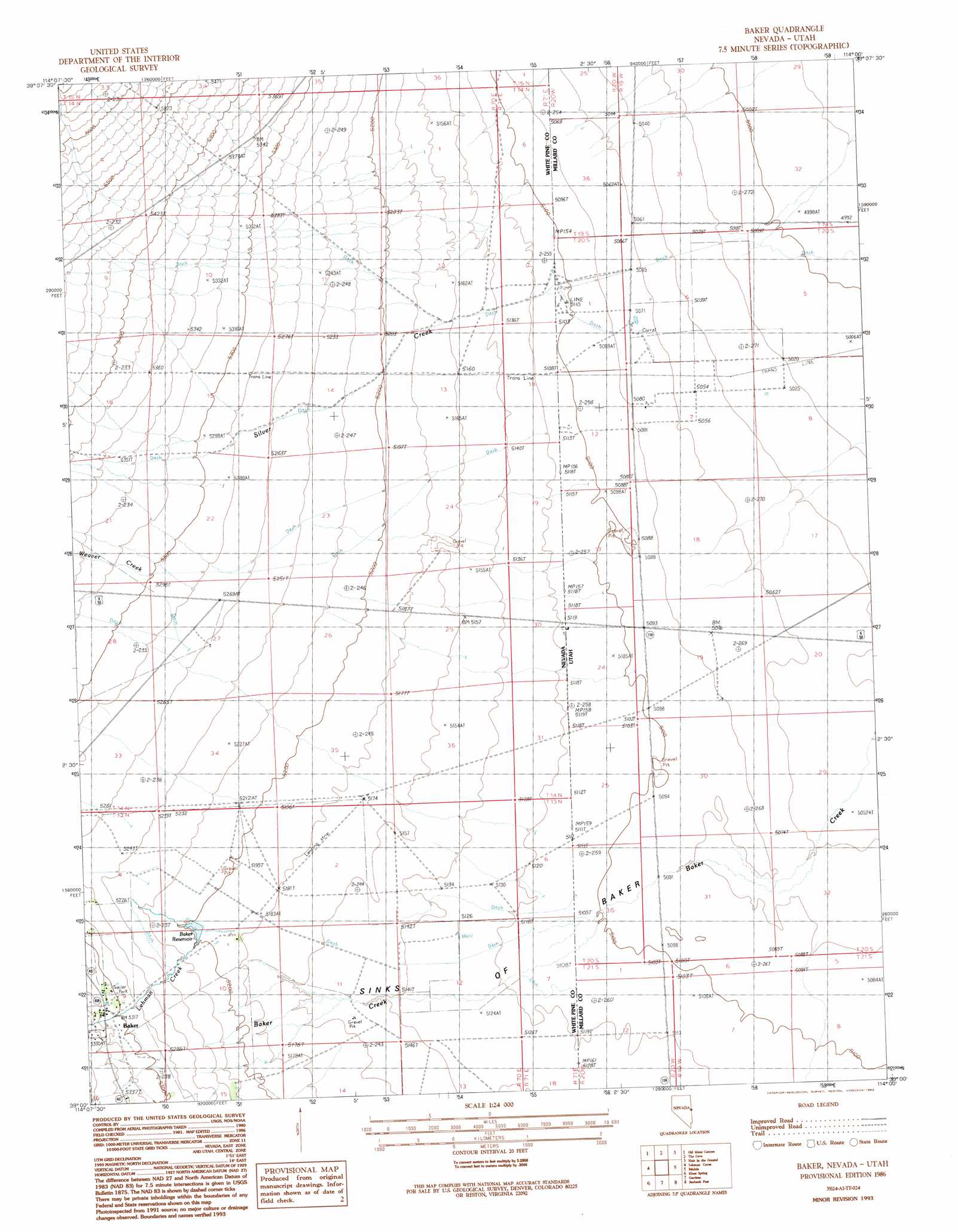
Baker Topo Map Nevada
To zoom in, hover over the map of Baker
USGS Topo Quad 39114a1 - 1:24,000 scale
| Topo Map Name: | Baker |
| USGS Topo Quad ID: | 39114a1 |
| Print Size: | ca. 21 1/4" wide x 27" high |
| Southeast Coordinates: | 39° N latitude / 114° W longitude |
| Map Center Coordinates: | 39.0625° N latitude / 114.0625° W longitude |
| U.S. States: | NV, UT |
| Filename: | o39114a1.jpg |
| Download Map JPG Image: | Baker topo map 1:24,000 scale |
| Map Type: | Topographic |
| Topo Series: | 7.5´ |
| Map Scale: | 1:24,000 |
| Source of Map Images: | United States Geological Survey (USGS) |
| Alternate Map Versions: |
Baker NV 1986, updated 1986 Download PDF Buy paper map Baker NV 1986, updated 1993 Download PDF Buy paper map Baker NV 2012 Download PDF Buy paper map Baker NV 2014 Download PDF Buy paper map |
1:24,000 Topo Quads surrounding Baker
Sixmile Canyon |
Mount Moriah |
Little Horse Canyon |
Gandy Sw |
North Knoll Spring |
Sacramento Pass |
Old Mans Canyon |
The Cove |
Hole In The Ground |
Knoll Hill |
Windy Peak |
Lehman Caves |
Baker |
Eskdale |
Buckskin Hills |
Wheeler Peak |
Kious Spring |
Garrison |
Burbank Pass |
Deadman Point |
Minerva Canyon |
Arch Canyon |
Needle Point Spring |
Cedar Pass |
Big Jensen Pass |
> Back to 39114a1 at 1:100,000 scale
> Back to 39114a1 at 1:250,000 scale
> Back to U.S. Topo Maps home
Baker topo map: Gazetteer
Baker: Basins
Sinks of Baker elevation 1559m 5114′Baker: Populated Places
Baker elevation 1619m 5311′Baker: Post Offices
Baker Post Office elevation 1619m 5311′Baker: Reservoirs
Baker Reservoir elevation 1584m 5196′Baker: Streams
Lehman Creek elevation 1589m 5213′Silver Creek elevation 1547m 5075′
Silver Creek elevation 1549m 5082′
Weaver Creek elevation 1550m 5085′
Baker: Valleys
Rock Canyon elevation 1696m 5564′Baker digital topo map on disk
Buy this Baker topo map showing relief, roads, GPS coordinates and other geographical features, as a high-resolution digital map file on DVD: