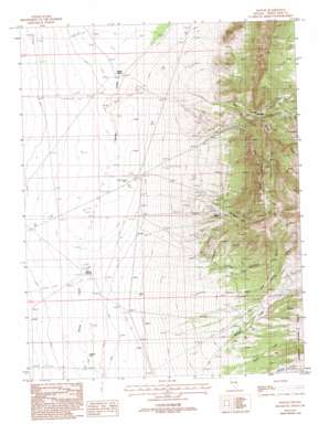
Hogum Topo Map Nevada
To zoom in, hover over the map of Hogum
USGS Topo Quad 39114a4 - 1:24,000 scale
| Topo Map Name: | Hogum |
| USGS Topo Quad ID: | 39114a4 |
| Print Size: | ca. 21 1/4" wide x 27" high |
| Southeast Coordinates: | 39° N latitude / 114.375° W longitude |
| Map Center Coordinates: | 39.0625° N latitude / 114.4375° W longitude |
| U.S. State: | NV |
| Filename: | o39114a4.jpg |
| Download Map JPG Image: | Hogum topo map 1:24,000 scale |
| Map Type: | Topographic |
| Topo Series: | 7.5´ |
| Map Scale: | 1:24,000 |
| Source of Map Images: | United States Geological Survey (USGS) |
| Alternate Map Versions: |
Hogum NV 1987, updated 1987 Download PDF Buy paper map Hogum NV 1987, updated 1993 Download PDF Buy paper map Hogum NV 2012 Download PDF Buy paper map Hogum NV 2014 Download PDF Buy paper map |
| FStopo: | US Forest Service topo Hogum is available: Download FStopo PDF Download FStopo TIF |
1:24,000 Topo Quads surrounding Hogum
> Back to 39114a1 at 1:100,000 scale
> Back to 39114a1 at 1:250,000 scale
> Back to U.S. Topo Maps home
Hogum topo map: Gazetteer
Hogum: Mines
Black Mule Mine elevation 2372m 7782′Crystal Queen Mine elevation 1752m 5748′
Dry Gulch Pilot Knob Mines elevation 2088m 6850′
Hogum Mines elevation 2140m 7020′
Lassie Jean Mine elevation 1745m 5725′
Osceola Mine elevation 2094m 6870′
Hogum: Populated Places
Hogum elevation 2104m 6902′Osceola elevation 2191m 7188′
Hogum: Post Offices
Osceola Post Office (historical) elevation 2112m 6929′Hogum: Ridges
Pilot Knob Ridge elevation 2462m 8077′Hogum: Springs
Layton Spring elevation 1736m 5695′Willard Springs elevation 1751m 5744′
Hogum: Streams
Willard Creek elevation 1947m 6387′Hogum: Valleys
Cold Spring Canyon elevation 2005m 6578′Colorado Gulch elevation 1956m 6417′
Dry Gulch elevation 1831m 6007′
Grub Gulch elevation 2062m 6765′
Jacks Gulch elevation 2175m 7135′
Mary Ann Canyon elevation 1838m 6030′
Serpent Gulch elevation 1954m 6410′
Hogum: Wells
Swallow Well elevation 1762m 5780′Hogum digital topo map on disk
Buy this Hogum topo map showing relief, roads, GPS coordinates and other geographical features, as a high-resolution digital map file on DVD:


