Ward Charcoal Ovens Topo Map Nevada
To zoom in, hover over the map of Ward Charcoal Ovens
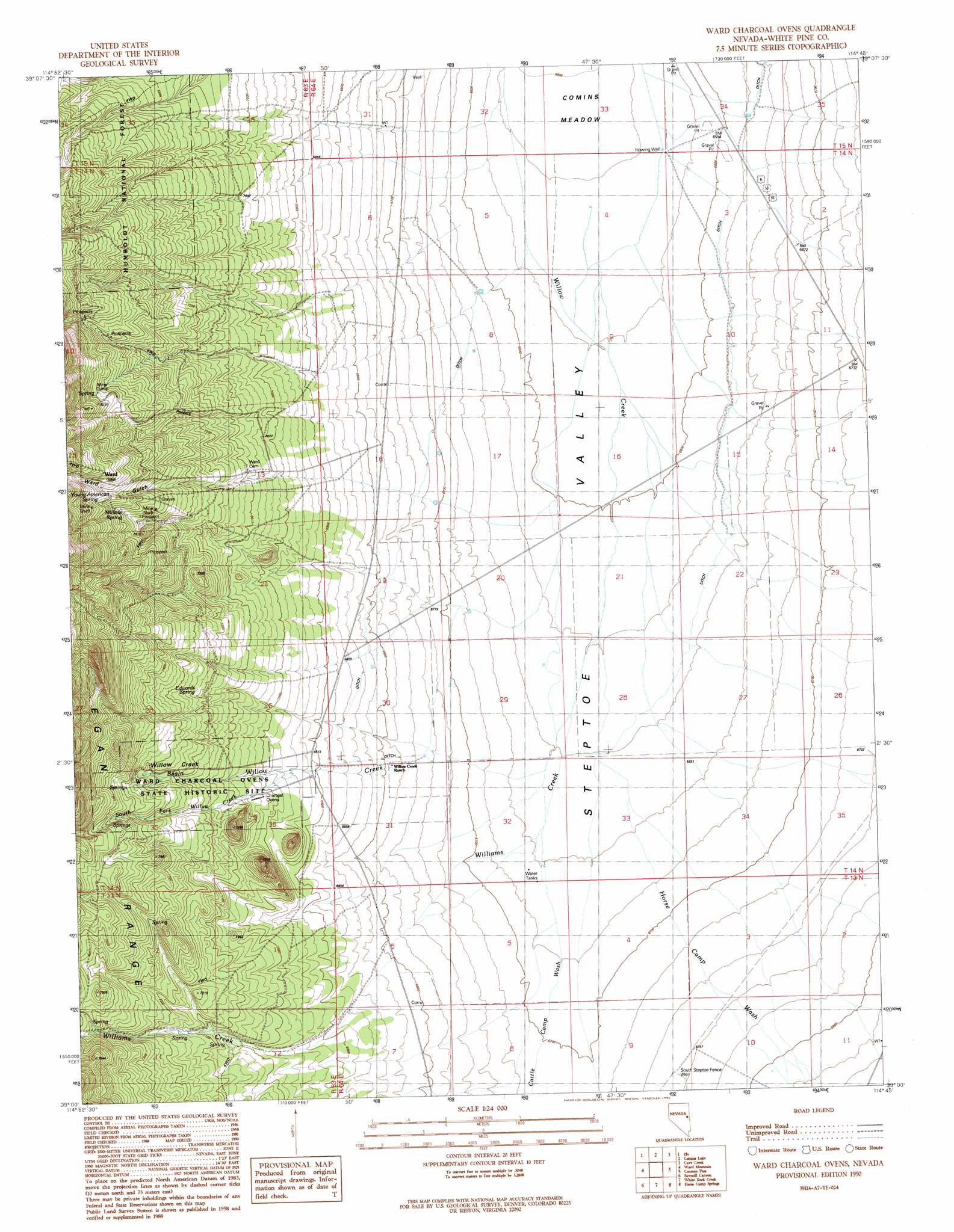
USGS Topo Quad 39114a7 - 1:24,000 scale
| Topo Map Name: | Ward Charcoal Ovens |
| USGS Topo Quad ID: | 39114a7 |
| Print Size: | ca. 21 1/4" wide x 27" high |
| Southeast Coordinates: | 39° N latitude / 114.75° W longitude |
| Map Center Coordinates: | 39.0625° N latitude / 114.8125° W longitude |
| U.S. State: | NV |
| Filename: | o39114a7.jpg |
| Download Map JPG Image: | Ward Charcoal Ovens topo map 1:24,000 scale |
| Map Type: | Topographic |
| Topo Series: | 7.5´ |
| Map Scale: | 1:24,000 |
| Source of Map Images: | United States Geological Survey (USGS) |
| Alternate Map Versions: |
Ward Charcoal Ovens NV 1990, updated 1991 Download PDF Buy paper map Ward Charcoal Ovens NV 2012 Download PDF Buy paper map Ward Charcoal Ovens NV 2014 Download PDF Buy paper map |
| FStopo: | US Forest Service topo Ward Charcoal Ovens is available: Download FStopo PDF Download FStopo TIF |
1:24,000 Topo Quads surrounding Ward Charcoal Ovens
Riepetown |
Ruth |
East Ely |
Cleve Creek Baldy |
South Schell Peak |
Giroux Wash |
Ely |
Comins Lake |
Cave Creek |
Cave Mountain |
Preston Reservoir |
Ward Mountain |
Ward Charcoal Ovens |
Connors Pass |
Majors Place |
Preston |
Sawmill Canyon |
White Rock Creek |
Horse Camp Springs |
North Spring Point |
Lund |
Brown Knoll |
Bullwhack Summit |
Cattle Camp Spring |
Lake Valley Summit |
> Back to 39114a1 at 1:100,000 scale
> Back to 39114a1 at 1:250,000 scale
> Back to U.S. Topo Maps home
Ward Charcoal Ovens topo map: Gazetteer
Ward Charcoal Ovens: Basins
Willow Creek Basin elevation 2215m 7267′Ward Charcoal Ovens: Parks
Ward Charcoal Ovens State Park elevation 2150m 7053′Ward Charcoal Ovens: Populated Places
Ward (historical) elevation 2356m 7729′Ward Charcoal Ovens: Post Offices
Ward Post Office (historical) elevation 2356m 7729′Ward Charcoal Ovens: Springs
Edwards Spring elevation 2201m 7221′Millsite Spring elevation 2287m 7503′
Willow Spring elevation 2010m 6594′
Young American Spring elevation 2334m 7657′
Ward Charcoal Ovens: Streams
Cattle Camp Wash elevation 2030m 6660′Cooper Wash elevation 2004m 6574′
Horse Camp Wash elevation 2026m 6646′
South Fork Willow Creek elevation 2118m 6948′
Williams Creek elevation 2023m 6637′
Ward Charcoal Ovens: Wells
South Steptoe Fence Well elevation 2060m 6758′Ward Charcoal Ovens digital topo map on disk
Buy this Ward Charcoal Ovens topo map showing relief, roads, GPS coordinates and other geographical features, as a high-resolution digital map file on DVD: