The Cove Topo Map Nevada
To zoom in, hover over the map of The Cove
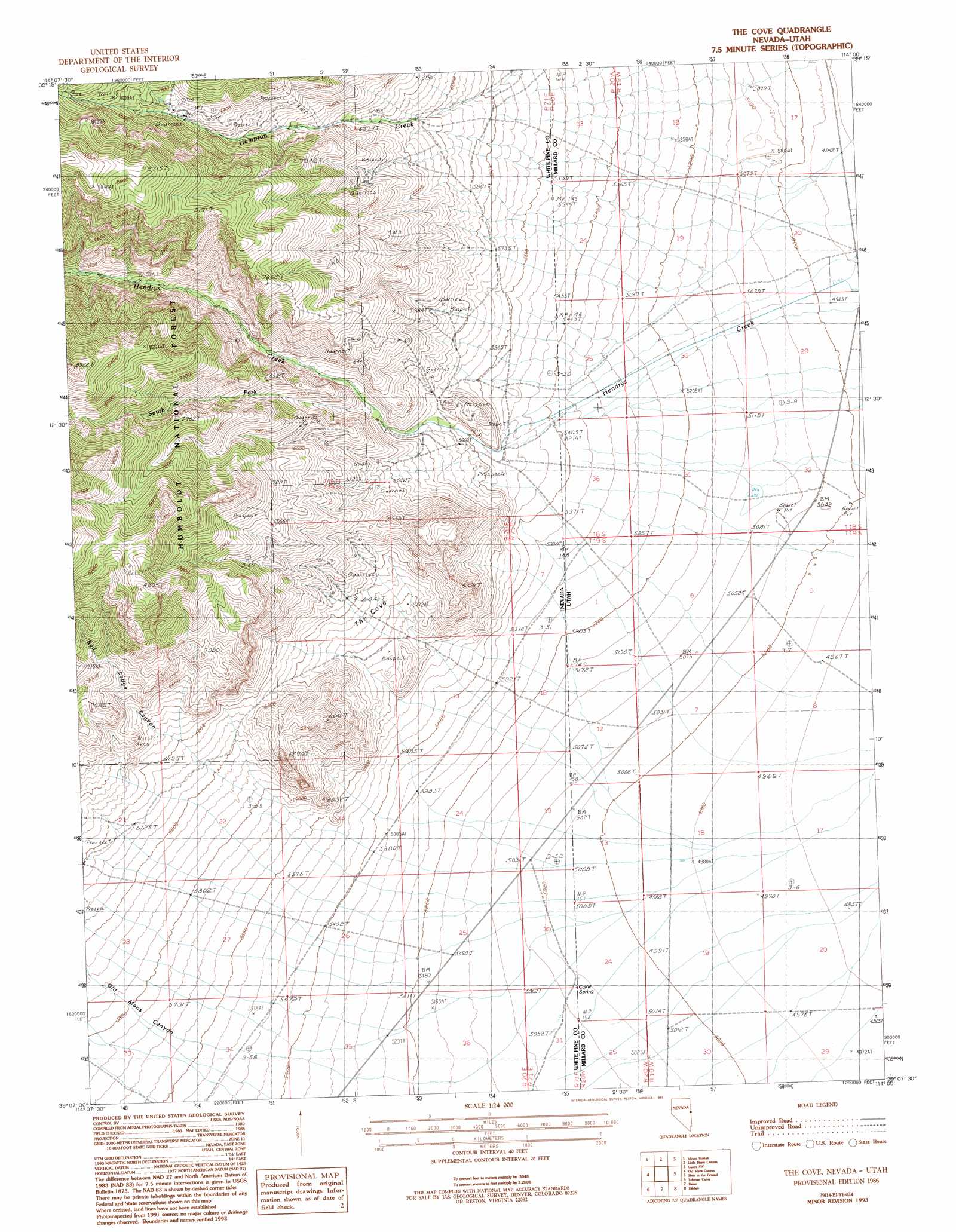
USGS Topo Quad 39114b1 - 1:24,000 scale
| Topo Map Name: | The Cove |
| USGS Topo Quad ID: | 39114b1 |
| Print Size: | ca. 21 1/4" wide x 27" high |
| Southeast Coordinates: | 39.125° N latitude / 114° W longitude |
| Map Center Coordinates: | 39.1875° N latitude / 114.0625° W longitude |
| U.S. States: | NV, UT |
| Filename: | o39114b1.jpg |
| Download Map JPG Image: | The Cove topo map 1:24,000 scale |
| Map Type: | Topographic |
| Topo Series: | 7.5´ |
| Map Scale: | 1:24,000 |
| Source of Map Images: | United States Geological Survey (USGS) |
| Alternate Map Versions: |
The Cove NV 1986, updated 1986 Download PDF Buy paper map The Cove NV 1986, updated 1993 Download PDF Buy paper map The Cove NV 2012 Download PDF Buy paper map The Cove NV 2015 Download PDF Buy paper map |
| FStopo: | US Forest Service topo The Cove is available: Download FStopo PDF Download FStopo TIF |
1:24,000 Topo Quads surrounding The Cove
Third Butte East |
Mormon Jack Pass |
Spring Mountain |
Gandy |
Foote Range |
Sixmile Canyon |
Mount Moriah |
Little Horse Canyon |
Gandy Sw |
North Knoll Spring |
Sacramento Pass |
Old Mans Canyon |
The Cove |
Hole In The Ground |
Knoll Hill |
Windy Peak |
Lehman Caves |
Baker |
Eskdale |
Buckskin Hills |
Wheeler Peak |
Kious Spring |
Garrison |
Burbank Pass |
Deadman Point |
> Back to 39114a1 at 1:100,000 scale
> Back to 39114a1 at 1:250,000 scale
> Back to U.S. Topo Maps home
The Cove topo map: Gazetteer
The Cove: Mines
Star Dust Mine elevation 1846m 6056′The Cove: Slopes
The Cove elevation 1794m 5885′The Cove: Springs
Caine Spring elevation 1534m 5032′Pipe Spring elevation 1540m 5052′
Red Spring elevation 1964m 6443′
The Cove: Streams
Hendrys Creek elevation 1520m 4986′Hendrys Creek elevation 1523m 4996′
South Fork Hendrys Creek elevation 1787m 5862′
The Cove: Valleys
Old Mans Canyon elevation 1707m 5600′Red Ledge Canyon elevation 1891m 6204′
The Cove digital topo map on disk
Buy this The Cove topo map showing relief, roads, GPS coordinates and other geographical features, as a high-resolution digital map file on DVD: