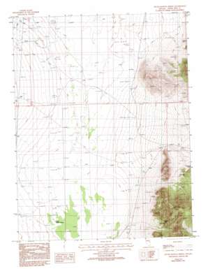
South Bastian Spring Topo Map Nevada
To zoom in, hover over the map of South Bastian Spring
USGS Topo Quad 39114b4 - 1:24,000 scale
| Topo Map Name: | South Bastian Spring |
| USGS Topo Quad ID: | 39114b4 |
| Print Size: | ca. 21 1/4" wide x 27" high |
| Southeast Coordinates: | 39.125° N latitude / 114.375° W longitude |
| Map Center Coordinates: | 39.1875° N latitude / 114.4375° W longitude |
| U.S. State: | NV |
| Filename: | o39114b4.jpg |
| Download Map JPG Image: | South Bastian Spring topo map 1:24,000 scale |
| Map Type: | Topographic |
| Topo Series: | 7.5´ |
| Map Scale: | 1:24,000 |
| Source of Map Images: | United States Geological Survey (USGS) |
| Alternate Map Versions: |
South Bastian Spring NV 1986, updated 1987 Download PDF Buy paper map South Bastian Spring NV 1986, updated 1993 Download PDF Buy paper map South Bastian Spring NV 2012 Download PDF Buy paper map South Bastian Spring NV 2014 Download PDF Buy paper map |
1:24,000 Topo Quads surrounding South Bastian Spring
> Back to 39114a1 at 1:100,000 scale
> Back to 39114a1 at 1:250,000 scale
> Back to U.S. Topo Maps home
South Bastian Spring topo map: Gazetteer
South Bastian Spring: Arches
Osceola Arch elevation 2138m 7014′South Bastian Spring: Mines
Gilded Age Number 1 Mine elevation 2020m 6627′Rose Cave Guano Mine elevation 2038m 6686′
Woodman Mine elevation 1983m 6505′
South Bastian Spring: Parks
Swamp Cedar Natural Area elevation 1720m 5643′South Bastian Spring: Springs
South Bastian Spring elevation 1726m 5662′South Bastian Spring: Streams
Cleve Creek elevation 1725m 5659′South Bastian Spring: Valleys
Turnley Canyon elevation 1903m 6243′South Bastian Spring: Wells
Fera Well elevation 1711m 5613′South Bastian Spring digital topo map on disk
Buy this South Bastian Spring topo map showing relief, roads, GPS coordinates and other geographical features, as a high-resolution digital map file on DVD:


