Spring Mountain Topo Map Nevada
To zoom in, hover over the map of Spring Mountain
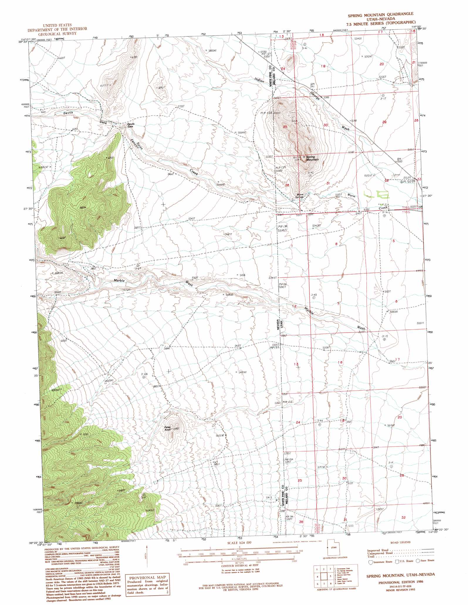
USGS Topo Quad 39114d1 - 1:24,000 scale
| Topo Map Name: | Spring Mountain |
| USGS Topo Quad ID: | 39114d1 |
| Print Size: | ca. 21 1/4" wide x 27" high |
| Southeast Coordinates: | 39.375° N latitude / 114° W longitude |
| Map Center Coordinates: | 39.4375° N latitude / 114.0625° W longitude |
| U.S. States: | NV, UT |
| Filename: | o39114d1.jpg |
| Download Map JPG Image: | Spring Mountain topo map 1:24,000 scale |
| Map Type: | Topographic |
| Topo Series: | 7.5´ |
| Map Scale: | 1:24,000 |
| Source of Map Images: | United States Geological Survey (USGS) |
| Alternate Map Versions: |
Spring Mountain UT 1986, updated 1986 Download PDF Buy paper map Spring Mountain UT 1986, updated 1994 Download PDF Buy paper map Spring Mountain UT 2011 Download PDF Buy paper map Spring Mountain UT 2014 Download PDF Buy paper map |
1:24,000 Topo Quads surrounding Spring Mountain
Grass Valley Wash |
Blue Mass Canyon |
Skinner Canyon |
Partoun |
Trout Creek |
White Cloud Point |
Government Peak |
Tin Springs Mountain |
Trout Creek Sw |
Cockscomb Ridge |
Third Butte East |
Mormon Jack Pass |
Spring Mountain |
Gandy |
Foote Range |
Sixmile Canyon |
Mount Moriah |
Little Horse Canyon |
Gandy Sw |
North Knoll Spring |
Sacramento Pass |
Old Mans Canyon |
The Cove |
Hole In The Ground |
Knoll Hill |
> Back to 39114a1 at 1:100,000 scale
> Back to 39114a1 at 1:250,000 scale
> Back to U.S. Topo Maps home
Spring Mountain topo map: Gazetteer
Spring Mountain: Gaps
Devils Gate elevation 1776m 5826′Spring Mountain: Mines
Marble Monster Mine elevation 1806m 5925′Marble Vale Mine elevation 1796m 5892′
Spring Mountain: Springs
Warm Springs elevation 1597m 5239′Spring Mountain: Streams
Indian George Wash elevation 1534m 5032′Swan Creek elevation 1529m 5016′
Spring Mountain: Summits
Petes Knoll elevation 1854m 6082′Spring Mountain elevation 1947m 6387′
Spring Mountain: Valleys
Devils Gate Canyon elevation 1575m 5167′Indian George Wash elevation 1534m 5032′
Spring Mountain digital topo map on disk
Buy this Spring Mountain topo map showing relief, roads, GPS coordinates and other geographical features, as a high-resolution digital map file on DVD: