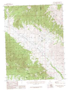
Skinner Canyon Topo Map Nevada
To zoom in, hover over the map of Skinner Canyon
USGS Topo Quad 39114f1 - 1:24,000 scale
| Topo Map Name: | Skinner Canyon |
| USGS Topo Quad ID: | 39114f1 |
| Print Size: | ca. 21 1/4" wide x 27" high |
| Southeast Coordinates: | 39.625° N latitude / 114° W longitude |
| Map Center Coordinates: | 39.6875° N latitude / 114.0625° W longitude |
| U.S. States: | NV, UT |
| Filename: | o39114f1.jpg |
| Download Map JPG Image: | Skinner Canyon topo map 1:24,000 scale |
| Map Type: | Topographic |
| Topo Series: | 7.5´ |
| Map Scale: | 1:24,000 |
| Source of Map Images: | United States Geological Survey (USGS) |
| Alternate Map Versions: |
Skinner Canyon NV 1986, updated 1988 Download PDF Buy paper map Skinner Canyon NV 2012 Download PDF Buy paper map Skinner Canyon NV 2014 Download PDF Buy paper map |
1:24,000 Topo Quads surrounding Skinner Canyon
> Back to 39114e1 at 1:100,000 scale
> Back to 39114a1 at 1:250,000 scale
> Back to U.S. Topo Maps home
Skinner Canyon topo map: Gazetteer
Skinner Canyon: Populated Places
Parker (historical) elevation 1973m 6473′Pleasant Valley (historical) elevation 1909m 6263′
Uvada (historical) elevation 1846m 6056′
Skinner Canyon: Post Offices
Parker Post Office (historical) elevation 1973m 6473′Pleasant Valley Post Office (historical) elevation 1909m 6263′
Uvada Post Office (historical) elevation 1846m 6056′
Skinner Canyon: Springs
Cane Spring elevation 1878m 6161′East Side Spring elevation 2100m 6889′
Gravel Spring elevation 1979m 6492′
Indian Spring elevation 2047m 6715′
Upper Sulphur Spring elevation 2255m 7398′
Skinner Canyon: Streams
Gravel Wash elevation 1990m 6528′Skinner Canyon: Valleys
Cliff Canyon elevation 2062m 6765′Dry Canyon elevation 1772m 5813′
Essex Canyon elevation 2059m 6755′
Mallory Canyon elevation 2044m 6706′
Pete Neece Canyon elevation 2043m 6702′
Pole Canyon elevation 2099m 6886′
Skinner Canyon elevation 1866m 6122′
Water Canyon elevation 2075m 6807′
Skinner Canyon digital topo map on disk
Buy this Skinner Canyon topo map showing relief, roads, GPS coordinates and other geographical features, as a high-resolution digital map file on DVD:


