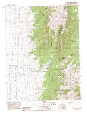
Schellbourne Topo Map Nevada
To zoom in, hover over the map of Schellbourne
USGS Topo Quad 39114g6 - 1:24,000 scale
| Topo Map Name: | Schellbourne |
| USGS Topo Quad ID: | 39114g6 |
| Print Size: | ca. 21 1/4" wide x 27" high |
| Southeast Coordinates: | 39.75° N latitude / 114.625° W longitude |
| Map Center Coordinates: | 39.8125° N latitude / 114.6875° W longitude |
| U.S. State: | NV |
| Filename: | o39114g6.jpg |
| Download Map JPG Image: | Schellbourne topo map 1:24,000 scale |
| Map Type: | Topographic |
| Topo Series: | 7.5´ |
| Map Scale: | 1:24,000 |
| Source of Map Images: | United States Geological Survey (USGS) |
| Alternate Map Versions: |
Schellbourne NV 1982, updated 1982 Download PDF Buy paper map Schellbourne NV 2012 Download PDF Buy paper map Schellbourne NV 2014 Download PDF Buy paper map |
| FStopo: | US Forest Service topo Schellbourne is available: Download FStopo PDF Download FStopo TIF |
1:24,000 Topo Quads surrounding Schellbourne
> Back to 39114e1 at 1:100,000 scale
> Back to 39114a1 at 1:250,000 scale
> Back to U.S. Topo Maps home
Schellbourne topo map: Gazetteer
Schellbourne: Gaps
Schellbourne Pass elevation 2320m 7611′Schellbourne: Mines
May Queen Mine elevation 2714m 8904′White Horse Mine elevation 2502m 8208′
Schellbourne: Post Offices
Schellbourne Post Office (historical) elevation 2062m 6765′Schellbourne: Springs
Basin Spring elevation 2301m 7549′Cold Spring elevation 2437m 7995′
Lewis Springs elevation 2263m 7424′
Mud Spring elevation 2217m 7273′
Queen Springs elevation 2229m 7312′
Schellbourne Springs elevation 2248m 7375′
Upper Gulch Spring elevation 2474m 8116′
Upper Long Gulch Spring elevation 2401m 7877′
Schellbourne: Summits
Lovell Peak elevation 2858m 9376′North Lovell Peak elevation 2942m 9652′
Queen Spring Mountain elevation 2722m 8930′
The Nipple elevation 2830m 9284′
Schellbourne: Valleys
Long Gulch elevation 1941m 6368′McMaughn Canyon elevation 2129m 6984′
Schellbourne: Wells
Fera One Hundred One elevation 2236m 7335′Schellbourne digital topo map on disk
Buy this Schellbourne topo map showing relief, roads, GPS coordinates and other geographical features, as a high-resolution digital map file on DVD:


