Moody Peak Topo Map Nevada
To zoom in, hover over the map of Moody Peak
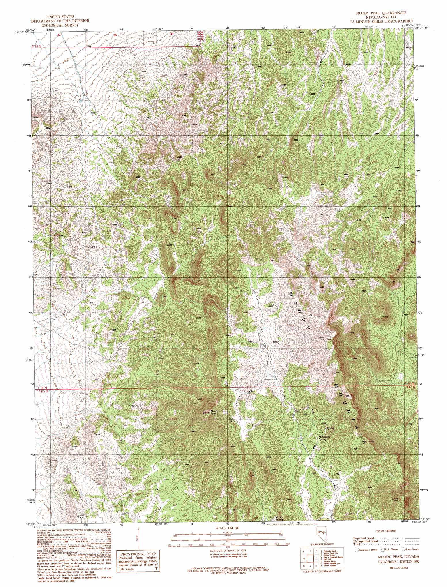
USGS Topo Quad 39115a8 - 1:24,000 scale
| Topo Map Name: | Moody Peak |
| USGS Topo Quad ID: | 39115a8 |
| Print Size: | ca. 21 1/4" wide x 27" high |
| Southeast Coordinates: | 39° N latitude / 115.875° W longitude |
| Map Center Coordinates: | 39.0625° N latitude / 115.9375° W longitude |
| U.S. State: | NV |
| Filename: | o39115a8.jpg |
| Download Map JPG Image: | Moody Peak topo map 1:24,000 scale |
| Map Type: | Topographic |
| Topo Series: | 7.5´ |
| Map Scale: | 1:24,000 |
| Source of Map Images: | United States Geological Survey (USGS) |
| Alternate Map Versions: |
Moody Peak NV 1990, updated 1990 Download PDF Buy paper map Moody Peak NV 2012 Download PDF Buy paper map Moody Peak NV 2014 Download PDF Buy paper map |
1:24,000 Topo Quads surrounding Moody Peak
West Of Bellevue Peak |
Bellevue Peak |
Pinto Summit Sw |
Black Point |
Pancake Summit Sw |
Cockalorum Spring |
Eightmile Well |
Moody Peak Nw |
Pogues Station |
Green Springs Nw |
Snowball Ranch |
East Of Snowball Ranch |
Moody Peak |
Bull Fork |
Green Springs Sw |
Park Mountain |
Summit Station |
Brown Summit Nw |
Brown Summit |
Duckwater |
Pritchards Station |
Red Ring Mountain |
Brown Summit Sw |
Sand Spring |
Bradshaw Spring |
> Back to 39115a1 at 1:100,000 scale
> Back to 39114a1 at 1:250,000 scale
> Back to U.S. Topo Maps home
Moody Peak topo map: Gazetteer
Moody Peak: Springs
Buck Spring elevation 2185m 7168′Collins Spring elevation 2464m 8083′
Mahogany Spring elevation 2342m 7683′
Moody Spring elevation 2268m 7440′
Moody Peak: Summits
Moody Mountain elevation 2672m 8766′Moody Peak elevation 2677m 8782′
Moody Peak digital topo map on disk
Buy this Moody Peak topo map showing relief, roads, GPS coordinates and other geographical features, as a high-resolution digital map file on DVD: