Giroux Wash Topo Map Nevada
To zoom in, hover over the map of Giroux Wash
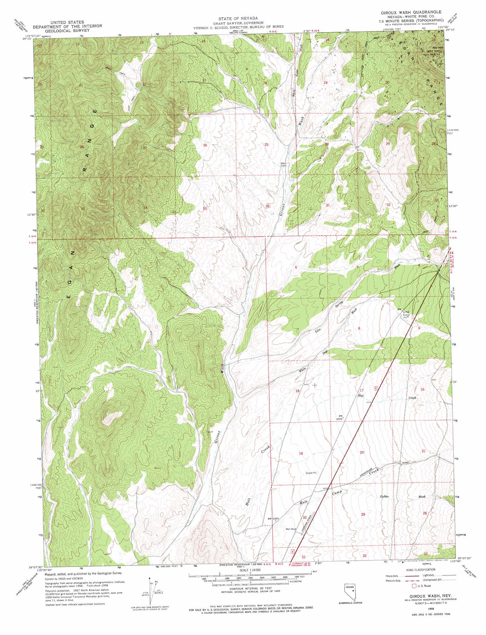
USGS Topo Quad 39115b1 - 1:24,000 scale
| Topo Map Name: | Giroux Wash |
| USGS Topo Quad ID: | 39115b1 |
| Print Size: | ca. 21 1/4" wide x 27" high |
| Southeast Coordinates: | 39.125° N latitude / 115° W longitude |
| Map Center Coordinates: | 39.1875° N latitude / 115.0625° W longitude |
| U.S. State: | NV |
| Filename: | o39115b1.jpg |
| Download Map JPG Image: | Giroux Wash topo map 1:24,000 scale |
| Map Type: | Topographic |
| Topo Series: | 7.5´ |
| Map Scale: | 1:24,000 |
| Source of Map Images: | United States Geological Survey (USGS) |
| Alternate Map Versions: |
Giroux Wash NV 1958, updated 1961 Download PDF Buy paper map Giroux Wash NV 1958, updated 1975 Download PDF Buy paper map Giroux Wash NV 2012 Download PDF Buy paper map Giroux Wash NV 2014 Download PDF Buy paper map |
| FStopo: | US Forest Service topo Giroux Wash is available: Download FStopo PDF Download FStopo TIF |
1:24,000 Topo Quads surrounding Giroux Wash
Sammys Springs |
Marking Corral Summit |
Robinson Summit |
Lusetti Canyon |
Mcgill |
Illipah |
Waldy Pond |
Riepetown |
Ruth |
East Ely |
Limestone Peak |
Railroad Crossing Dam |
Giroux Wash |
Ely |
Comins Lake |
Easter Springs |
Blackjack Springs |
Preston Reservoir |
Ward Mountain |
Ward Charcoal Ovens |
Horse Track Spring |
Badger Hole Spring |
Preston |
Sawmill Canyon |
White Rock Creek |
> Back to 39115a1 at 1:100,000 scale
> Back to 39114a1 at 1:250,000 scale
> Back to U.S. Topo Maps home
Giroux Wash topo map: Gazetteer
Giroux Wash: Streams
Dead Horse Wash elevation 2074m 6804′Gubler Wash elevation 1983m 6505′
Holt Camp Creek elevation 1905m 6250′
Lion Spring Wash elevation 1941m 6368′
White River Wash elevation 2027m 6650′
White Sage Wash elevation 1931m 6335′
Giroux Wash: Summits
Rib Hill elevation 2461m 8074′Giroux Wash digital topo map on disk
Buy this Giroux Wash topo map showing relief, roads, GPS coordinates and other geographical features, as a high-resolution digital map file on DVD: