Green Springs Nw Topo Map Nevada
To zoom in, hover over the map of Green Springs Nw
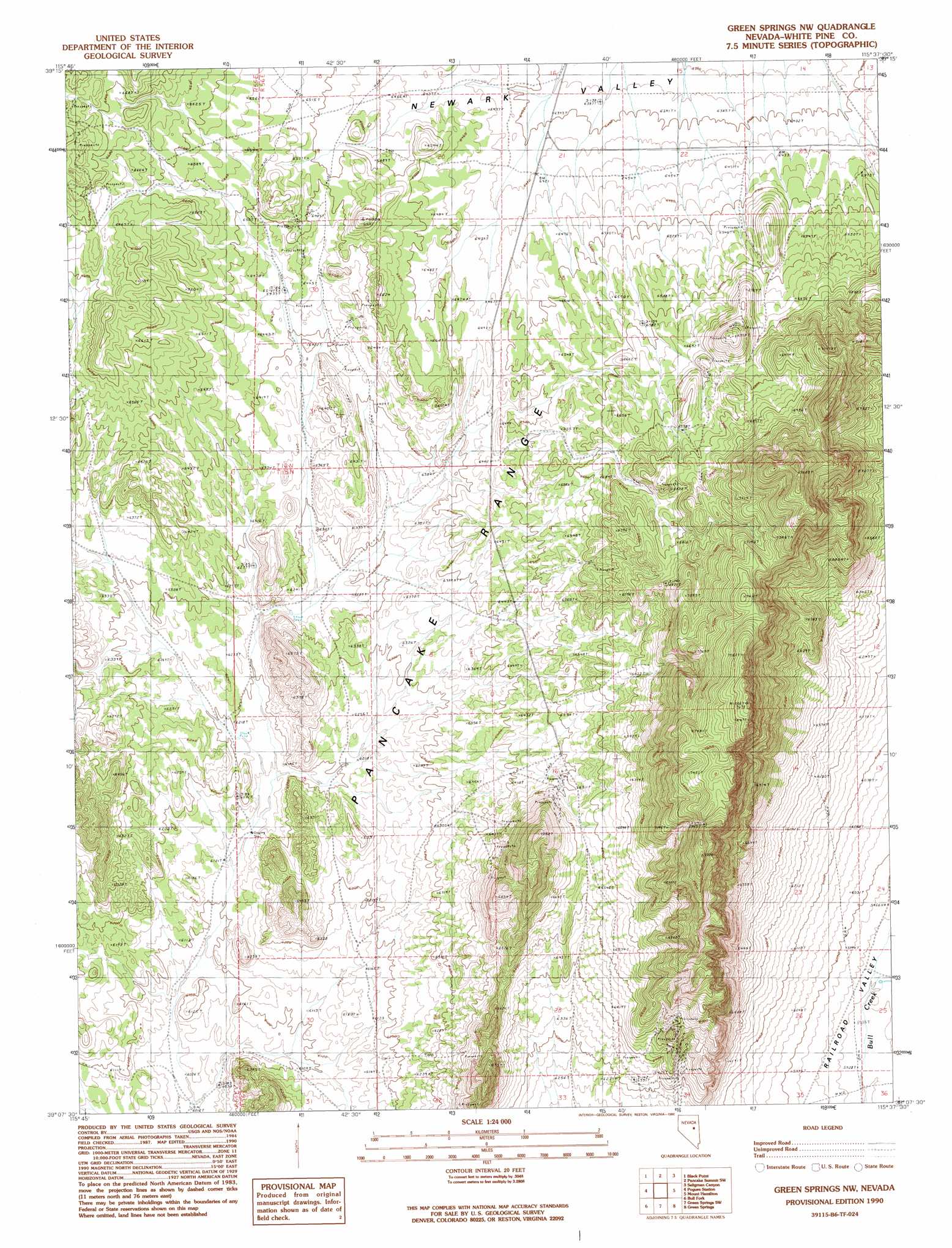
USGS Topo Quad 39115b6 - 1:24,000 scale
| Topo Map Name: | Green Springs Nw |
| USGS Topo Quad ID: | 39115b6 |
| Print Size: | ca. 21 1/4" wide x 27" high |
| Southeast Coordinates: | 39.125° N latitude / 115.625° W longitude |
| Map Center Coordinates: | 39.1875° N latitude / 115.6875° W longitude |
| U.S. State: | NV |
| Filename: | o39115b6.jpg |
| Download Map JPG Image: | Green Springs Nw topo map 1:24,000 scale |
| Map Type: | Topographic |
| Topo Series: | 7.5´ |
| Map Scale: | 1:24,000 |
| Source of Map Images: | United States Geological Survey (USGS) |
| Alternate Map Versions: |
Green Springs NW NV 1990, updated 1990 Download PDF Buy paper map Green Springs NW NV 2012 Download PDF Buy paper map Green Springs NW NV 2014 Download PDF Buy paper map |
1:24,000 Topo Quads surrounding Green Springs Nw
Pinto Summit |
Silverado Mountain |
Pancake Summit |
East Of Pancake Summit |
Antelope Mountain |
Pinto Summit Sw |
Black Point |
Pancake Summit Sw |
Seligman Canyon |
Hamilton |
Moody Peak Nw |
Pogues Station |
Green Springs Nw |
Mount Hamilton |
Treasure Hill |
Moody Peak |
Bull Fork |
Green Springs Sw |
Green Springs |
Indian Garden Mountain |
Brown Summit Nw |
Brown Summit |
Duckwater |
Duckwater Ne |
Currant Mountain |
> Back to 39115a1 at 1:100,000 scale
> Back to 39114a1 at 1:250,000 scale
> Back to U.S. Topo Maps home
No gazetteer data is available for the Green Springs Nw topo map sheet.
Green Springs Nw digital topo map on disk
Buy this Green Springs Nw topo map showing relief, roads, GPS coordinates and other geographical features, as a high-resolution digital map file on DVD: