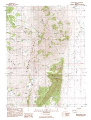
Diamond Peak Topo Map Nevada
To zoom in, hover over the map of Diamond Peak
USGS Topo Quad 39115e7 - 1:24,000 scale
| Topo Map Name: | Diamond Peak |
| USGS Topo Quad ID: | 39115e7 |
| Print Size: | ca. 21 1/4" wide x 27" high |
| Southeast Coordinates: | 39.5° N latitude / 115.75° W longitude |
| Map Center Coordinates: | 39.5625° N latitude / 115.8125° W longitude |
| U.S. State: | NV |
| Filename: | o39115e7.jpg |
| Download Map JPG Image: | Diamond Peak topo map 1:24,000 scale |
| Map Type: | Topographic |
| Topo Series: | 7.5´ |
| Map Scale: | 1:24,000 |
| Source of Map Images: | United States Geological Survey (USGS) |
| Alternate Map Versions: |
Diamond Peak NV 1990, updated 1990 Download PDF Buy paper map Diamond Peak NV 2012 Download PDF Buy paper map Diamond Peak NV 2014 Download PDF Buy paper map |
1:24,000 Topo Quads surrounding Diamond Peak
> Back to 39115e1 at 1:100,000 scale
> Back to 39114a1 at 1:250,000 scale
> Back to U.S. Topo Maps home
Diamond Peak topo map: Gazetteer
Diamond Peak: Flats
Torre Flat elevation 2379m 7805′Diamond Peak: Gaps
Newark Summit elevation 2267m 7437′Diamond Peak: Mines
Battery Mine elevation 2652m 8700′Bay State Mine elevation 2037m 6683′
Gimmie Mine elevation 2001m 6564′
Meister Mine elevation 2017m 6617′
Diamond Peak: Populated Places
Newark (historical) elevation 1894m 6213′Diamond Peak: Springs
Cottonwood Spring elevation 2301m 7549′Poison Spring elevation 2347m 7700′
Stinson Spring elevation 1787m 5862′
Diamond Peak: Summits
Alpha Peak elevation 2733m 8966′Bold Bluff elevation 2648m 8687′
Diamond Peak elevation 3223m 10574′
Fusulina Peak elevation 2458m 8064′
Newark Mountain elevation 2589m 8494′
Diamond Peak: Valleys
Adobe Canyon elevation 1874m 6148′Green Canyon elevation 2127m 6978′
Mining Canyon elevation 1876m 6154′
Sadler Canyon elevation 1892m 6207′
Water Canyon elevation 1897m 6223′
Diamond Peak digital topo map on disk
Buy this Diamond Peak topo map showing relief, roads, GPS coordinates and other geographical features, as a high-resolution digital map file on DVD:


