Mcbrides Sheep Well Topo Map Nevada
To zoom in, hover over the map of Mcbrides Sheep Well
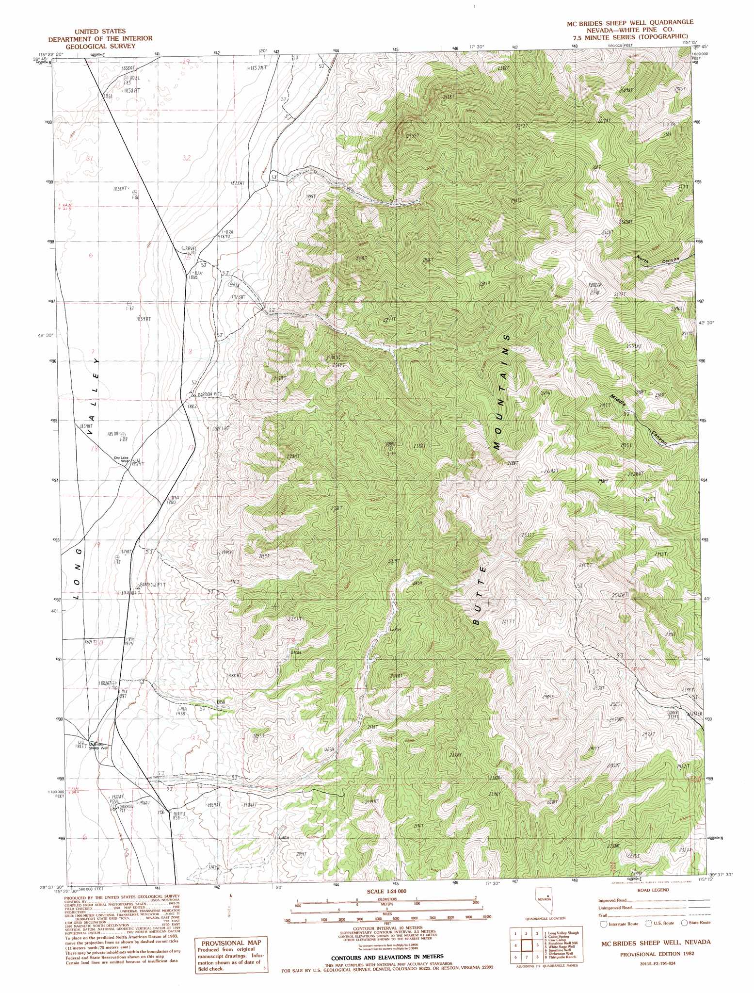
USGS Topo Quad 39115f3 - 1:24,000 scale
| Topo Map Name: | Mcbrides Sheep Well |
| USGS Topo Quad ID: | 39115f3 |
| Print Size: | ca. 21 1/4" wide x 27" high |
| Southeast Coordinates: | 39.625° N latitude / 115.25° W longitude |
| Map Center Coordinates: | 39.6875° N latitude / 115.3125° W longitude |
| U.S. State: | NV |
| Filename: | o39115f3.jpg |
| Download Map JPG Image: | Mcbrides Sheep Well topo map 1:24,000 scale |
| Map Type: | Topographic |
| Topo Series: | 7.5´ |
| Map Scale: | 1:24,000 |
| Source of Map Images: | United States Geological Survey (USGS) |
| Alternate Map Versions: |
McBrides Sheep Well NV 1982, updated 1982 Download PDF Buy paper map McBrides Sheep Well NV 2012 Download PDF Buy paper map McBrides Sheep Well NV 2014 Download PDF Buy paper map |
1:24,000 Topo Quads surrounding Mcbrides Sheep Well
Big Bald Mountain |
Tognini Spring |
Junction Well |
Ninemile Well Nw |
Ninemile Well |
Mooney Basin Summit |
Long Valley Slough |
Cabin Spring |
Cow Camp |
Franks Well |
Buck Mountain East |
Sunshine Well Nw |
Mcbrides Sheep Well |
White Sage Well |
Hunter Point |
Beck Pass |
Sunshine Well |
Dickenson Well |
Thirtymile Ranch |
Combs Creek |
East Of Pancake Summit |
Antelope Mountain |
Sammys Springs |
Marking Corral Summit |
Robinson Summit |
> Back to 39115e1 at 1:100,000 scale
> Back to 39114a1 at 1:250,000 scale
> Back to U.S. Topo Maps home
Mcbrides Sheep Well topo map: Gazetteer
Mcbrides Sheep Well: Ranges
Butte Mountains elevation 2672m 8766′Mcbrides Sheep Well: Valleys
Swasey Knolls Wash elevation 2421m 7942′Mcbrides Sheep Well: Wells
Dry Lake Well elevation 1861m 6105′McBrides Sheep Well elevation 1886m 6187′
Mcbrides Sheep Well digital topo map on disk
Buy this Mcbrides Sheep Well topo map showing relief, roads, GPS coordinates and other geographical features, as a high-resolution digital map file on DVD: