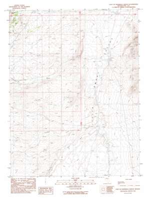
East Of Snowball Ranch Topo Map Nevada
To zoom in, hover over the map of East Of Snowball Ranch
USGS Topo Quad 39116a1 - 1:24,000 scale
| Topo Map Name: | East Of Snowball Ranch |
| USGS Topo Quad ID: | 39116a1 |
| Print Size: | ca. 21 1/4" wide x 27" high |
| Southeast Coordinates: | 39° N latitude / 116° W longitude |
| Map Center Coordinates: | 39.0625° N latitude / 116.0625° W longitude |
| U.S. State: | NV |
| Filename: | o39116a1.jpg |
| Download Map JPG Image: | East Of Snowball Ranch topo map 1:24,000 scale |
| Map Type: | Topographic |
| Topo Series: | 7.5´ |
| Map Scale: | 1:24,000 |
| Source of Map Images: | United States Geological Survey (USGS) |
| Alternate Map Versions: |
East of Snowball Ranch NV 1990, updated 1990 Download PDF Buy paper map East of Snowball Ranch NV 2012 Download PDF Buy paper map East of Snowball Ranch NV 2015 Download PDF Buy paper map |
1:24,000 Topo Quads surrounding East Of Snowball Ranch
> Back to 39116a1 at 1:100,000 scale
> Back to 39116a1 at 1:250,000 scale
> Back to U.S. Topo Maps home
East Of Snowball Ranch topo map: Gazetteer
East Of Snowball Ranch: Arroyos
Willow Creek Wash elevation 1922m 6305′East Of Snowball Ranch: Springs
Willow Creek Spring elevation 1896m 6220′East Of Snowball Ranch: Streams
Big Fault Wash elevation 1946m 6384′Cottonwood Creek elevation 2013m 6604′
Snowball Creek elevation 1937m 6354′
Willow Creek elevation 1921m 6302′
East Of Snowball Ranch digital topo map on disk
Buy this East Of Snowball Ranch topo map showing relief, roads, GPS coordinates and other geographical features, as a high-resolution digital map file on DVD:


