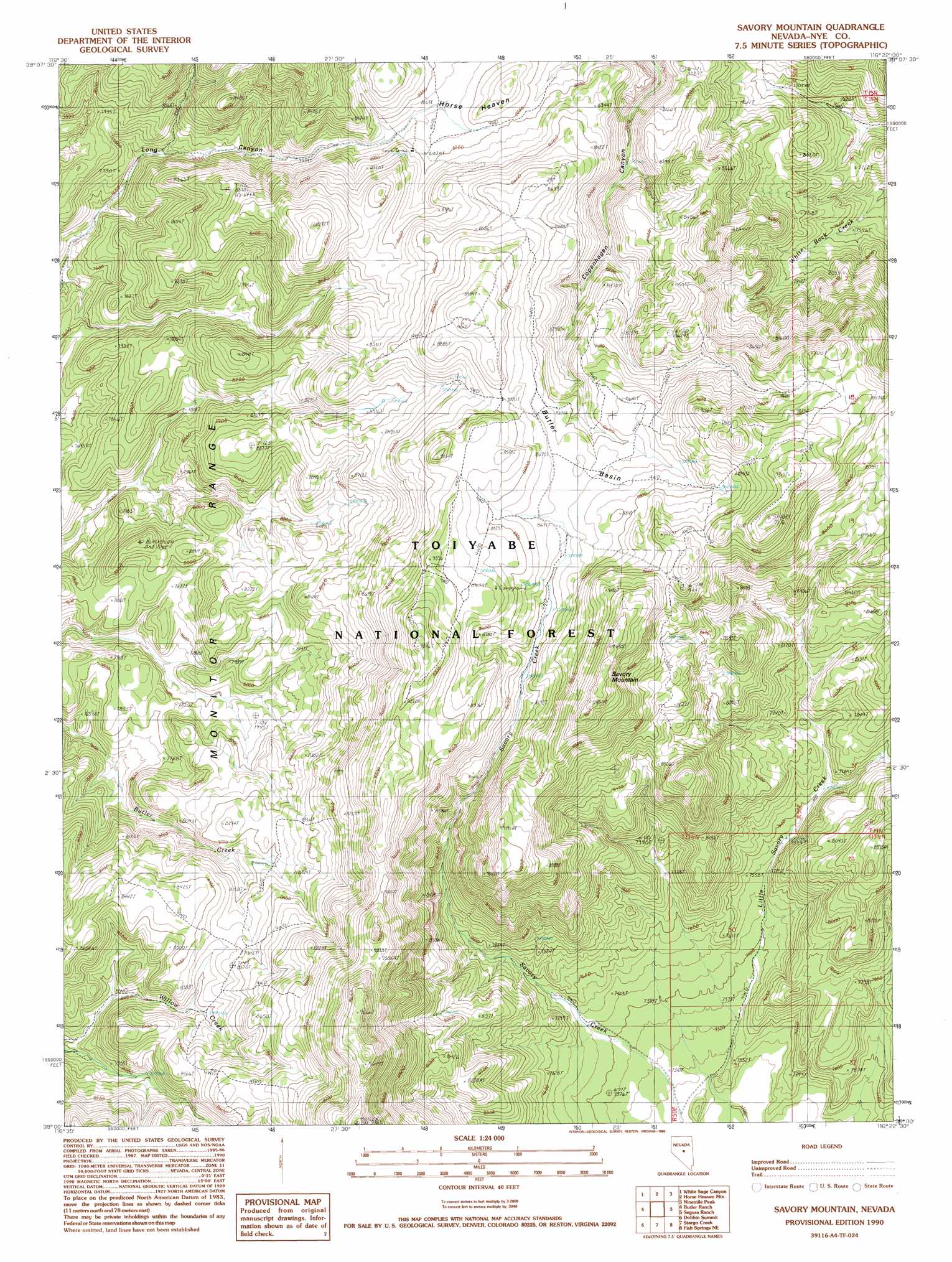
Savory Mountain Topo Map Nevada
To zoom in, hover over the map of Savory Mountain
USGS Topo Quad 39116a4 - 1:24,000 scale
| Topo Map Name: | Savory Mountain |
| USGS Topo Quad ID: | 39116a4 |
| Print Size: | ca. 21 1/4" wide x 27" high |
| Southeast Coordinates: | 39° N latitude / 116.375° W longitude |
| Map Center Coordinates: | 39.0625° N latitude / 116.4375° W longitude |
| U.S. State: | NV |
| Filename: | o39116a4.jpg |
| Download Map JPG Image: | Savory Mountain topo map 1:24,000 scale |
| Map Type: | Topographic |
| Topo Series: | 7.5´ |
| Map Scale: | 1:24,000 |
| Source of Map Images: | United States Geological Survey (USGS) |
| Alternate Map Versions: |
Savory Mountain NV 1990, updated 1990 Download PDF Buy paper map Savory Mountain NV 2012 Download PDF Buy paper map Savory Mountain NV 2014 Download PDF Buy paper map |
| FStopo: | US Forest Service topo Savory Mountain is available: Download FStopo PDF Download FStopo TIF |
1:24,000 Topo Quads surrounding Savory Mountain
Potts Well |
Wallace Canyon |
Well Canyon |
Sullivan Wash |
West Of Bellevue Peak |
The Monitor |
White Sage Canyon |
Horse Heaven Mountain |
Ninemile Peak |
Cockalorum Spring |
Dianas Punch Bowl |
Butler Ranch |
Savory Mountain |
Segura Ranch |
Snowball Ranch |
Box Spring |
Dobbin Summit |
Stargo Creek |
Fish Springs Ne |
Park Mountain |
Mosquito Creek |
Danville |
Fish Springs |
Fish Springs Se |
Pritchards Station |
> Back to 39116a1 at 1:100,000 scale
> Back to 39116a1 at 1:250,000 scale
> Back to U.S. Topo Maps home
Savory Mountain topo map: Gazetteer
Savory Mountain: Basins
Butler Basin elevation 2645m 8677′Savory Mountain: Summits
Savory Mountain elevation 2882m 9455′Savory Mountain digital topo map on disk
Buy this Savory Mountain topo map showing relief, roads, GPS coordinates and other geographical features, as a high-resolution digital map file on DVD: