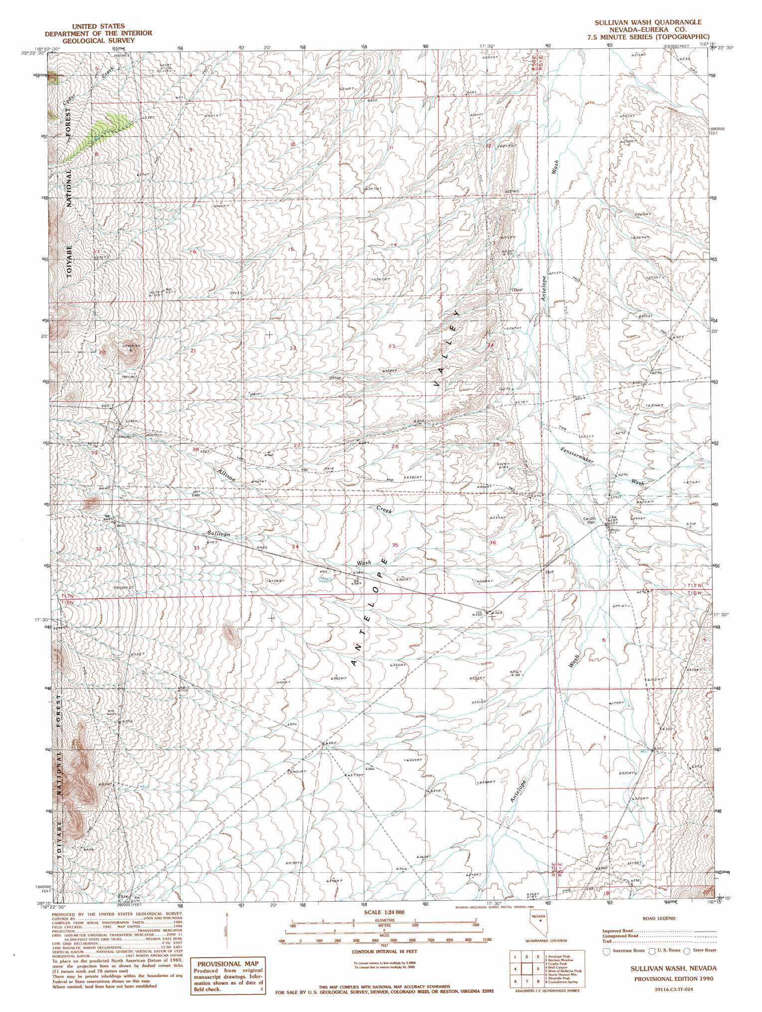
Sullivan Wash Topo Map Nevada
To zoom in, hover over the map of Sullivan Wash
USGS Topo Quad 39116c3 - 1:24,000 scale
| Topo Map Name: | Sullivan Wash |
| USGS Topo Quad ID: | 39116c3 |
| Print Size: | ca. 21 1/4" wide x 27" high |
| Southeast Coordinates: | 39.25° N latitude / 116.25° W longitude |
| Map Center Coordinates: | 39.3125° N latitude / 116.3125° W longitude |
| U.S. State: | NV |
| Filename: | o39116c3.jpg |
| Download Map JPG Image: | Sullivan Wash topo map 1:24,000 scale |
| Map Type: | Topographic |
| Topo Series: | 7.5´ |
| Map Scale: | 1:24,000 |
| Source of Map Images: | United States Geological Survey (USGS) |
| Alternate Map Versions: |
Sullivan Wash NV 1990, updated 1990 Download PDF Buy paper map Sullivan Wash NV 2012 Download PDF Buy paper map Sullivan Wash NV 2015 Download PDF Buy paper map |
| FStopo: | US Forest Service topo Sullivan Wash is available: Download FStopo PDF Download FStopo TIF |
1:24,000 Topo Quads surrounding Sullivan Wash
Bean Flat West |
Bean Flat East |
Bartine Ranch |
Hay Ranch |
Devon Peak |
Jackrabbit Spring |
Antelope Peak |
Antelope Meadow |
Combs Peak |
Spring Valley Summit |
Wallace Canyon |
Well Canyon |
Sullivan Wash |
West Of Bellevue Peak |
Bellevue Peak |
White Sage Canyon |
Horse Heaven Mountain |
Ninemile Peak |
Cockalorum Spring |
Eightmile Well |
Butler Ranch |
Savory Mountain |
Segura Ranch |
Snowball Ranch |
East Of Snowball Ranch |
> Back to 39116a1 at 1:100,000 scale
> Back to 39116a1 at 1:250,000 scale
> Back to U.S. Topo Maps home
Sullivan Wash topo map: Gazetteer
Sullivan Wash: Reservoirs
Allison Creek Reservoir elevation 2019m 6624′Sullivan Wash: Streams
Allison Creek elevation 1915m 6282′Copenhagen Creek elevation 1932m 6338′
Fenstermaker Wash elevation 1912m 6272′
Sullivan Wash elevation 1920m 6299′
Willow Creek elevation 1900m 6233′
Sullivan Wash: Wells
Cerutti Well elevation 1917m 6289′Sullivan Wash digital topo map on disk
Buy this Sullivan Wash topo map showing relief, roads, GPS coordinates and other geographical features, as a high-resolution digital map file on DVD: