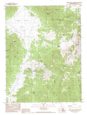
Spring Valley Summit Topo Map Nevada
To zoom in, hover over the map of Spring Valley Summit
USGS Topo Quad 39116d1 - 1:24,000 scale
| Topo Map Name: | Spring Valley Summit |
| USGS Topo Quad ID: | 39116d1 |
| Print Size: | ca. 21 1/4" wide x 27" high |
| Southeast Coordinates: | 39.375° N latitude / 116° W longitude |
| Map Center Coordinates: | 39.4375° N latitude / 116.0625° W longitude |
| U.S. State: | NV |
| Filename: | o39116d1.jpg |
| Download Map JPG Image: | Spring Valley Summit topo map 1:24,000 scale |
| Map Type: | Topographic |
| Topo Series: | 7.5´ |
| Map Scale: | 1:24,000 |
| Source of Map Images: | United States Geological Survey (USGS) |
| Alternate Map Versions: |
Spring Valley Summit NV 1990, updated 1990 Download PDF Buy paper map Spring Valley Summit NV 2012 Download PDF Buy paper map Spring Valley Summit NV 2015 Download PDF Buy paper map |
1:24,000 Topo Quads surrounding Spring Valley Summit
> Back to 39116a1 at 1:100,000 scale
> Back to 39116a1 at 1:250,000 scale
> Back to U.S. Topo Maps home
Spring Valley Summit topo map: Gazetteer
Spring Valley Summit: Basins
Stevens Basin elevation 2198m 7211′Spring Valley Summit: Flats
Dry Lake elevation 2199m 7214′Spring Valley Summit: Gaps
Spring Valley Summit elevation 2350m 7709′Spring Valley Summit: Mines
Dugout Tunnels elevation 2471m 8106′Kentucky Mine elevation 2283m 7490′
Mountain Boy Mine elevation 2374m 7788′
Prospect Mountain Tunnel elevation 2206m 7237′
Reese and Berry Mine elevation 2308m 7572′
Rose Mine elevation 2317m 7601′
Silver Conner Mine elevation 2098m 6883′
Spring Valley Summit: Populated Places
Prospect (historical) elevation 2300m 7545′Spring Valley Summit: Post Offices
Prospect Post Office (historical) elevation 2300m 7545′Spring Valley Summit: Ranges
Mountain Boy Range elevation 2185m 7168′Spring Valley Summit: Springs
Josephine Spring elevation 2411m 7910′McCulloughs Spring elevation 2290m 7513′
Spring Valley Summit: Summits
Atrypa Peak elevation 2734m 8969′Brush Peak elevation 2256m 7401′
Castle Mountain elevation 2381m 7811′
Grays Peak elevation 2622m 8602′
Lookout Mountain elevation 2492m 8175′
McCulloughs Butte elevation 2359m 7739′
Spanish Mountain elevation 2441m 8008′
Swiss Mountain elevation 2423m 7949′
Temple Peak elevation 2442m 8011′
White Mountain elevation 2847m 9340′
Spring Valley Summit: Valleys
Cave Canyon elevation 2212m 7257′Dugout Canyon elevation 2270m 7447′
Jones Canyon elevation 2212m 7257′
Reese and Berry Canyon elevation 2222m 7290′
Robinson Canyon elevation 2105m 6906′
Spring Valley elevation 2142m 7027′
Spring Valley Canyon elevation 1993m 6538′
Spring Valley Summit: Wells
Dry Lake Well elevation 2199m 7214′Spring Valley Summit digital topo map on disk
Buy this Spring Valley Summit topo map showing relief, roads, GPS coordinates and other geographical features, as a high-resolution digital map file on DVD:


