Cape Horn Topo Map Nevada
To zoom in, hover over the map of Cape Horn
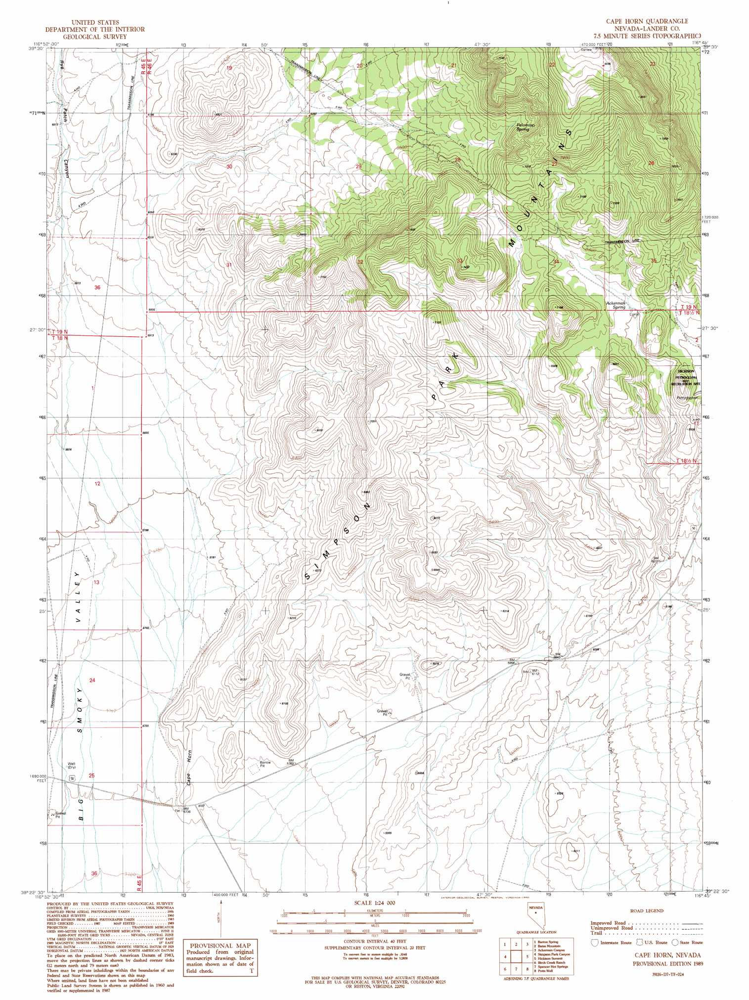
USGS Topo Quad 39116d7 - 1:24,000 scale
| Topo Map Name: | Cape Horn |
| USGS Topo Quad ID: | 39116d7 |
| Print Size: | ca. 21 1/4" wide x 27" high |
| Southeast Coordinates: | 39.375° N latitude / 116.75° W longitude |
| Map Center Coordinates: | 39.4375° N latitude / 116.8125° W longitude |
| U.S. State: | NV |
| Filename: | o39116d7.jpg |
| Download Map JPG Image: | Cape Horn topo map 1:24,000 scale |
| Map Type: | Topographic |
| Topo Series: | 7.5´ |
| Map Scale: | 1:24,000 |
| Source of Map Images: | United States Geological Survey (USGS) |
| Alternate Map Versions: |
Cape Horn NV 1989, updated 1990 Download PDF Buy paper map Cape Horn NV 2012 Download PDF Buy paper map Cape Horn NV 2014 Download PDF Buy paper map |
| FStopo: | US Forest Service topo Cape Horn is available: Download FStopo PDF Download FStopo TIF |
1:24,000 Topo Quads surrounding Cape Horn
Vigus Butte Ne |
Mount Callaghan |
Grass Valley Ranch |
Salt Marsh Canyon |
Shagnasty |
Yankee Blade |
Barton Spring |
Bates Mountain |
Ackerman Canyon |
Bean Flat West |
Austin |
Simpson Park Canyon |
Cape Horn |
Hickison Summit |
Jackrabbit Spring |
North Toiyabe Peak |
Birch Creek Ranch |
Spencer Hot Springs |
Potts Well |
Wallace Canyon |
Kingston |
Wildcat Peak Nw |
Petes Summit |
The Monitor |
White Sage Canyon |
> Back to 39116a1 at 1:100,000 scale
> Back to 39116a1 at 1:250,000 scale
> Back to U.S. Topo Maps home
Cape Horn topo map: Gazetteer
Cape Horn: Parks
Hickison Petroglyth Recreation Site elevation 2092m 6863′Cape Horn: Springs
Ackerman Spring elevation 2019m 6624′Cape Horn: Summits
Cape Horn elevation 1812m 5944′Cape Horn digital topo map on disk
Buy this Cape Horn topo map showing relief, roads, GPS coordinates and other geographical features, as a high-resolution digital map file on DVD: