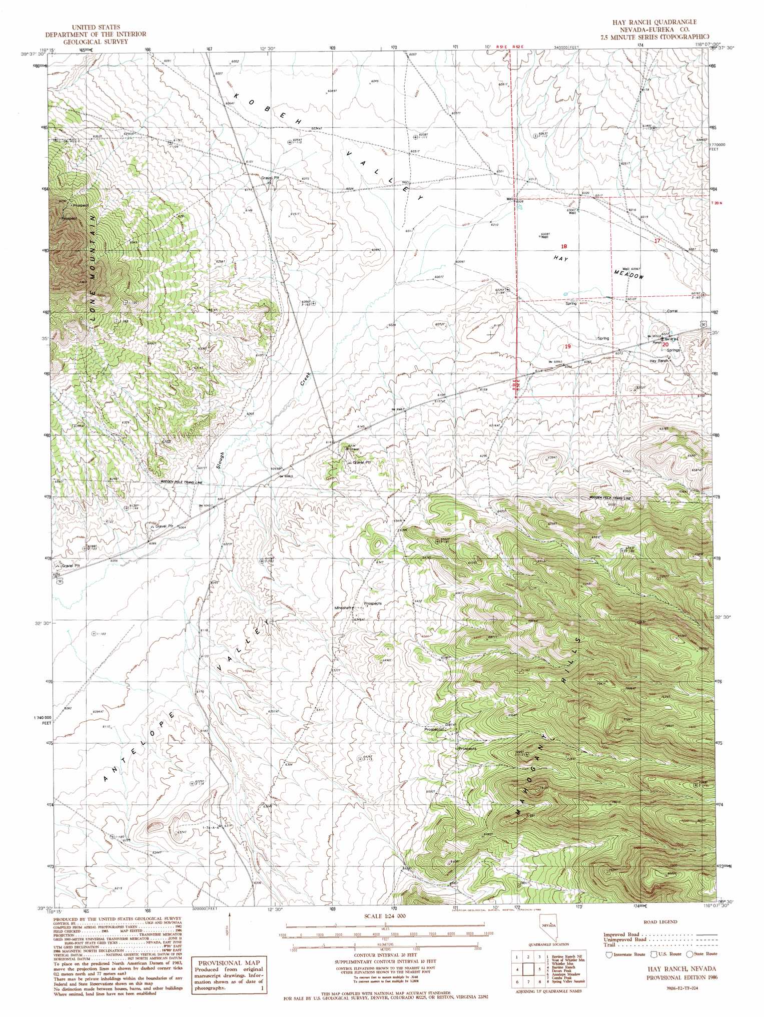
Hay Ranch Topo Map Nevada
To zoom in, hover over the map of Hay Ranch
USGS Topo Quad 39116e2 - 1:24,000 scale
| Topo Map Name: | Hay Ranch |
| USGS Topo Quad ID: | 39116e2 |
| Print Size: | ca. 21 1/4" wide x 27" high |
| Southeast Coordinates: | 39.5° N latitude / 116.125° W longitude |
| Map Center Coordinates: | 39.5625° N latitude / 116.1875° W longitude |
| U.S. State: | NV |
| Filename: | o39116e2.jpg |
| Download Map JPG Image: | Hay Ranch topo map 1:24,000 scale |
| Map Type: | Topographic |
| Topo Series: | 7.5´ |
| Map Scale: | 1:24,000 |
| Source of Map Images: | United States Geological Survey (USGS) |
| Alternate Map Versions: |
Hay Ranch NV 1986, updated 1986 Download PDF Buy paper map Hay Ranch NV 2012 Download PDF Buy paper map Hay Ranch NV 2014 Download PDF Buy paper map |
1:24,000 Topo Quads surrounding Hay Ranch
Three Bar Ranch |
Roberts Creek Mountain |
Garden Pass |
Tule Dam Spring |
West Of Christina Peak |
Bartine Ranch Nw |
Bartine Ranch Ne |
West Of Whistler Mountain |
Whistler Mountain |
North Of Eureka |
Bean Flat East |
Bartine Ranch |
Hay Ranch |
Devon Peak |
Eureka |
Antelope Peak |
Antelope Meadow |
Combs Peak |
Spring Valley Summit |
Pinto Summit |
Well Canyon |
Sullivan Wash |
West Of Bellevue Peak |
Bellevue Peak |
Pinto Summit Sw |
> Back to 39116e1 at 1:100,000 scale
> Back to 39116a1 at 1:250,000 scale
> Back to U.S. Topo Maps home
Hay Ranch topo map: Gazetteer
Hay Ranch: Flats
Hay Meadow elevation 1835m 6020′Hay Ranch: Streams
U'ans-in-dame Creek elevation 1842m 6043′Hay Ranch digital topo map on disk
Buy this Hay Ranch topo map showing relief, roads, GPS coordinates and other geographical features, as a high-resolution digital map file on DVD: