Barton Spring Topo Map Nevada
To zoom in, hover over the map of Barton Spring
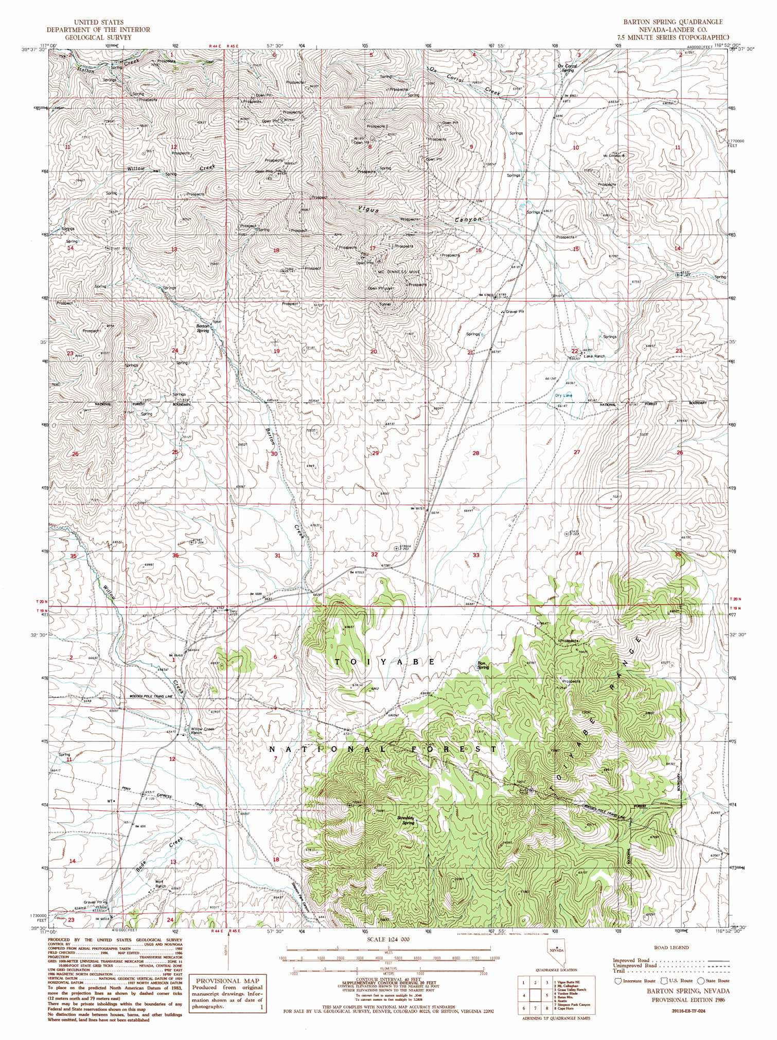
USGS Topo Quad 39116e8 - 1:24,000 scale
| Topo Map Name: | Barton Spring |
| USGS Topo Quad ID: | 39116e8 |
| Print Size: | ca. 21 1/4" wide x 27" high |
| Southeast Coordinates: | 39.5° N latitude / 116.875° W longitude |
| Map Center Coordinates: | 39.5625° N latitude / 116.9375° W longitude |
| U.S. State: | NV |
| Filename: | o39116e8.jpg |
| Download Map JPG Image: | Barton Spring topo map 1:24,000 scale |
| Map Type: | Topographic |
| Topo Series: | 7.5´ |
| Map Scale: | 1:24,000 |
| Source of Map Images: | United States Geological Survey (USGS) |
| Alternate Map Versions: |
Barton Spring NV 1986, updated 1986 Download PDF Buy paper map Barton Spring NV 2012 Download PDF Buy paper map Barton Spring NV 2014 Download PDF Buy paper map |
| FStopo: | US Forest Service topo Barton Spring is available: Download FStopo PDF Download FStopo TIF |
1:24,000 Topo Quads surrounding Barton Spring
Manhattan Mountain |
Joe Eason Mountain |
Hall Creek South |
Cowboy Rest Creek |
West Of Fagin Mountain |
Vigus Butte Nw |
Vigus Butte Ne |
Mount Callaghan |
Grass Valley Ranch |
Salt Marsh Canyon |
Vigus Butte |
Yankee Blade |
Barton Spring |
Bates Mountain |
Ackerman Canyon |
West Of Austin |
Austin |
Simpson Park Canyon |
Cape Horn |
Hickison Summit |
Bunker Hill |
North Toiyabe Peak |
Birch Creek Ranch |
Spencer Hot Springs |
Potts Well |
> Back to 39116e1 at 1:100,000 scale
> Back to 39116a1 at 1:250,000 scale
> Back to U.S. Topo Maps home
Barton Spring topo map: Gazetteer
Barton Spring: Mines
Green Tree Mine elevation 2352m 7716′McGinness Mine elevation 2284m 7493′
Barton Spring: Springs
Barton Spring elevation 2146m 7040′Box Spring elevation 2069m 6788′
Ox Corral Spring elevation 2073m 6801′
Streshley Spring elevation 2191m 7188′
Barton Spring: Streams
Bade Creek elevation 1961m 6433′Barton Creek elevation 1964m 6443′
Barton Spring: Valleys
Emigrant Canyon elevation 1964m 6443′Thorpe Canyon elevation 1975m 6479′
Vigus Canyon elevation 2049m 6722′
Barton Spring digital topo map on disk
Buy this Barton Spring topo map showing relief, roads, GPS coordinates and other geographical features, as a high-resolution digital map file on DVD: