Shagnasty Topo Map Nevada
To zoom in, hover over the map of Shagnasty
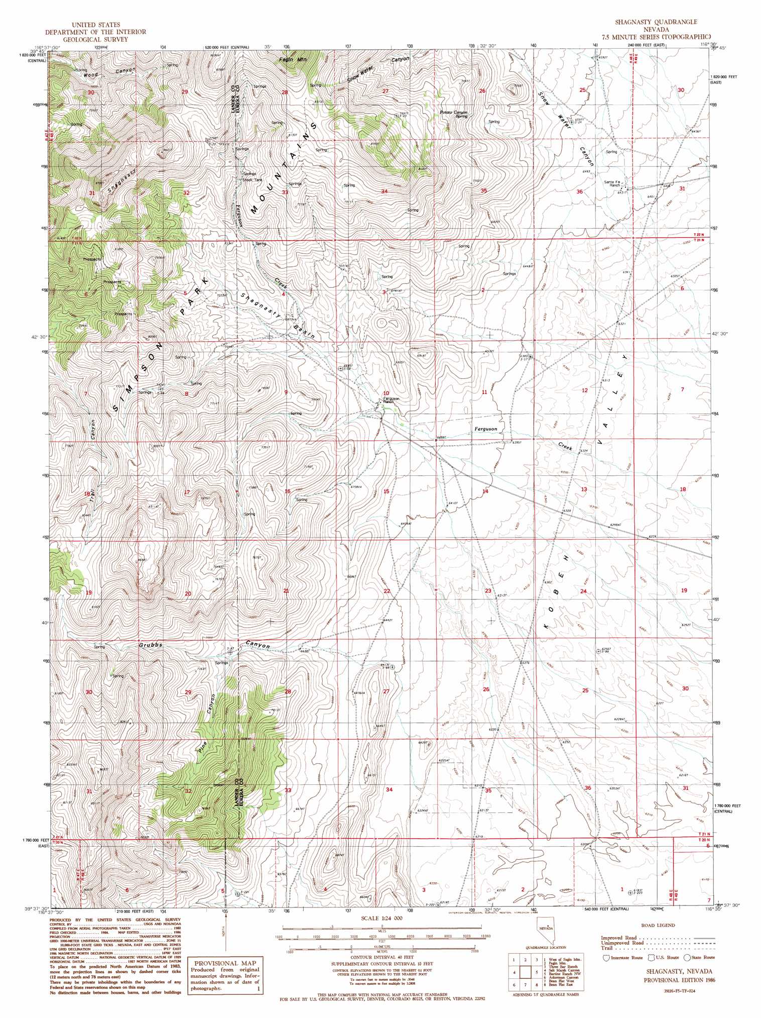
USGS Topo Quad 39116f5 - 1:24,000 scale
| Topo Map Name: | Shagnasty |
| USGS Topo Quad ID: | 39116f5 |
| Print Size: | ca. 21 1/4" wide x 27" high |
| Southeast Coordinates: | 39.625° N latitude / 116.5° W longitude |
| Map Center Coordinates: | 39.6875° N latitude / 116.5625° W longitude |
| U.S. State: | NV |
| Filename: | o39116f5.jpg |
| Download Map JPG Image: | Shagnasty topo map 1:24,000 scale |
| Map Type: | Topographic |
| Topo Series: | 7.5´ |
| Map Scale: | 1:24,000 |
| Source of Map Images: | United States Geological Survey (USGS) |
| Alternate Map Versions: |
Shagnasty NV 1986, updated 1986 Download PDF Buy paper map Shagnasty NV 2012 Download PDF Buy paper map Shagnasty NV 2015 Download PDF Buy paper map |
1:24,000 Topo Quads surrounding Shagnasty
Corral Canyon |
Little Hot Springs |
Walti Hot Springs |
Tonkin Summit |
Cooper Peak |
Cowboy Rest Creek |
West Of Fagin Mountain |
Fagin Mountain |
Three Bar Ranch |
Roberts Creek Mountain |
Grass Valley Ranch |
Salt Marsh Canyon |
Shagnasty |
Bartine Ranch Nw |
Bartine Ranch Ne |
Bates Mountain |
Ackerman Canyon |
Bean Flat West |
Bean Flat East |
Bartine Ranch |
Cape Horn |
Hickison Summit |
Jackrabbit Spring |
Antelope Peak |
Antelope Meadow |
> Back to 39116e1 at 1:100,000 scale
> Back to 39116a1 at 1:250,000 scale
> Back to U.S. Topo Maps home
Shagnasty topo map: Gazetteer
Shagnasty: Basins
Shagnasty Basin elevation 2129m 6984′Shagnasty: Springs
Potato Canyon Spring elevation 2250m 7381′Shagnasty: Streams
Ferguson Creek elevation 1911m 6269′Shagnasty: Summits
Shagnasty elevation 2511m 8238′Shagnasty: Valleys
Grubbs Canyon elevation 1999m 6558′Pine Canyon elevation 2090m 6856′
Snow Water Canyon elevation 2086m 6843′
Shagnasty: Wells
Etcheverry Number One elevation 1893m 6210′Shagnasty digital topo map on disk
Buy this Shagnasty topo map showing relief, roads, GPS coordinates and other geographical features, as a high-resolution digital map file on DVD: