Little Hot Springs Topo Map Nevada
To zoom in, hover over the map of Little Hot Springs
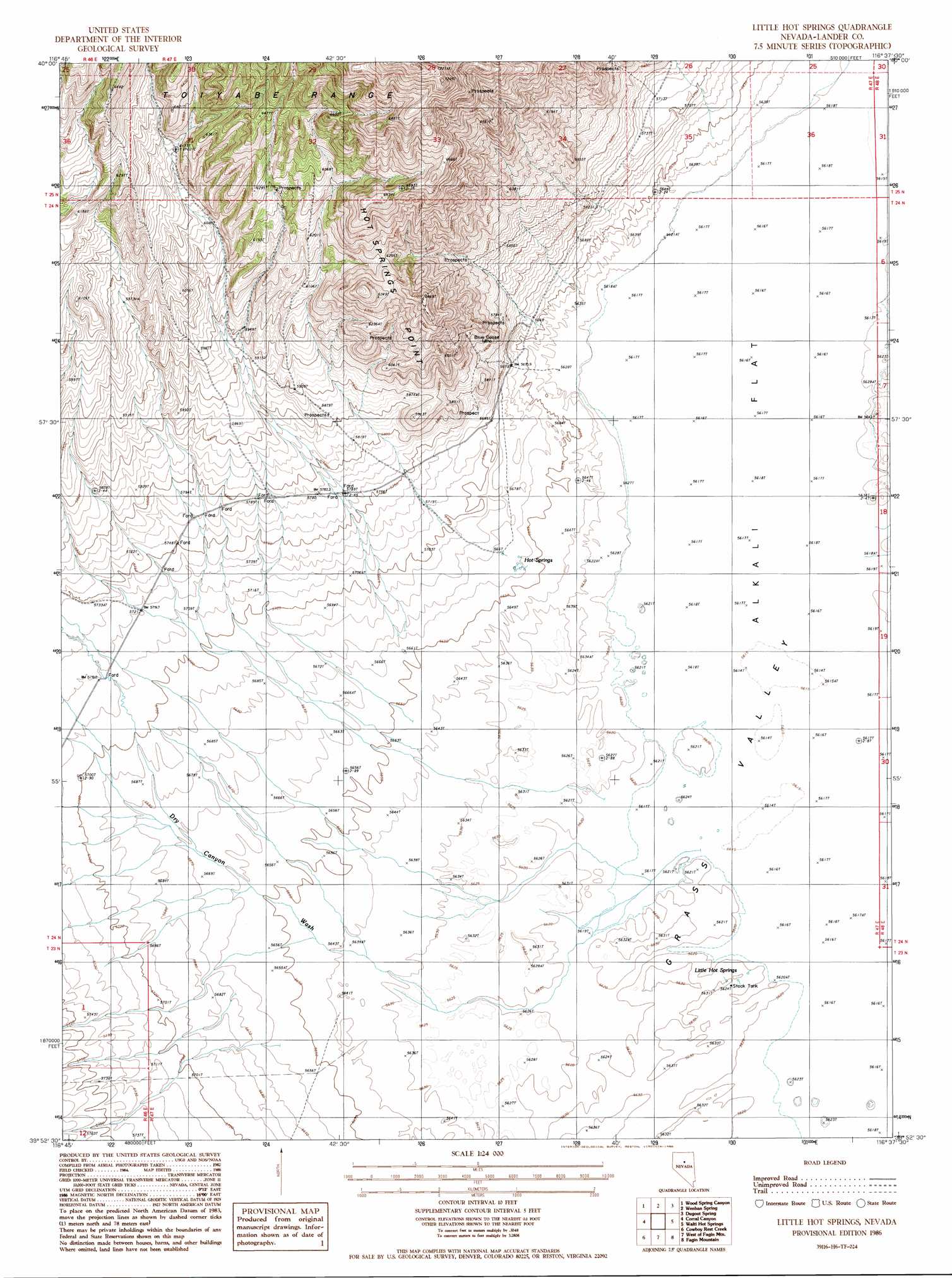
USGS Topo Quad 39116h6 - 1:24,000 scale
| Topo Map Name: | Little Hot Springs |
| USGS Topo Quad ID: | 39116h6 |
| Print Size: | ca. 21 1/4" wide x 27" high |
| Southeast Coordinates: | 39.875° N latitude / 116.625° W longitude |
| Map Center Coordinates: | 39.9375° N latitude / 116.6875° W longitude |
| U.S. State: | NV |
| Filename: | o39116h6.jpg |
| Download Map JPG Image: | Little Hot Springs topo map 1:24,000 scale |
| Map Type: | Topographic |
| Topo Series: | 7.5´ |
| Map Scale: | 1:24,000 |
| Source of Map Images: | United States Geological Survey (USGS) |
| Alternate Map Versions: |
Little Hot Springs NV 1986, updated 1986 Download PDF Buy paper map Little Hot Springs NV 2012 Download PDF Buy paper map Little Hot Springs NV 2014 Download PDF Buy paper map |
1:24,000 Topo Quads surrounding Little Hot Springs
Carico Lake North |
Rocky Pass |
Cortez Canyon |
Cortez |
Buckhorn Mine |
Carico Lake South |
Wood Spring Canyon |
Wenban Spring |
Dugout Spring |
Rocky Hills |
Hall Creek North |
Corral Canyon |
Little Hot Springs |
Walti Hot Springs |
Tonkin Summit |
Hall Creek South |
Cowboy Rest Creek |
West Of Fagin Mountain |
Fagin Mountain |
Three Bar Ranch |
Mount Callaghan |
Grass Valley Ranch |
Salt Marsh Canyon |
Shagnasty |
Bartine Ranch Nw |
> Back to 39116e1 at 1:100,000 scale
> Back to 39116a1 at 1:250,000 scale
> Back to U.S. Topo Maps home
Little Hot Springs topo map: Gazetteer
Little Hot Springs: Mines
Blue Goose Mine elevation 1813m 5948′Little Hot Springs: Ranges
Toiyabe Range elevation 2015m 6610′Little Hot Springs: Springs
Crow Spring elevation 1729m 5672′Hot Springs elevation 1726m 5662′
Little Hot Springs elevation 1717m 5633′
Little Hot Springs: Streams
Dry Canyon Wash elevation 1714m 5623′Little Hot Springs digital topo map on disk
Buy this Little Hot Springs topo map showing relief, roads, GPS coordinates and other geographical features, as a high-resolution digital map file on DVD: